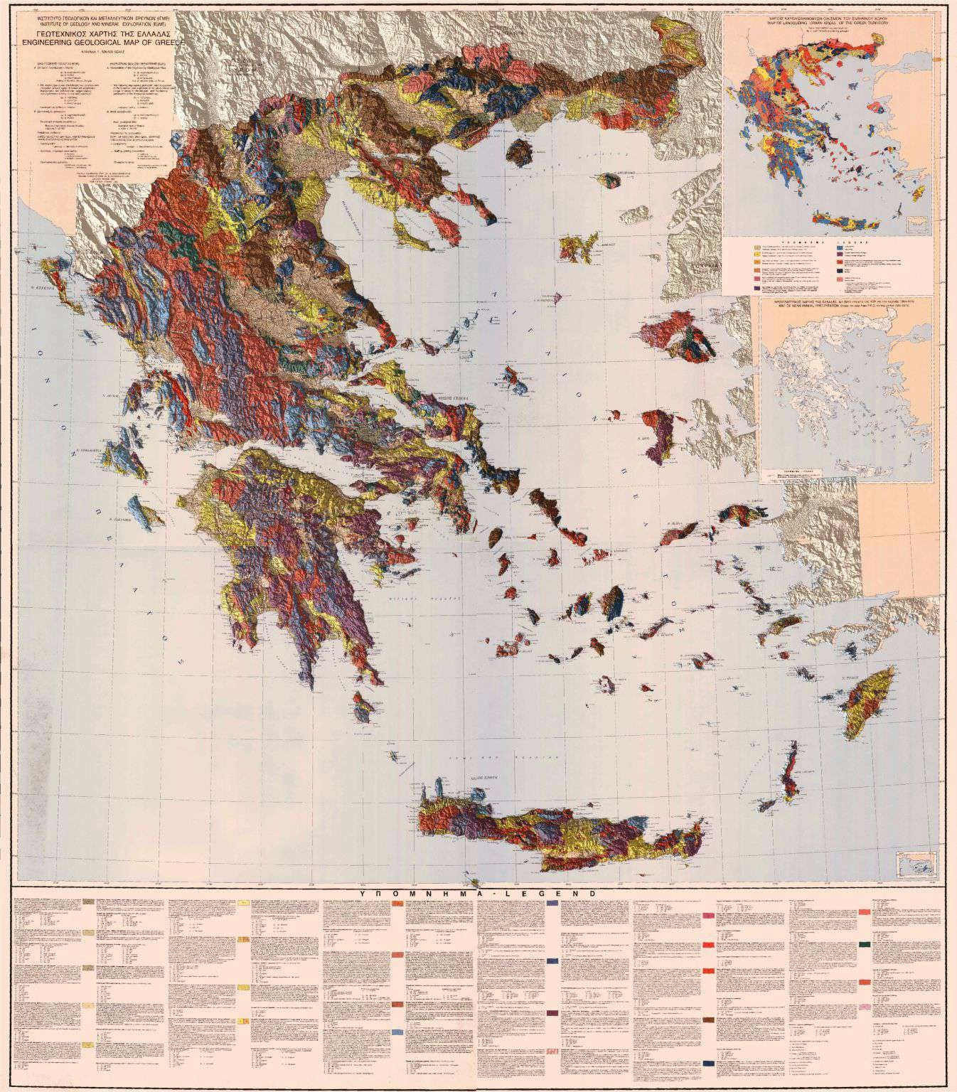
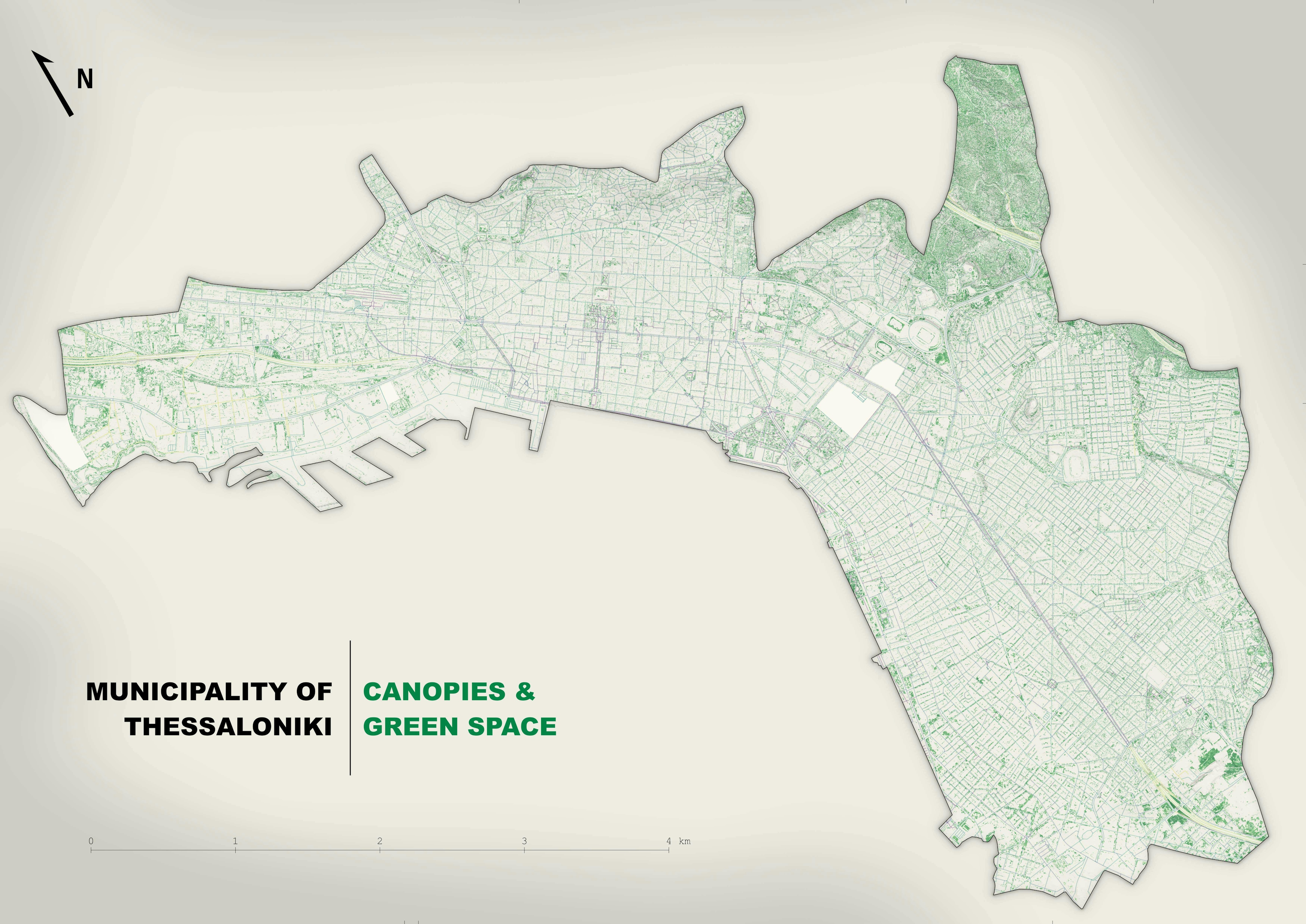
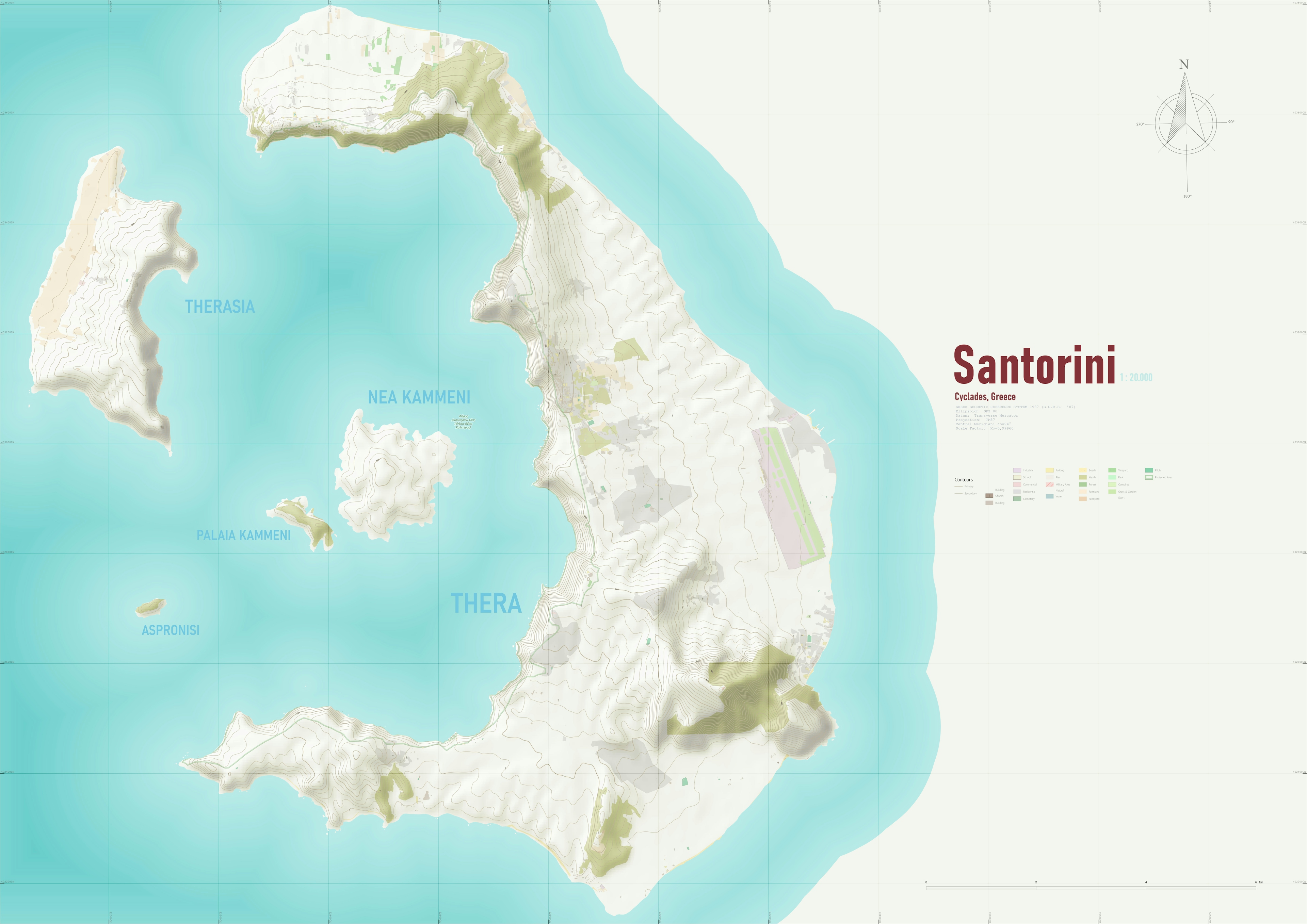
Geotechnical Map of Greece on SRTM DEM

Tools used
BlenderQGIS
tags
QGIS
More by Efstathios Lymperis

You might also like


Join the community!
We're a place where geospatial professionals showcase their works and discover opportunities.
Geotechnical Map of Greece on SRTM DEM
More by Efstathios Lymperis
You might also like
We're a place where geospatial professionals showcase their works and discover opportunities.