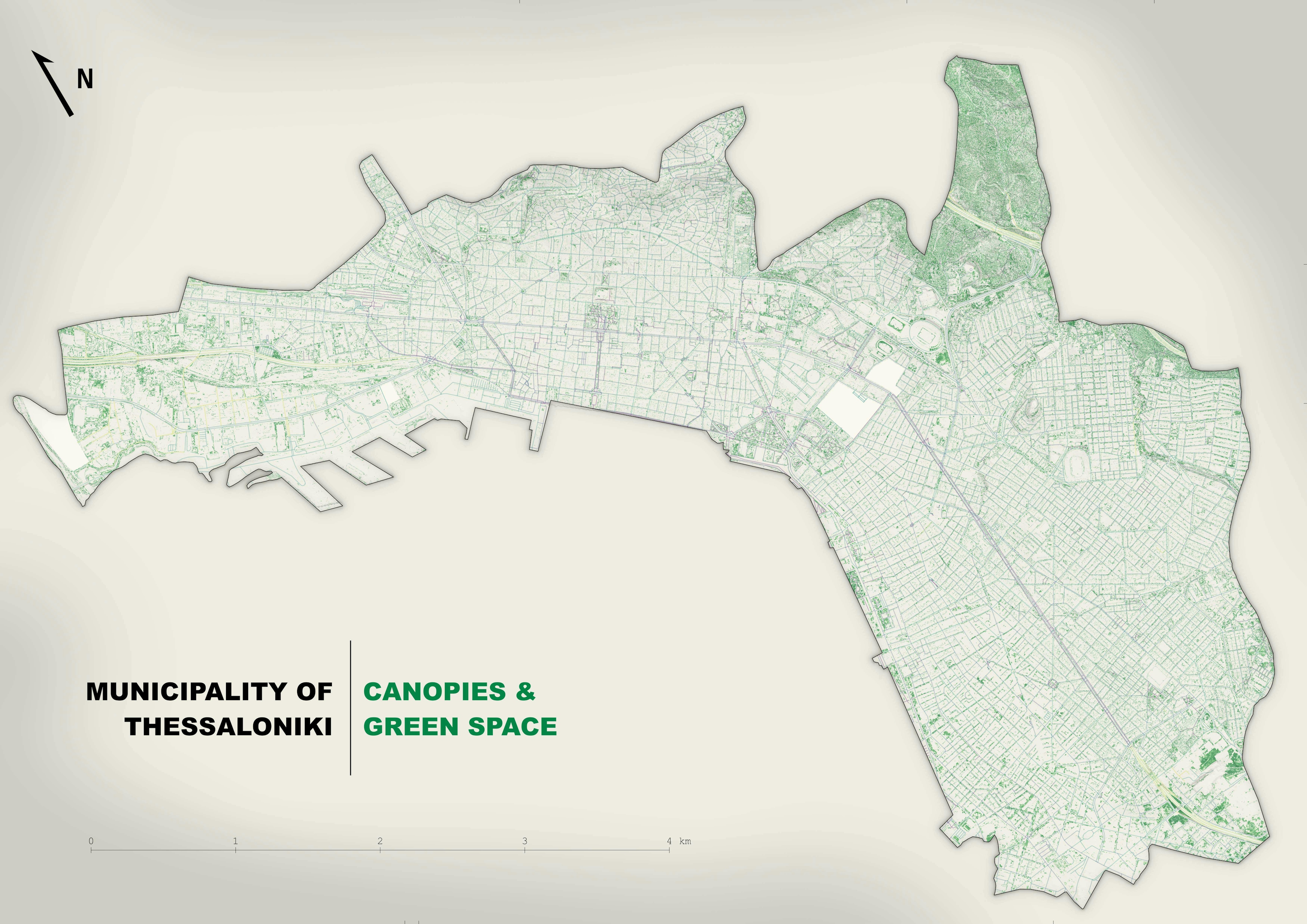
I love these AeriaLod visualisations....
Data: OpenStreetMap
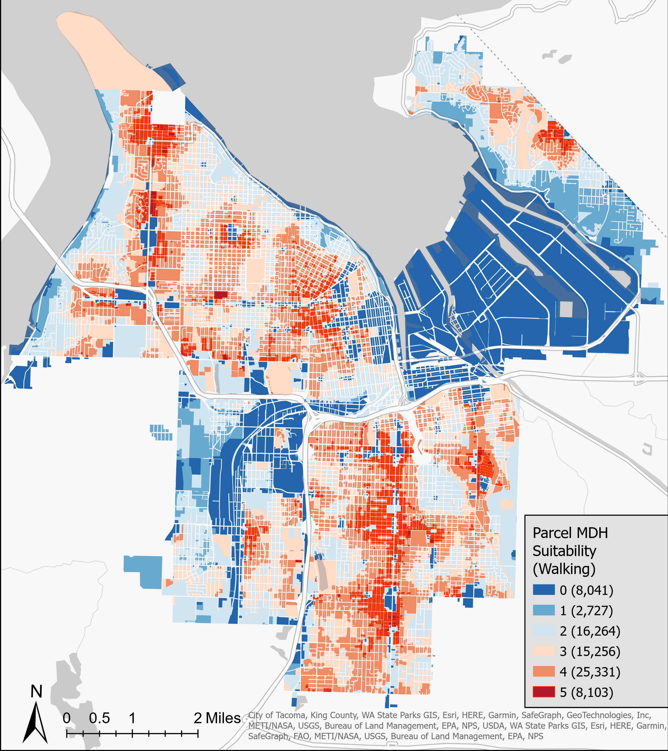
Municipality of Thessaloniki - 3D Vis
I love these AeriaLod visualisations....
Data: OpenStreetMap
More by Efstathios Lymperis
You might also like
We're a place where geospatial professionals showcase their works and discover opportunities.


.gif&w=3840&q=100)


_645201.jpg&w=48&q=40 "Eguagie-suyi Precious")