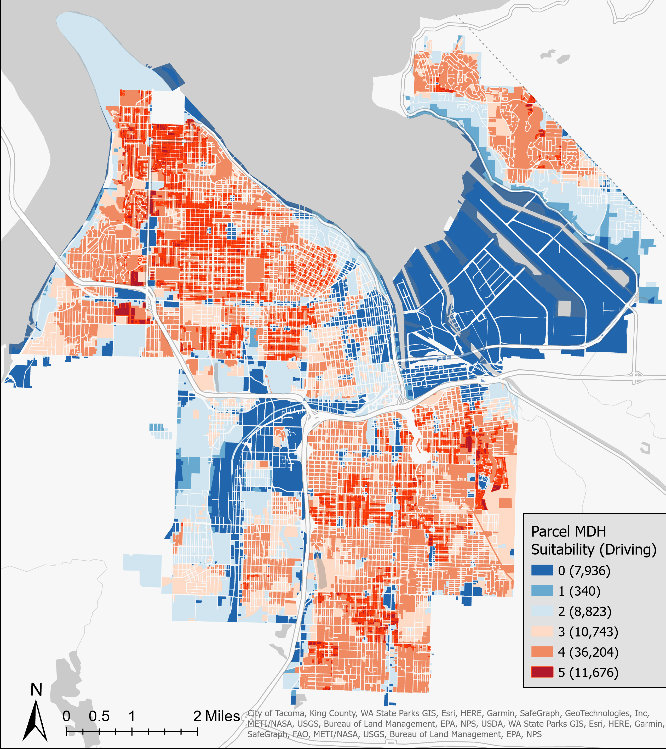
This map was completed as part of the thesis project, "Site Selection of Medium Density Housing in Tacoma, Washington: Where to Place 'Missing Middle' Housing?" Medium density housing refers to a type of housing for multiple units to occupy the same approximate space as a large single family home. As cities continue to grow, density of housing must increase to house the expanding populations.
In the project, a variety of demographic and infrastructure data in both vector and raster formats were integrated using the Weighted Sum tool to understand the suitability of MDH. Two scenarios were simulated, one where residents prioritized motor vehicles as their primary mode of transport while the latter prioritized walking and public transit usage.
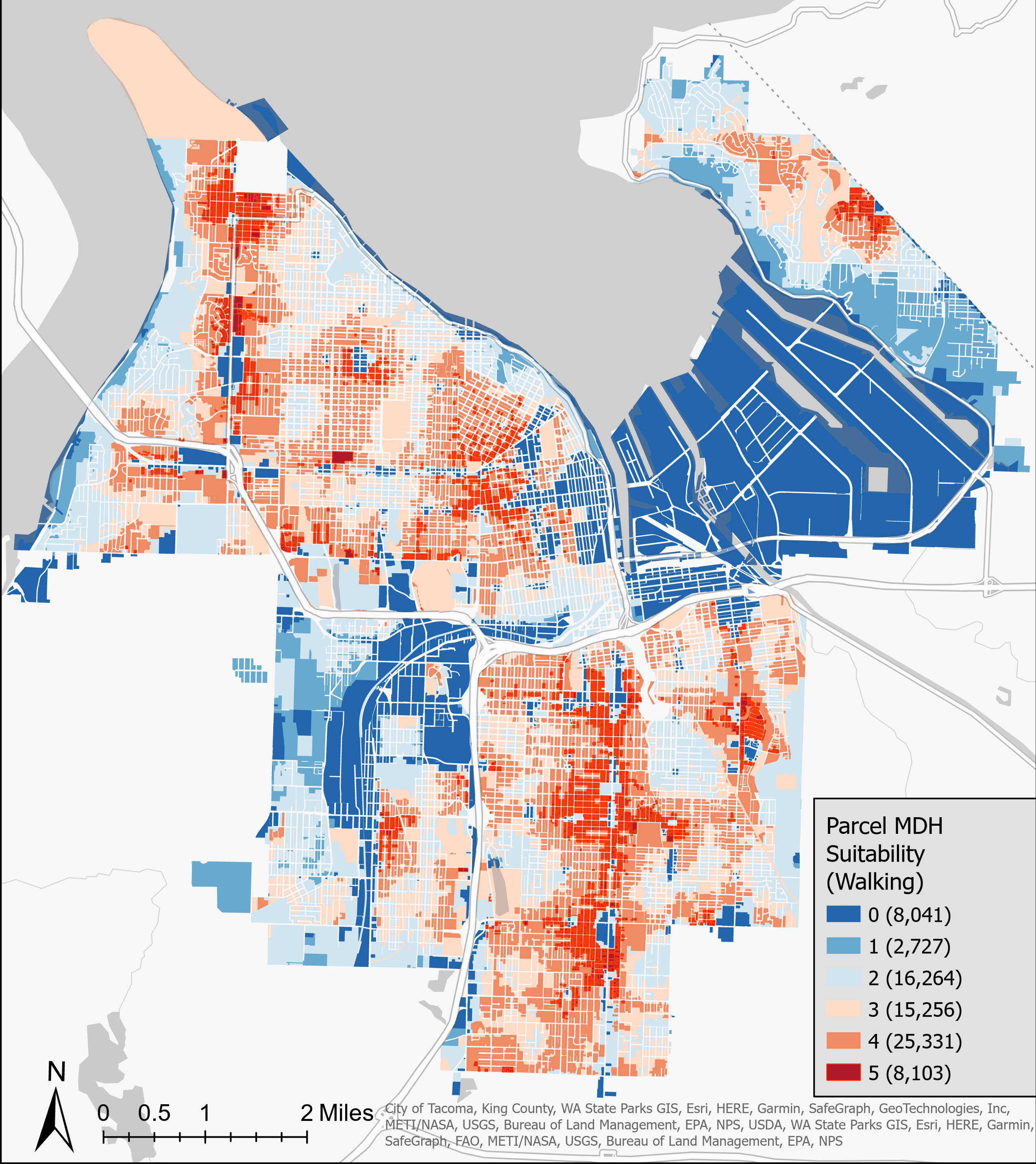
The map above shows the suitability for medium density housing for every parcel in the City of Tacoma. Counts of the number of parcels scored are also noted. Overall, this map indicates that for households the prefer walking, good portions of most neighborhoods would be suitable for denser levels of housing. These higher suitability areas primarily occur near business districts that can provide amenities for larger populations. But a number of areas score low in suitability due to insufficient public transit, highways forming barriers and distance from amenities. This map indicates that the layout of resources and amenities significantly impacts the walkability of Tacoma, inhibiting the feasibility of reducing dependence on personal motor vehicles.