Sign up or log in to your Spatialnode account.

Takes less than a few seconds.

TANI II DEM AND CONTOUR MAP

Gyile Dennis
Gyile Dennis•

April 18, 2023

TANI II DEM AND CONTOUR MAP

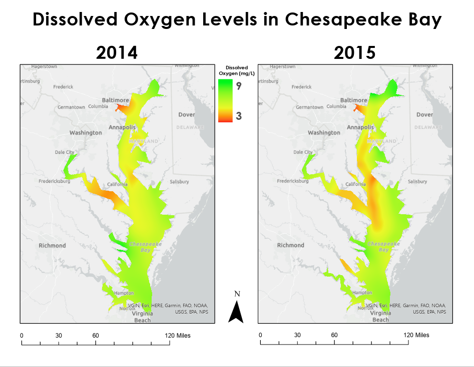
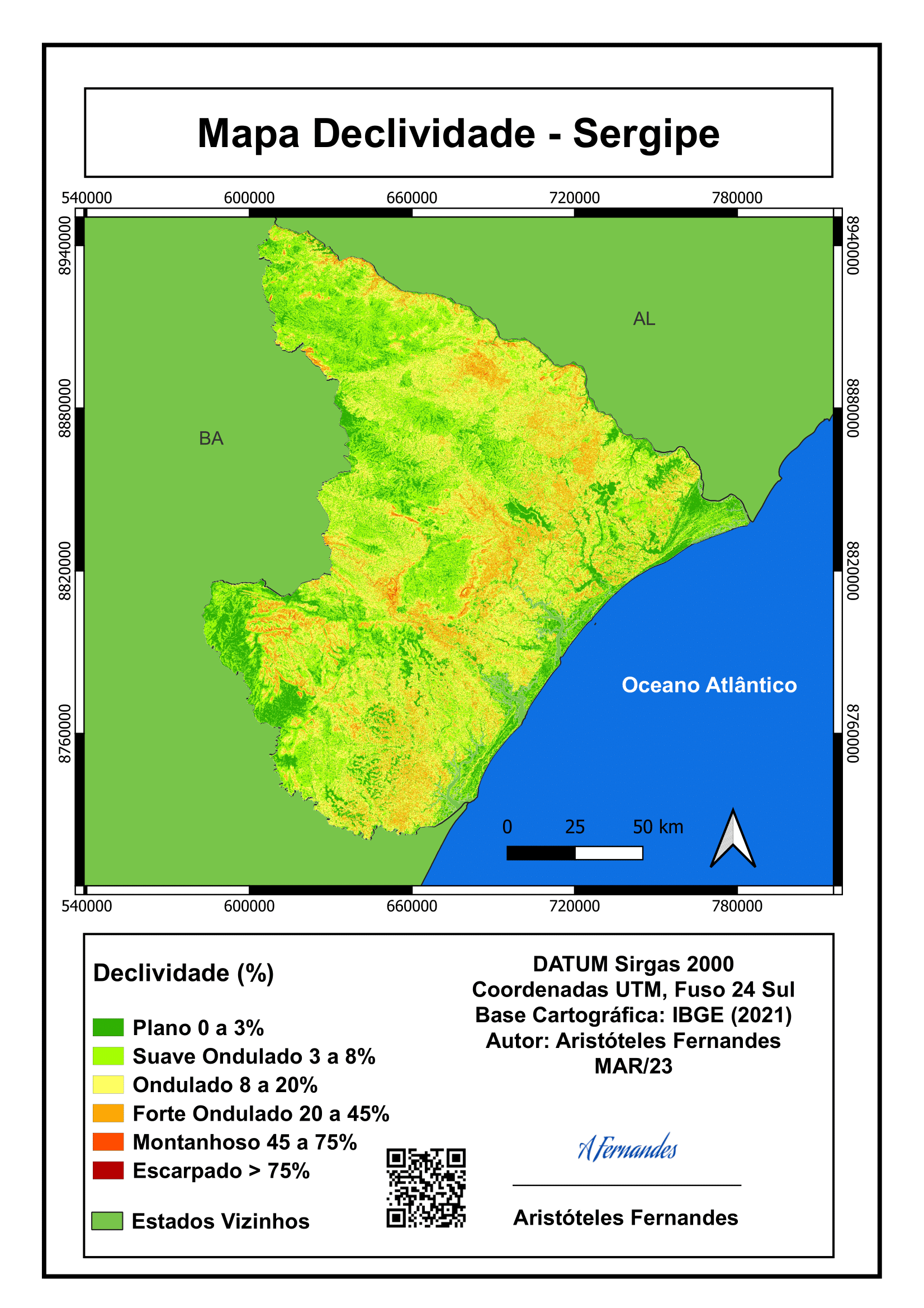
I wanted to know the digital elevation model of TANI II forest reserve and it's contour. 


Tools used

Contour IDW Spatial analyst

Plug-ins used

Spatial analyst

tags

GISGoogle

You might also like

Virginia Agricultural Forest Districts
Keran Nkongolo
Virginia Agricultural Forest Districts
Keran NkongoloPro
11
Análise com dados do IBGE
Carlos Joubert Sousa da Rocha
Análise com dados do IBGE
Carlos Joubert...
202
GDAL: JPEGs Image Preview and Tile Index
Paola Prieto Botero
GDAL: JPEGs Image Preview and Tile Index
Paola Prieto Botero
23
Flood risk assessment
Onyeakagbuna Amos
Flood risk assessment
Onyeakagbuna Amos
7
Variability in Extent of Malheur Lake
Brittany Biro
Variability in Extent of Malheur Lake
Brittany Biro
8
RAINFALL MAP OF OYO STATE.
Aderonke ADETORO
RAINFALL MAP OF OYO STATE.
Aderonke ADETORO
86
USA Drought Map for the Year 2022
Enoch Oluwaferanmi Babayemi
USA Drought Map for the Year 2022
Enoch Oluwaferanmi Babayemi
15
Uso da Terra Presidente Figueiredo, AM
Aguinaldo José de Oliveira
Uso da Terra Presidente Figueiredo, AM
Aguinaldo José...
13
Iowa Conservation and Recreation
Keran Nkongolo
Iowa Conservation and Recreation
Keran NkongoloPro
7
Diocese of Duluth Parish Mapping
Reese Dresch
Diocese of Duluth Parish Mapping
Reese Dresch
77
Firearm Mortality Rate & Presidency 2020
Jonathan Correa Varela
Firearm Mortality Rate & Presidency 2020
Jonathan Correa Varela
17
Mapa de Clima do Nordeste Brasileiro
Maria Gabriela Menegussi
Mapa de Clima do Nordeste Brasileiro
Maria Gabriela Menegussi
16

Join the community!

We're a place where geospatial professionals showcase their works and discover opportunities.

Sign Up for free