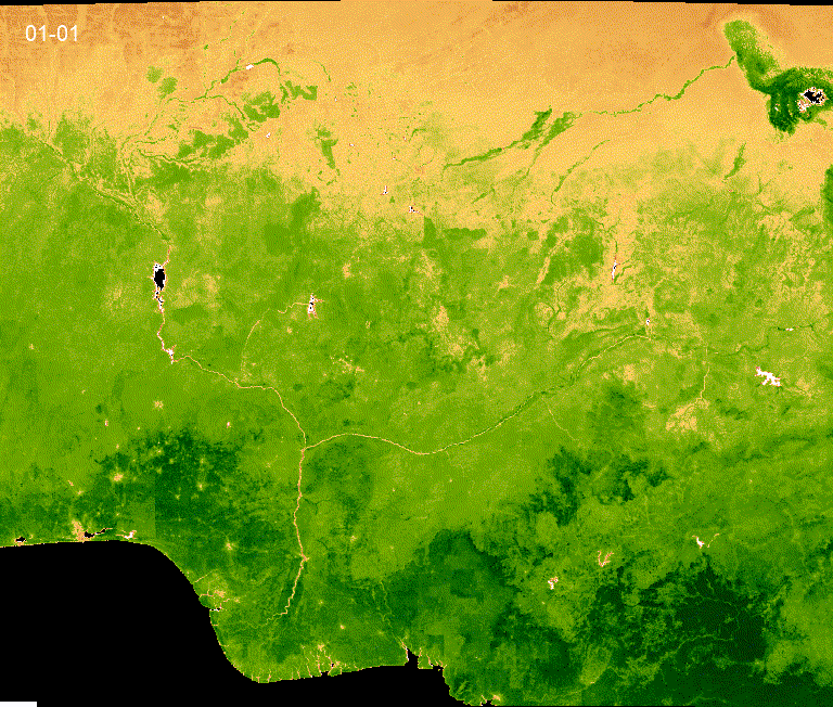
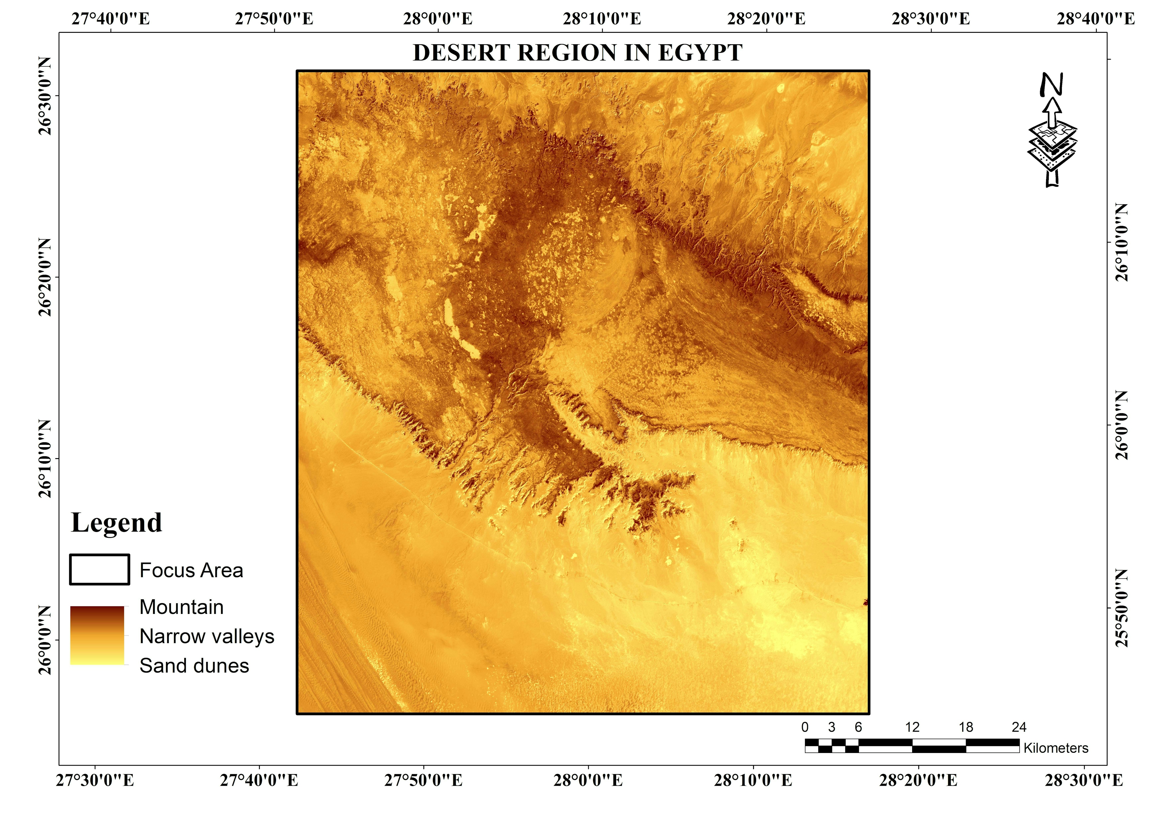
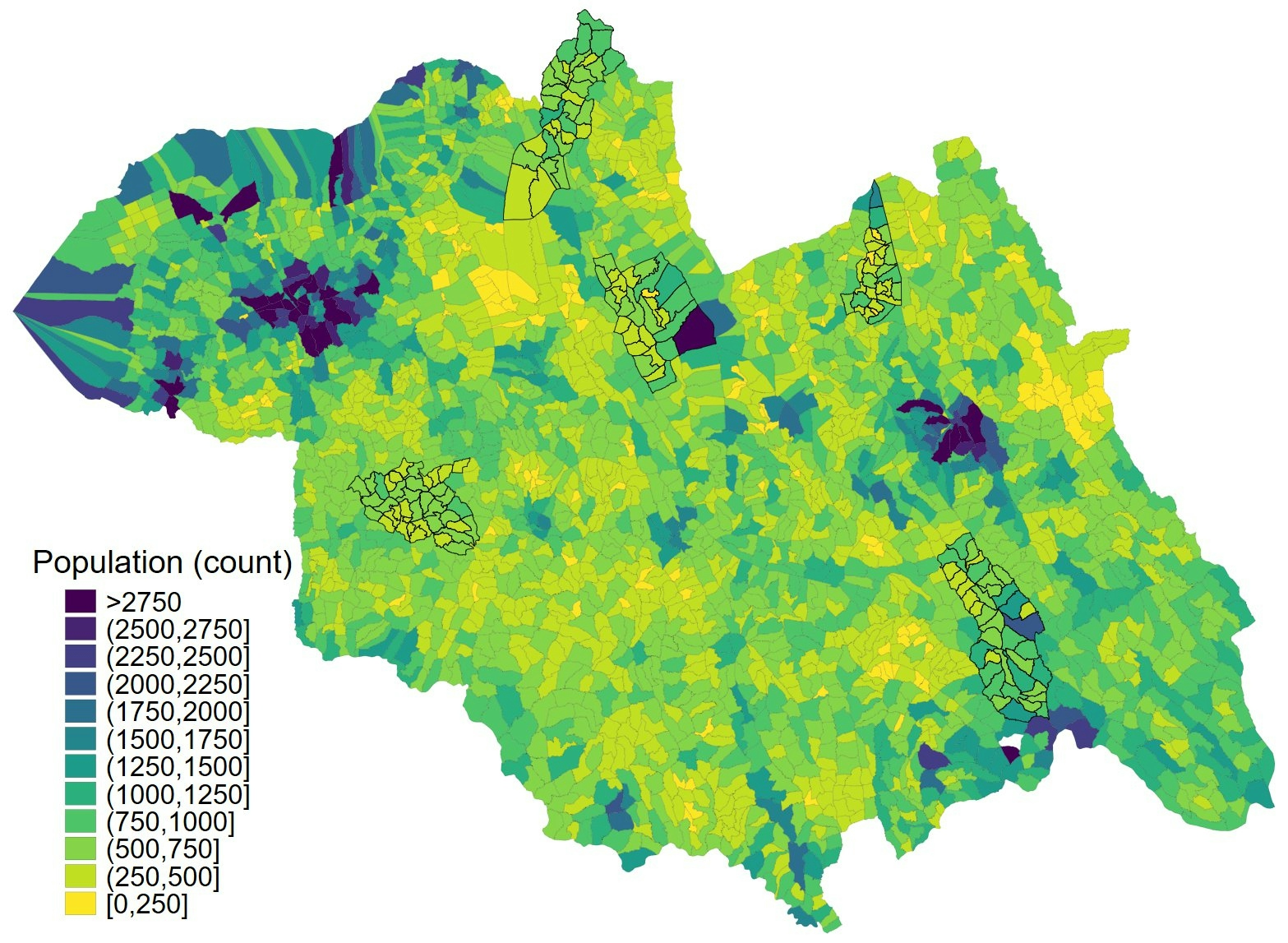
Sign up or log in to your Spatialnode account.

Takes less than a few seconds.

NDVI for 2001-2021

Mercy Onaopemipo Akintola
Mercy Onaopemipo Akintola•

November 04, 2021

NDVI for 2001-2021
Using gif to show ndvi from 2000-2021 in less than 30sec
Demo

Tools used

ArcGIS ProGoogle Earth Engine(GEE)Spatial analyst

Plug-ins used

geemap

tags

ArcGIS OnlineArcGIS ProArcMapQGIS2WebR

More by Mercy Onaopemipo Akintola

Desert Region in Egypt
9
Oil Spills Using GIS and Remote Sensing
47
Str and Catchment Area in Sagamu Area
119

You might also like

What is Supply Chain Network Design?
Matthew Forrest
What is Supply Chain Network Design?
Matthew Forrest
579
Favorability map for new constructions
Katalin Peter
Favorability map for new constructions
Katalin Peter
5
Uso e Ocupação Solo - SC (2003 - 2023)
Paulo Vitor Moraes Estella
Uso e Ocupação Solo - SC (2003 - 2023)
Paulo Vitor...
21
DETERMINATION OF GEOID SURFACE
Ireoluwa Orodiji
DETERMINATION OF GEOID SURFACE
Ireoluwa Orodiji
6
Sea Level Rise in New York City
Derek R Schiavone
Sea Level Rise in New York City
Derek R Schiavone
127
LOCALIZAÇÃO DO MUNICÍPIO DE BELÉM
Mapa_Geo
LOCALIZAÇÃO DO MUNICÍPIO DE BELÉM
Mapa_Geo
95
DIVISÃO POLITCA DO ZAÍRE
Raduel Fernando da Fonseca
DIVISÃO POLITCA DO ZAÍRE
Raduel Fernando...
21
Mapa de Localização
Eliezer Fernandes
Mapa de Localização
Eliezer Fernandes
8
Hotspot analysis
Adeolu Oshadare
Hotspot analysis
Adeolu Oshadare
556
Street Guide Map of Okirika Main Town
Comson Iyamisigh
Street Guide Map of Okirika Main Town
Comson Iyamisigh
6
exercise 3
DrewOlenick
exercise 3
DrewOlenick
3
Shaded relief map of Australia
Balogun Temitope
Shaded relief map of Australia
Balogun Temitope
701

Join the community!

We're a place where geospatial professionals showcase their works and discover opportunities.

Sign Up for free