Sign up or log in to your Spatialnode account.

Takes less than a few seconds.

Water point distribution

Chimango Chisuwo
Chimango Chisuwo•

April 10, 2023

Water point distribution

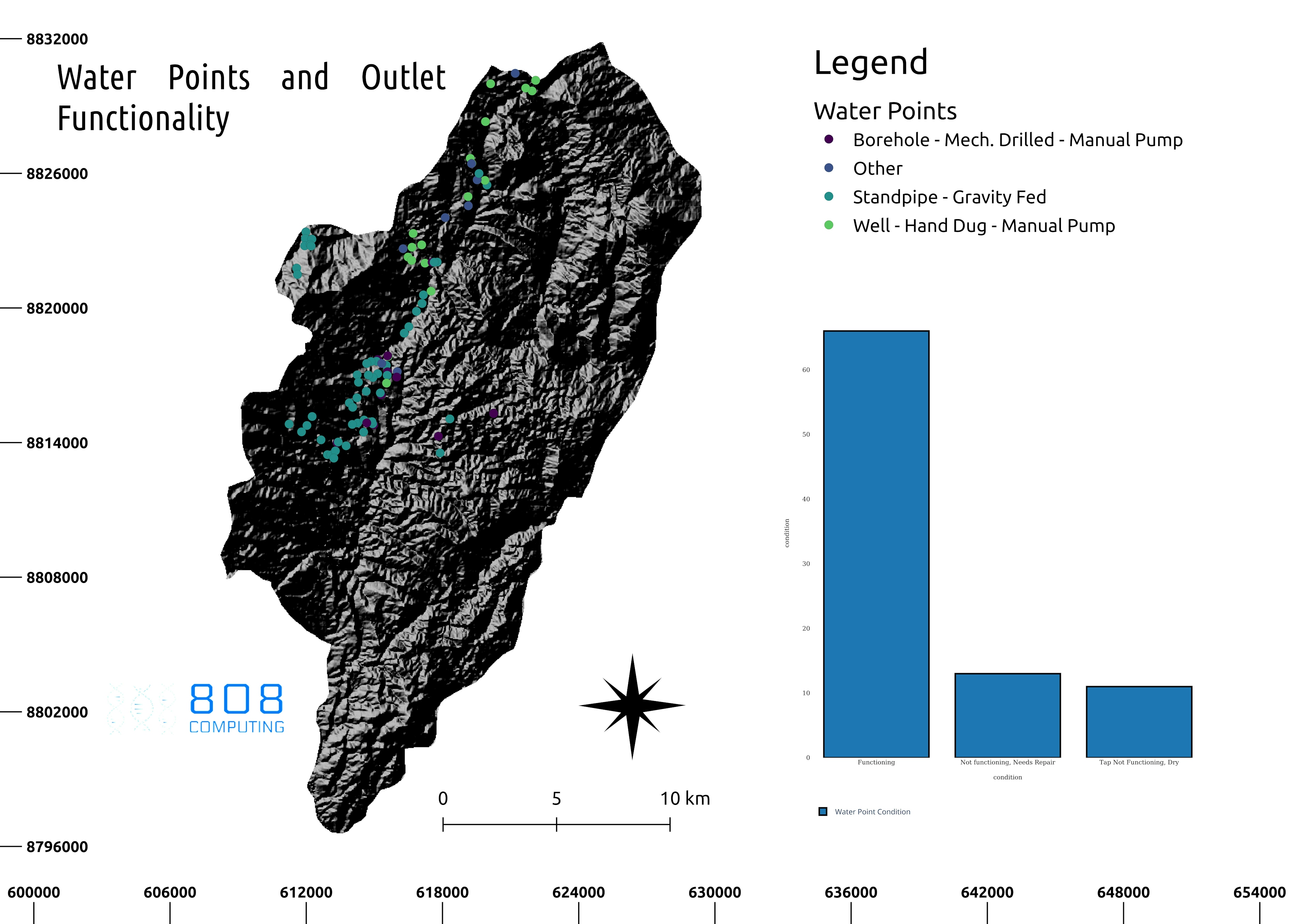
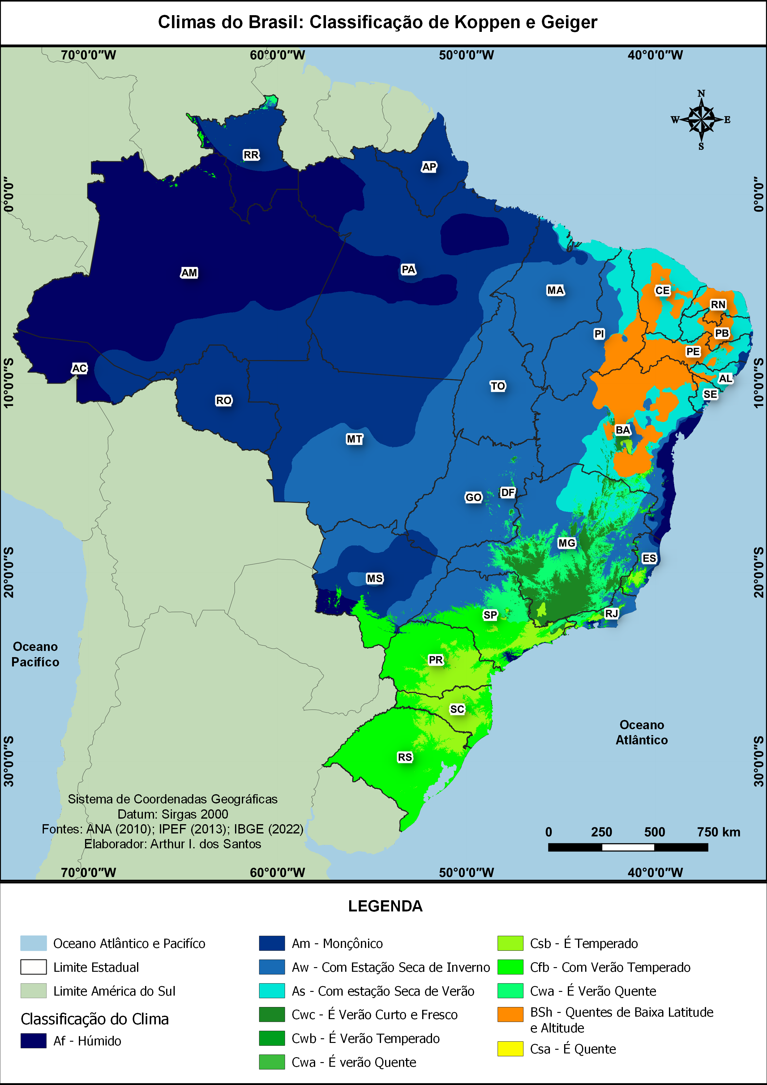
Water points classified based on operation status and water quality exported from an interactive map plot


Tools used

QGIS

Plug-ins used

QGIS

tags

Water

More by Chimango Chisuwo

Browser rendered terrain 3D models
13

You might also like

Mapa de estudo  ambiental
Paulo Ricardo Gomes de Souza
Mapa de estudo ambiental
Paulo Ricardo...
168
Roads and Buildings In Wuse, Abuja
Okiki Akinboyewa
Roads and Buildings In Wuse, Abuja
Okiki Akinboyewa
4
Access map
Daniel Rubens Santos Ribeiro
Access map
Daniel Rubens...
33
Suitable settlements for retirees.
Awolu Stella Adejumoke
Suitable settlements for retirees.
Awolu Stella Adejumoke
17
Duhernal Lake Pollutant Load Modeling
Shrithik S
Duhernal Lake Pollutant Load Modeling
Shrithik S
19
Mapa de localização SLB
Vanessa Cristiane Santos
Mapa de localização SLB
Vanessa Cristiane Santos
48
Calculation of NBR of a fire in SE Spain
Marta Rueda Pasadas
Calculation of NBR of a fire in SE Spain
Marta Rueda Pasadas
21
Planta de Georreferenciamento IFPA
Giovanni Augusto Valente da Silva
Planta de Georreferenciamento IFPA
Giovanni Augusto...
42
Idaho Wells and Lead Mines
Keran Nkongolo
Idaho Wells and Lead Mines
Keran NkongoloPro
5
Biomas do Brasil
Mauricio Matheus
Biomas do Brasil
Mauricio Matheus
13
Liquor Stores Proximity
Sammer
Liquor Stores Proximity
Sammer
13
LANDUSE/LANDCOVER MAP OF KETA LAGOON
Emmanuel Opoku
LANDUSE/LANDCOVER MAP OF KETA LAGOON
Emmanuel Opoku
4

Join the community!

We're a place where geospatial professionals showcase their works and discover opportunities.

Sign Up for free