Sign up or log in to your Spatialnode account.

Takes less than a few seconds.

Mapa hipsométrico

Guilherme Fidelis
Guilherme Fidelis•

July 16, 2022

Mapa hipsométrico

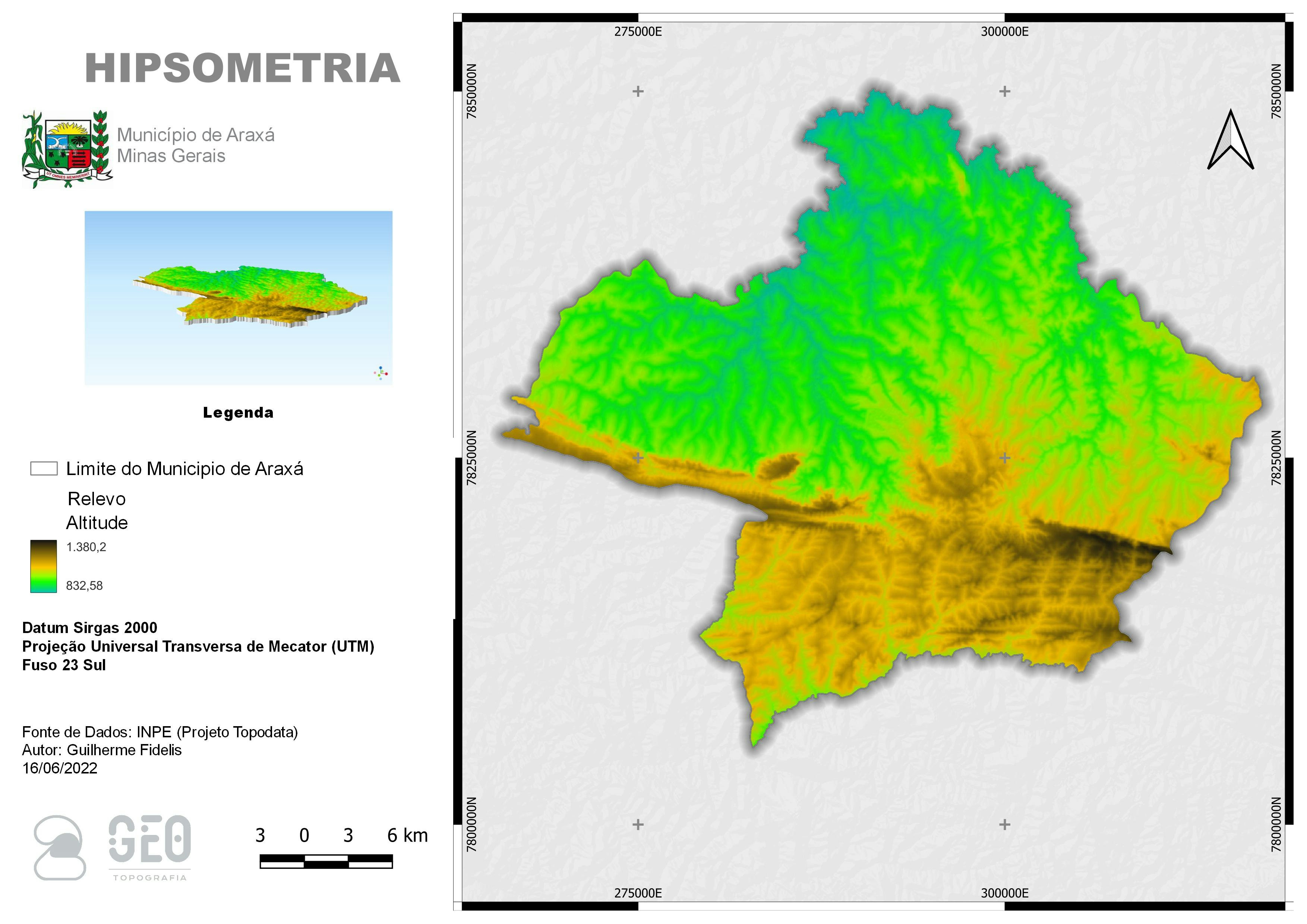
Hipisometria do município de Araxá Minas Gerais

Fonte de Dados: INPE (Projeto Topodata)


Tools used

QGIS

More by Guilherme Fidelis

Imagem do município de Ijaci Mg
83

You might also like

Normalized Difference Vegetation Index
Motunrayo Adeyemi
Normalized Difference Vegetation Index
Motunrayo Adeyemi
31
Land Use Analyzer
Alexandros Voukenas
Land Use Analyzer
Alexandros Voukenas
51
Cutting Raster image into squares
Paola Prieto Botero
Cutting Raster image into squares
Paola Prieto Botero
22
Microplanejamento Operacional
Marina Martins de Almeida
Microplanejamento Operacional
Marina Martins...
137
FLOOD SIMULATION
Francis Ndiritu
FLOOD SIMULATION
Francis Ndiritu
99
MAPA GEOLÓGICO DO MUNICÍPIO DE UIRAÚNA
Jonatha Iuri
MAPA GEOLÓGICO DO MUNICÍPIO DE UIRAÚNA
Jonatha Iuri
20
Elevation Map Switzerland | Imhof Style
Viola Schweiger
Elevation Map Switzerland | Imhof Style
Viola Schweiger
116
Design Vintage do Litoral Norte do MA
Jardel Estevam Barbosa dos Santos
Design Vintage do Litoral Norte do MA
Jardel Estevam...
11
Travelling under social influence
Katalin Peter
Travelling under social influence
Katalin Peter
28
World Happiness PowerBI Dashboard
Paola Prieto Botero
World Happiness PowerBI Dashboard
Paola Prieto Botero
44
Cu exports from Chile to America in 2021
Miriela Ulloa Santana
Cu exports from Chile to America in 2021
Miriela Ulloa Santana
117
Avalanche Risk Around Mt. Baker Ski Area
Drew S
Avalanche Risk Around Mt. Baker Ski Area
Drew S
38

Join the community!

We're a place where geospatial professionals showcase their works and discover opportunities.

Sign Up for free