

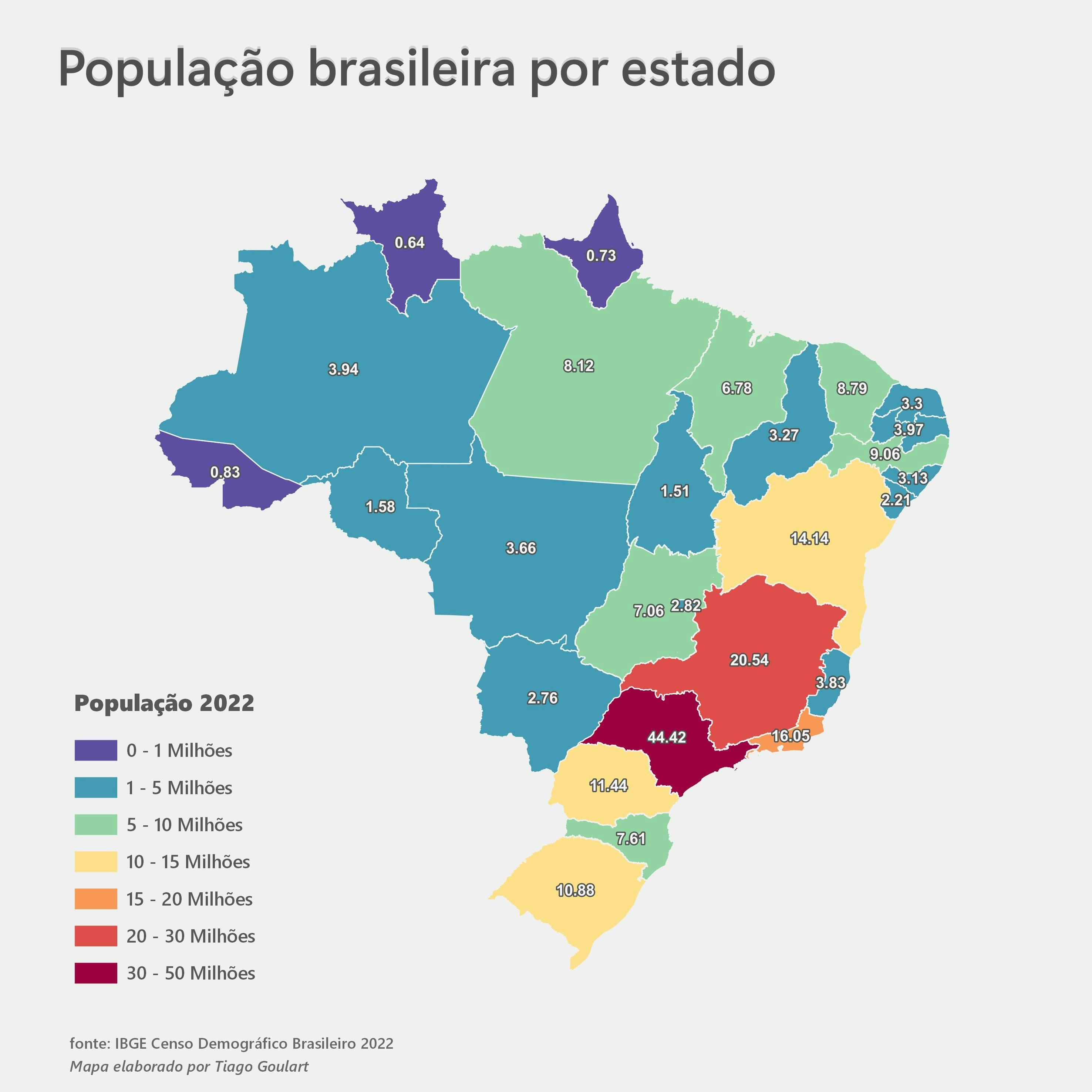
Presenting the topographic profile of the region around the Rio Paranaita Basin in Mato Grosso, Brazil, this map visualizes the elevation range across the landscape. The altitude variation is represented through a color gradient, with red indicating the highest elevations of up to 454,199 meters and blue representing lower elevations down to 213,546 meters. The elevation data was sourced from the Earth Explorer provided by USGS, and the visualization was generated using a Digital Elevation Model (DEM). Although hydrographic boundaries are not delineated in this map, the elevation information is crucial for hydrological studies, environmental monitoring, and planning infrastructure in the region.
Elevation Profile of the Basin Area
Plug-ins used
QuickMapServices
tags
DEMQGISSpatial analystWatershed
More by TIAGO LANDIM GOULART DE OLIVEIRA


You might also like


_2067263.png&w=3840&q=100)


.svg "Keran Nkongolo")


Join the community!
We're a place where geospatial professionals showcase their works and discover opportunities.