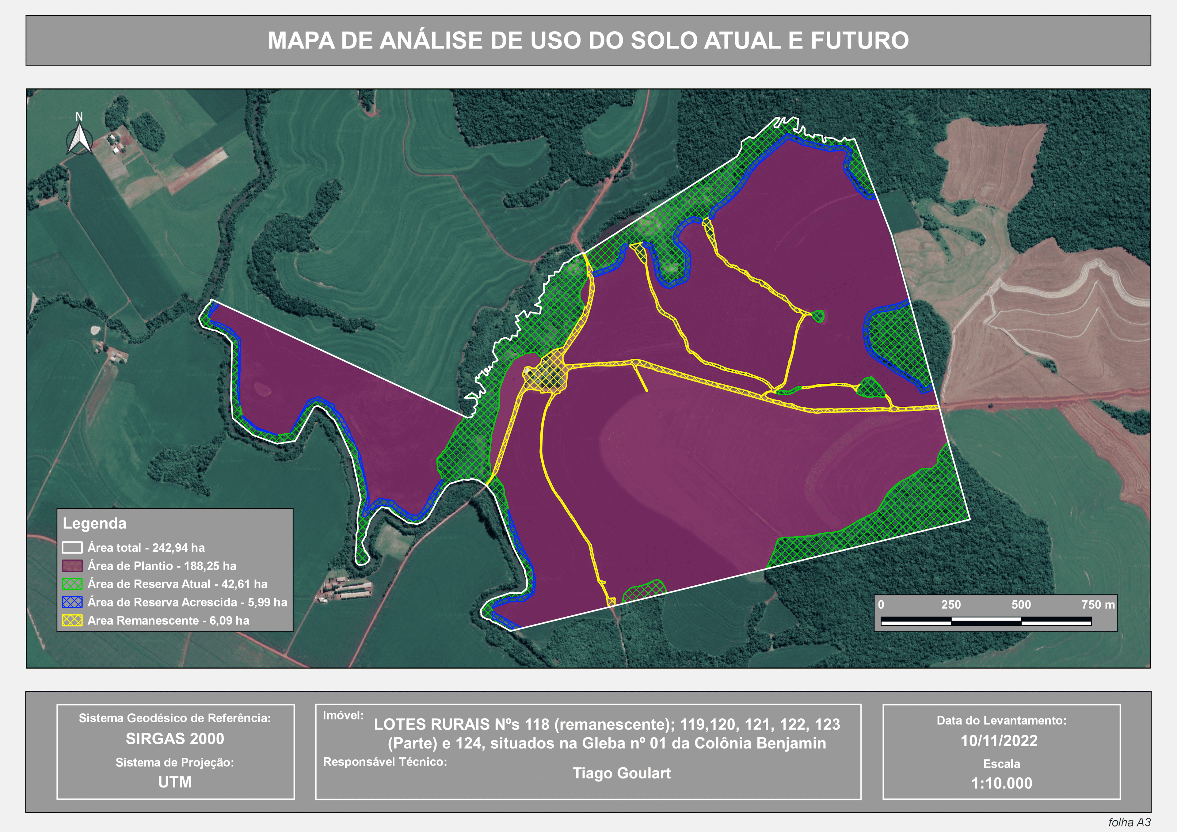
The map shows a proposed analysis that takes into consideration that the ditches crossing the farmer's rural property can be regarded as sporadic watercourses, in other words, intermittent water bodies that do not have water throughout the year. This may exempt the farmer from preserving the slopes of these ditches, as stipulated in Resolution No. 357/2005 of the National Environment Council (CONAMA).
Furthermore, considering the fact that such ditches have been observed in the area since 2003, as can be seen in the image below, and that the observed terrain has topographical characteristics conducive to the formation of these ditches, as demonstrated in the DTM, it can be considered that they have formed naturally, without human intervention. Since they are not located in Permanent Preservation Areas (PPAs), there is no legal obligation to preserve the slopes of these ditches.