
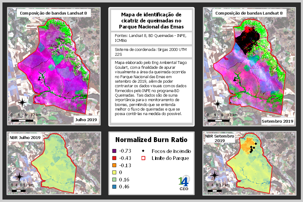
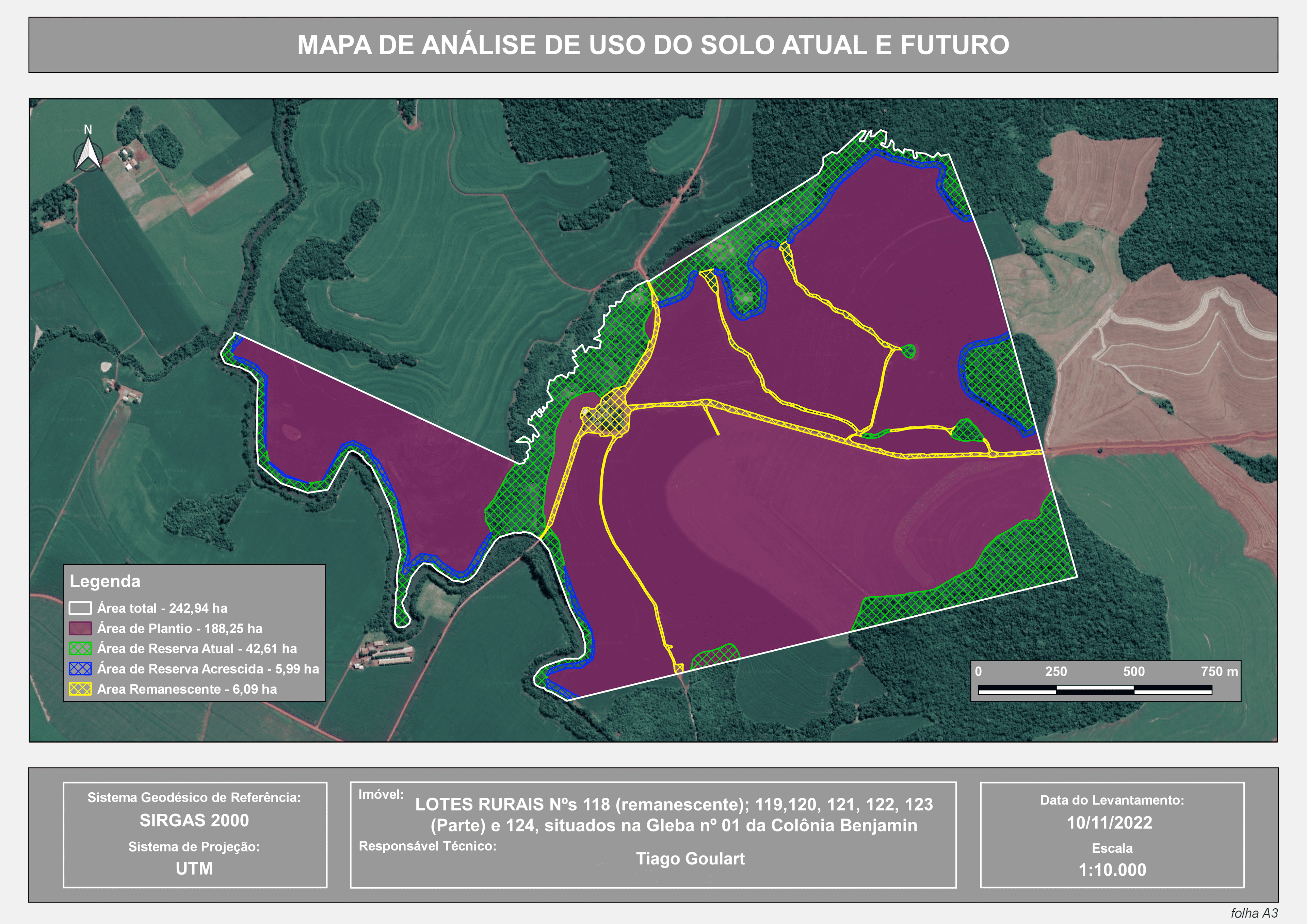
In 2019, a severe wildfire occurred in Emas National Park in Goiás, causing damage to the local biodiversity and significant atmospheric impacts. Based on this, I created a map using Landsat 8 satellite imagery, which allowed me to calculate the Normalized Burn Ratio (NBR). By contrasting this data with fire data from INPE (National Institute for Space Research) and vector data from the park provided by ICMBio (Chico Mendes Institute for Biodiversity Conservation), it was possible to graphically represent the wildfire and its consequences on the local vegetation.
Normalized Burn Ratio
Plug-ins used
Landsat 8QuickMapServices
tags
GISsatellite datasatellite imagerySpatial Analysis
More by TIAGO LANDIM GOULART DE OLIVEIRA


You might also like


Join the community!
We're a place where geospatial professionals showcase their works and discover opportunities.