

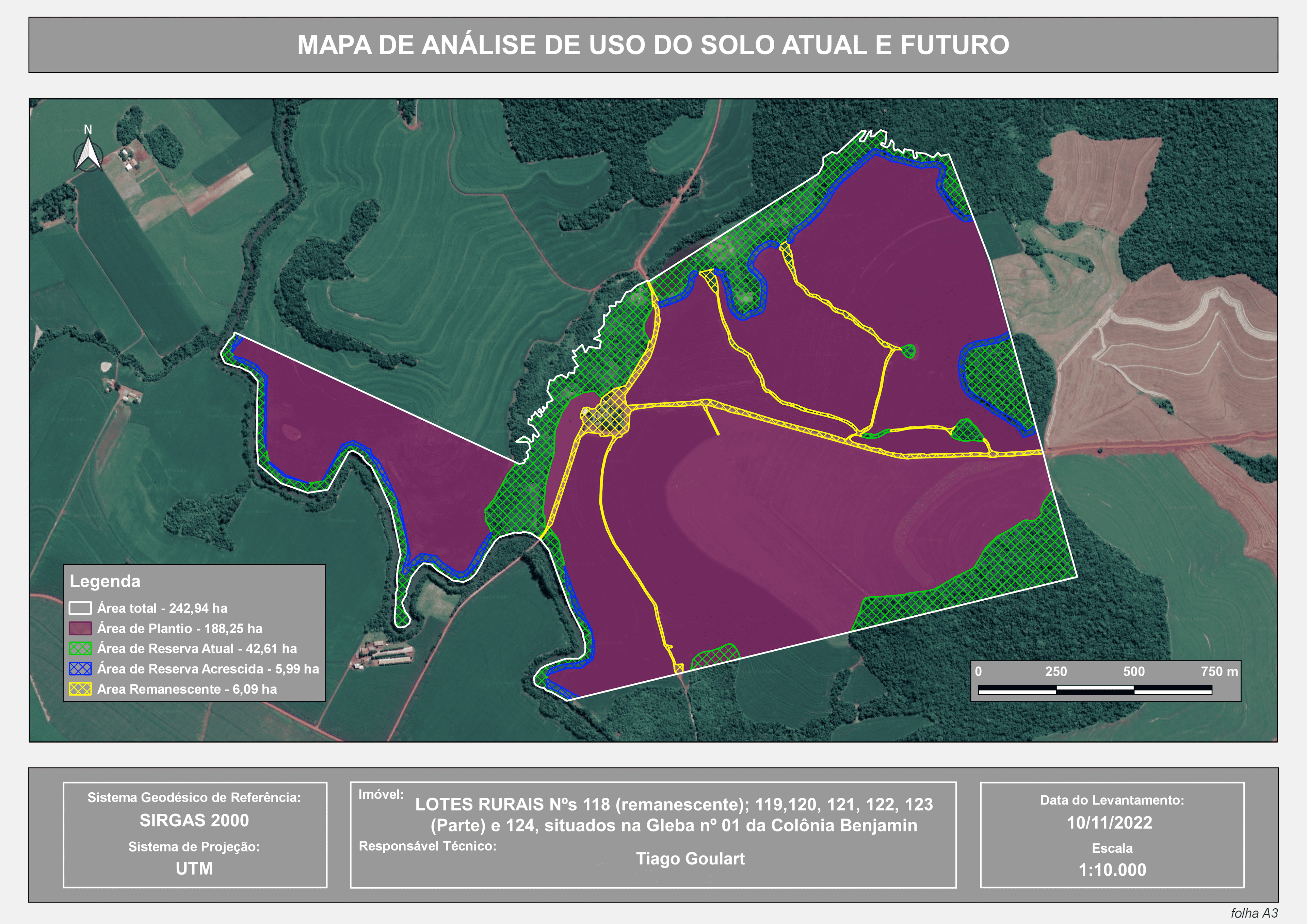
I created an A4-sized map featuring a colored digital elevation model (DEM) in the upper section. The DEM highlights the decrease in altitude towards the southeast, corresponding to observed features like rivers and ponds in the field. Additionally, the map includes a high-resolution orthophoto with a spatial resolution of 5cm per pixel and contour lines at 1 and 2-meter intervals. All these products were generated by me following an aerial survey with a drone and processed using OpenDroneMap (ODM) and QGIS.
Elevation Model Demo Map
Plug-ins used
GRASS GISQGIS, Interpolation TIN
tags
ContoursDEMDTM
More by TIAGO LANDIM GOULART DE OLIVEIRA


You might also like


.png&w=3840&q=100)


Join the community!
We're a place where geospatial professionals showcase their works and discover opportunities.