
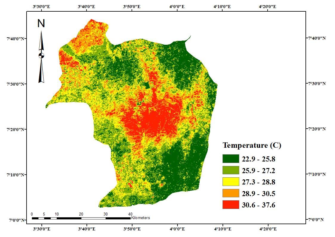
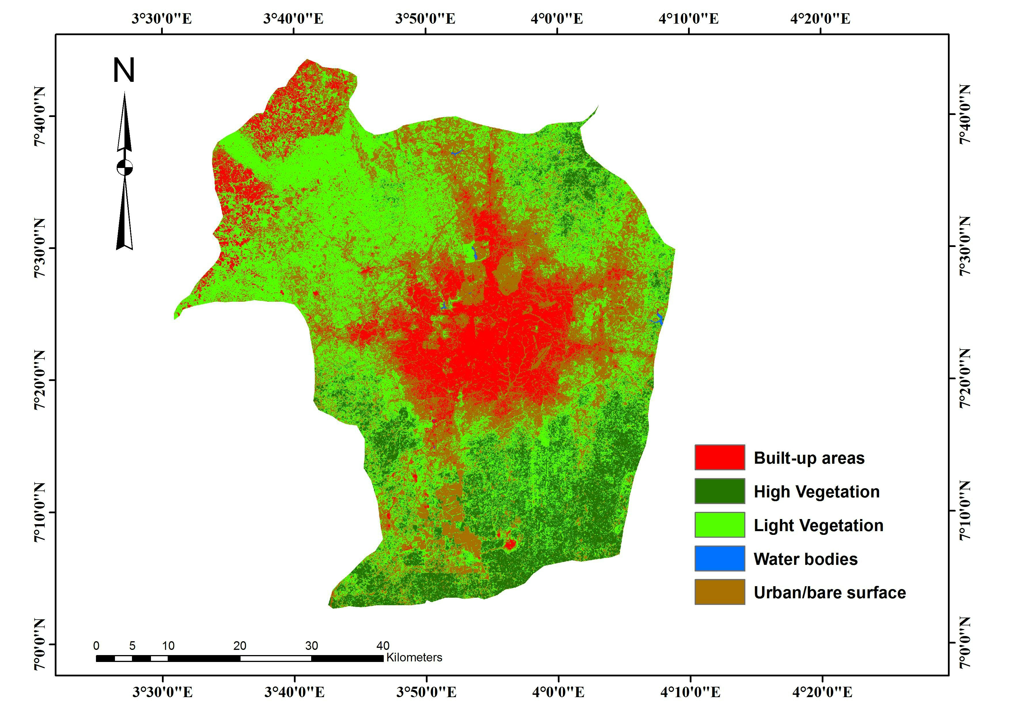
This project used Landsat to generate and analyze Land Surface Temperature for the entire Ibadan region. The analysis was done to compare changes in surface temperature over the years in the region. The result showed that land surface temperature is fast increasing and the core of the region expanding rapidly.
Land Surface Temperature Analysis
Tools used
ArcMapRemote Sensing
Plug-ins used
ArcMapGeoserver
tags
ArcMapland coverLULC
More by Lawrence Akpoterai
_7771518.jpg&w=3840&q=100)

You might also like


Join the community!
We're a place where geospatial professionals showcase their works and discover opportunities.