.svg "Nicholas mattes")
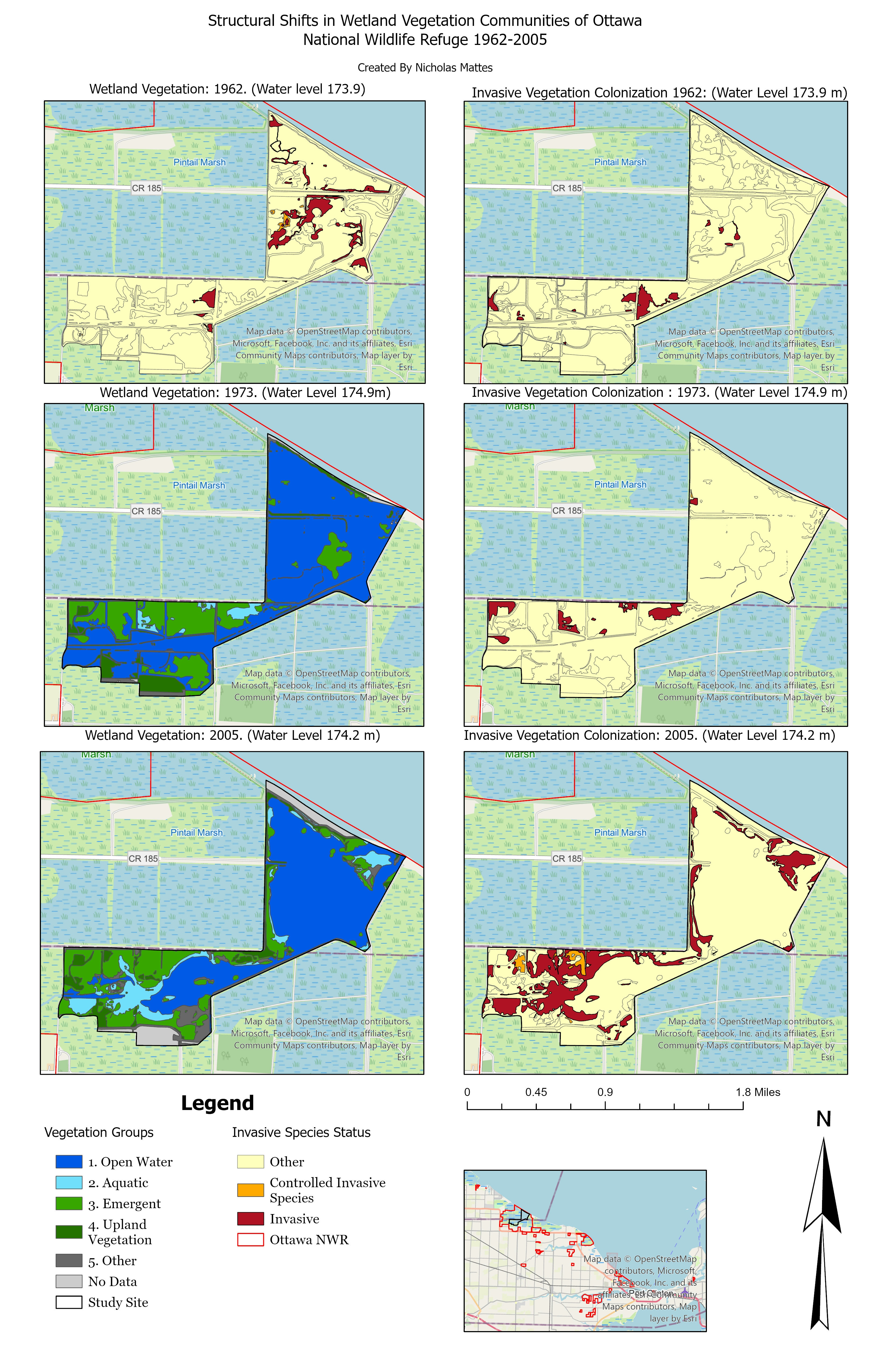
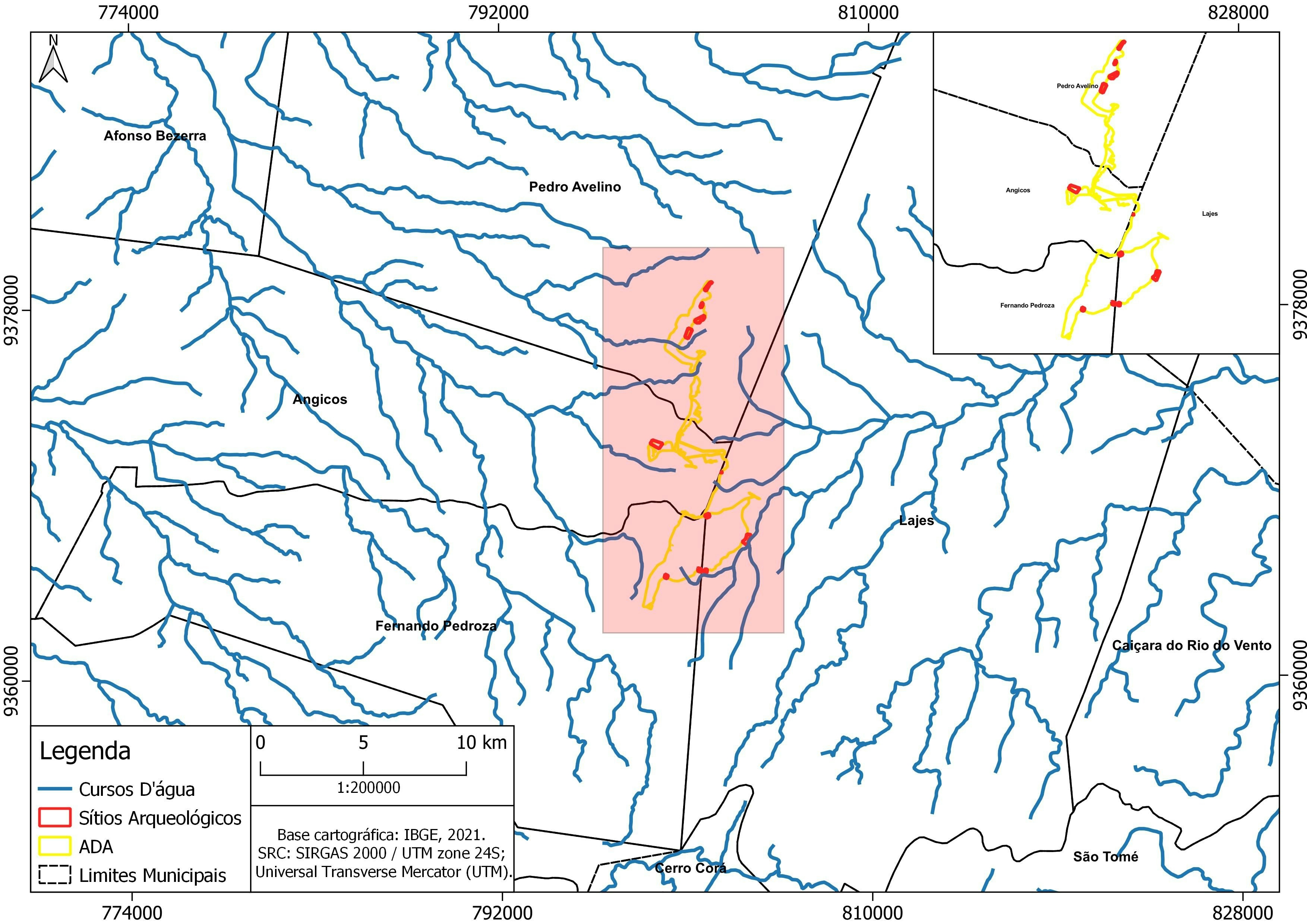
This project was completed in 2023 during the final course of my GIS certification from Penn state, and maps the changes in wetland vegetation within the Ottawa National wildlife refuge from 1962-2005. The vegetation polygons were interpreted from remote sensing data and provided as part of the project data. The goal of this project was to visualize the influence that hydrological fluctuation within Lake Erie had on adjacent wetland vegetation communities.
Ottawa NWR Wetland Vegetation Analysis
Tools used
ArcGIS ProSpatial analystZonal Statistics
Plug-ins used
Data ManagementSpatial analyst
tags
ArcGIS Prowetland
You might also like


.png&w=3840&q=100)
 He")


Join the community!
We're a place where geospatial professionals showcase their works and discover opportunities.