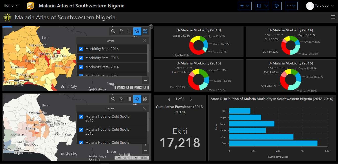
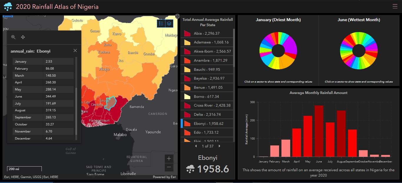
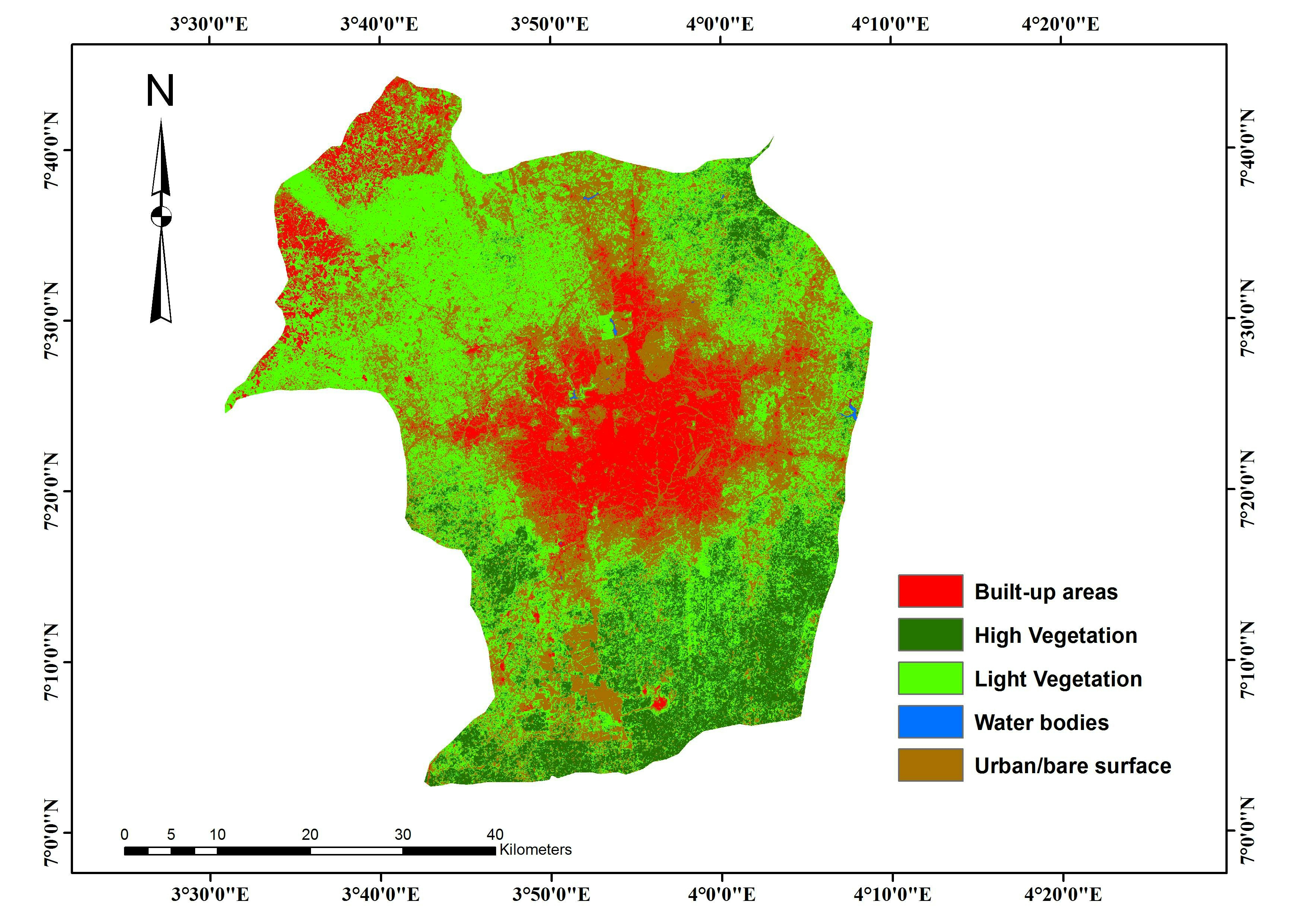
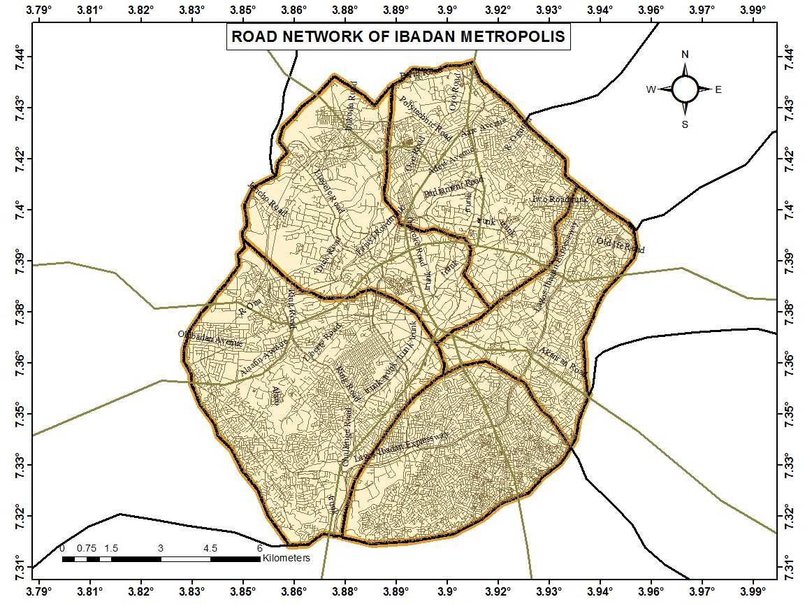
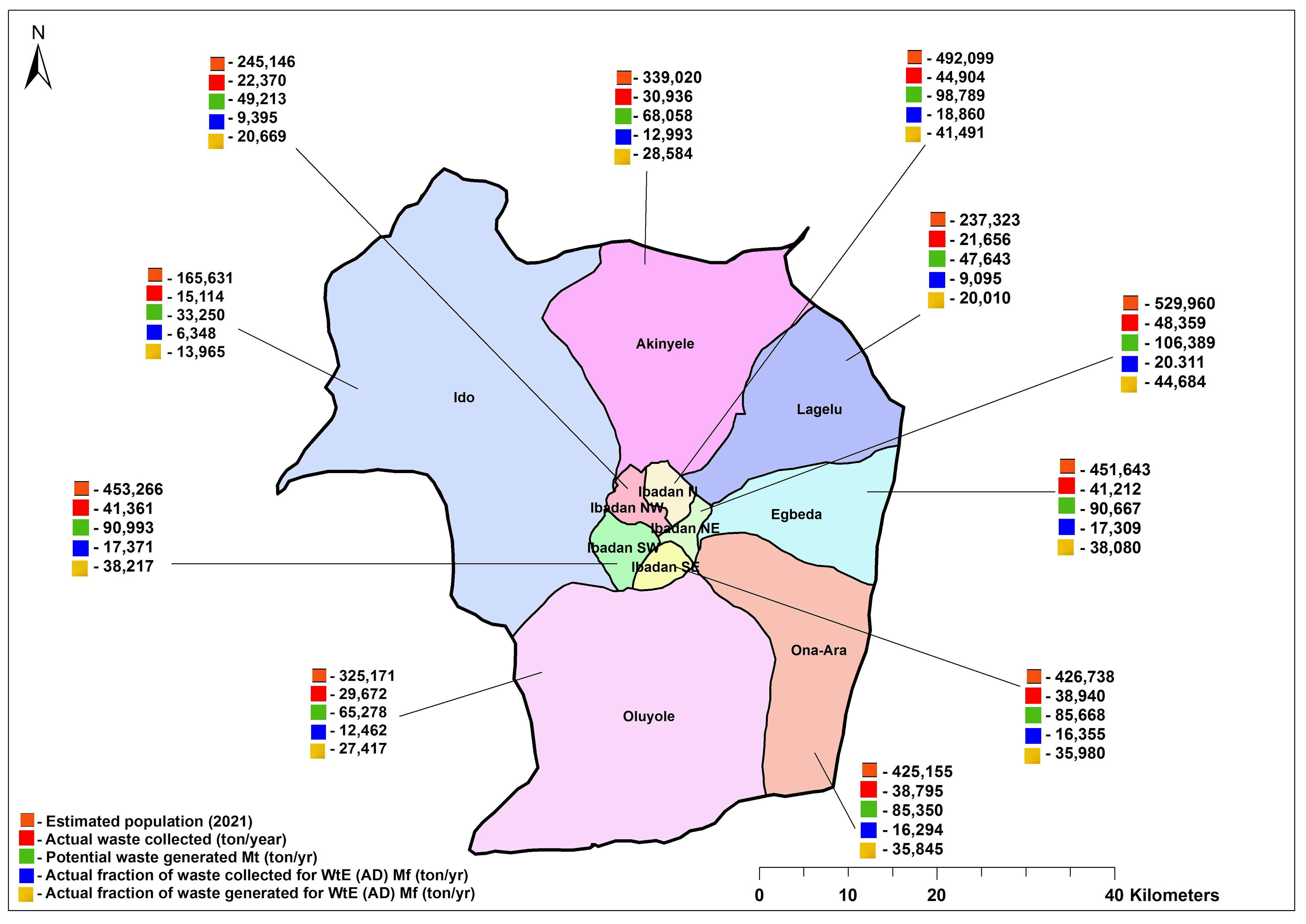
Spatial visualization of applicants ??

_7771518.jpg&w=3840&q=100)
Tools used
ArcMap
Plug-ins used
ArcMap
tags
Data VisualizationProjects
More by Lawrence Akpoterai

You might also like


Join the community!
We're a place where geospatial professionals showcase their works and discover opportunities.