
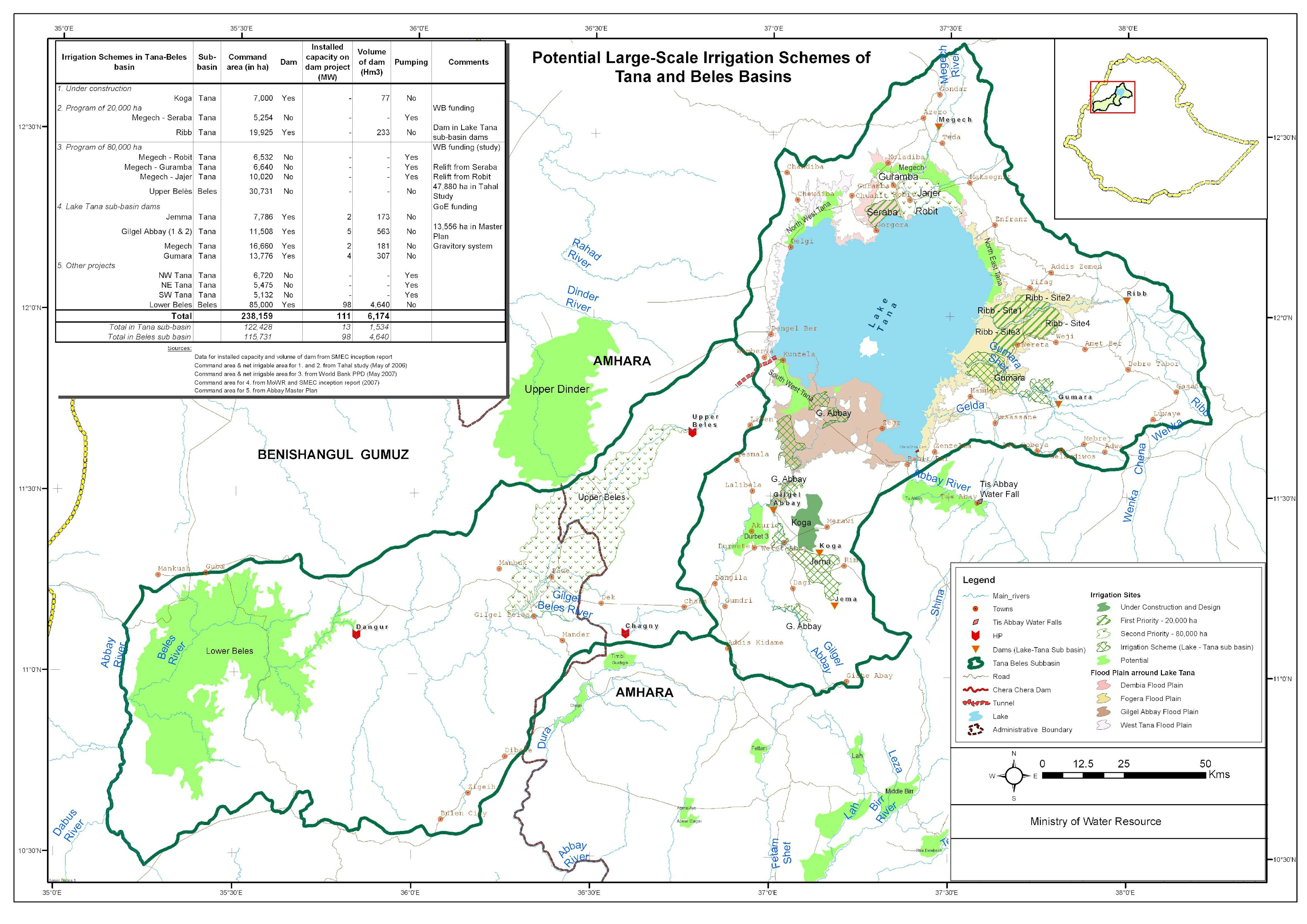
I produced this map as part of a project called "Tana Beles Integrated Water Resources Development: Institutional and Capacity Building Studies". The project aimed to enable institutions and investments for integrated planning, management, and development in the Tana and Beles Sub-basins to accelerate sustainable growth.
Potential Large Scale Irrigation Schemes
Tools used
ArcMapExcel
Plug-ins used
Mapping
tags
Tana
More by Girma Kussa

You might also like


Join the community!
We're a place where geospatial professionals showcase their works and discover opportunities.