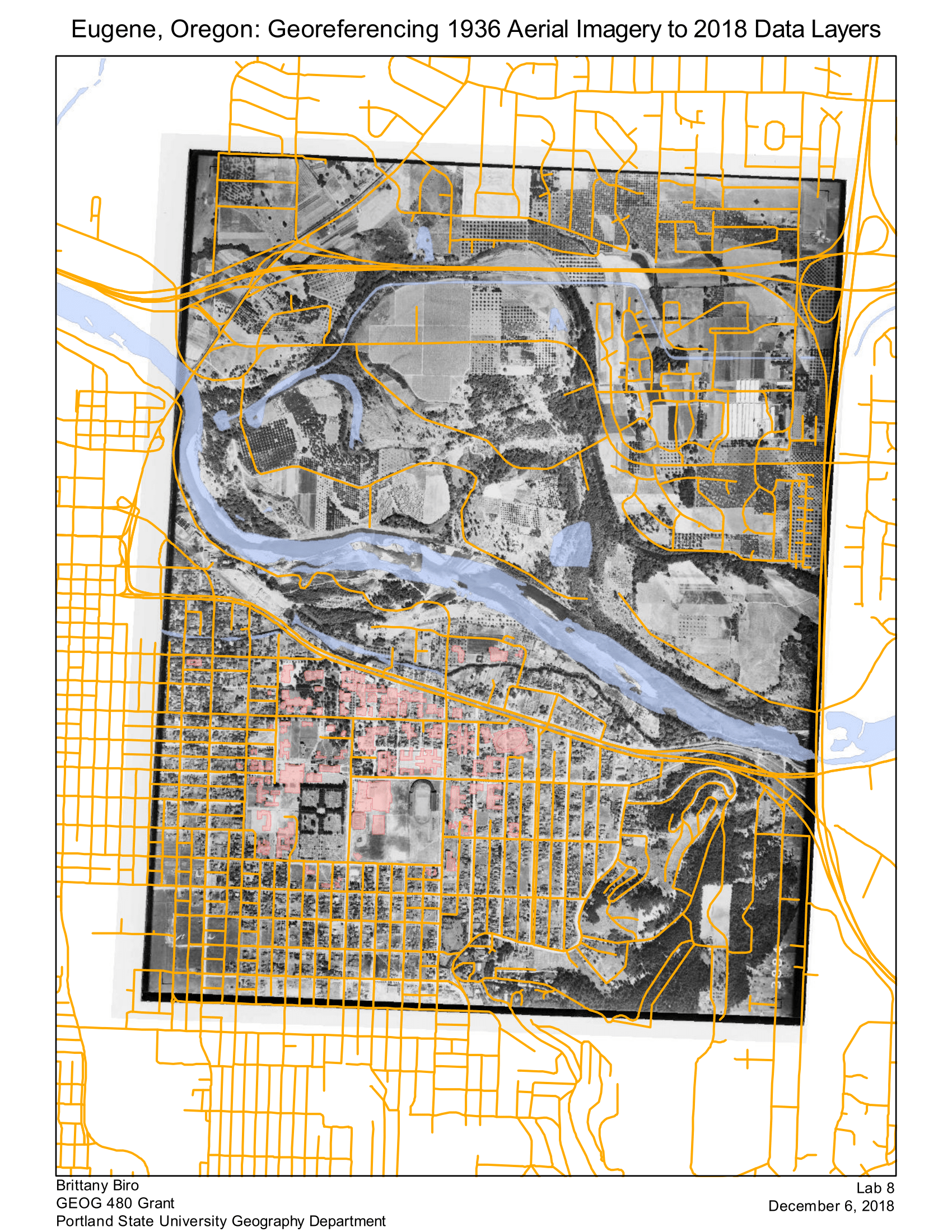
The raster image layer was georeferenced to the Roads_TIGER_2018 layer, which uses
the “NAD_1983_HARN_StatePlane_Oregon_South_FIPS_3602_Feet_Intl” projected coordinate
system. The process of georeferencing using this as the alignment layer caused 3884.jpg to acquire
that same projected coordinate system.
In the raster image, there are much fewer roads north of the river, and many of the
roads there in the Roads_TIGER_2018 vector layer did not exist when the original image was taken.
So, it was challenging to find sufficient road points on that part of the raster image that corresponded
to the vector roads layer. According to ArcMap documentation, the best practice when georeferencing is to have control points near each corner of the image, and some more control points evenly distributed among the rest of the image. As it turns out, it was hard to find good control points in the corners of this image, because the corners were mostly farmland, and the NHS layers show newer road features in those corners that do not correspond to the image.
I used 10 control points and my Total RMS Error value was “34.9532”.


.svg "Alec Soltes")