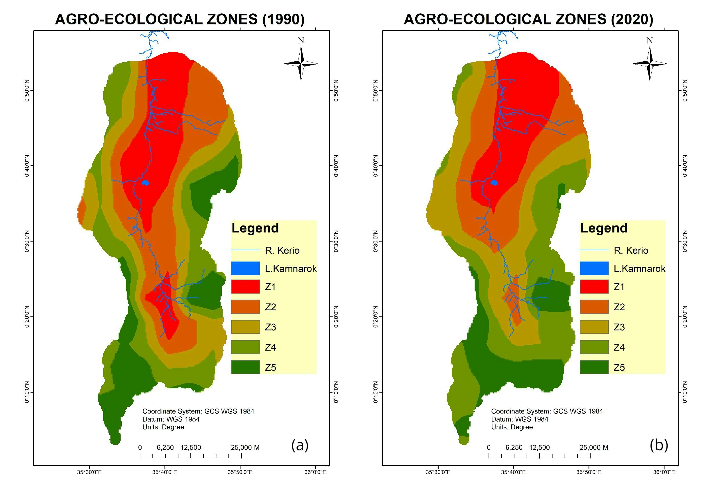
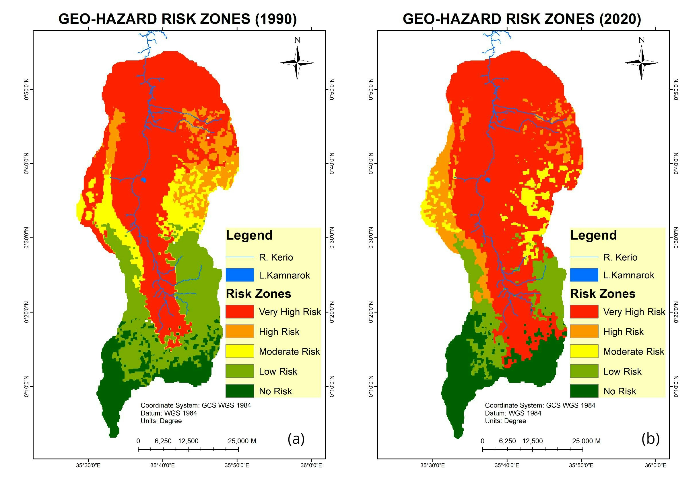
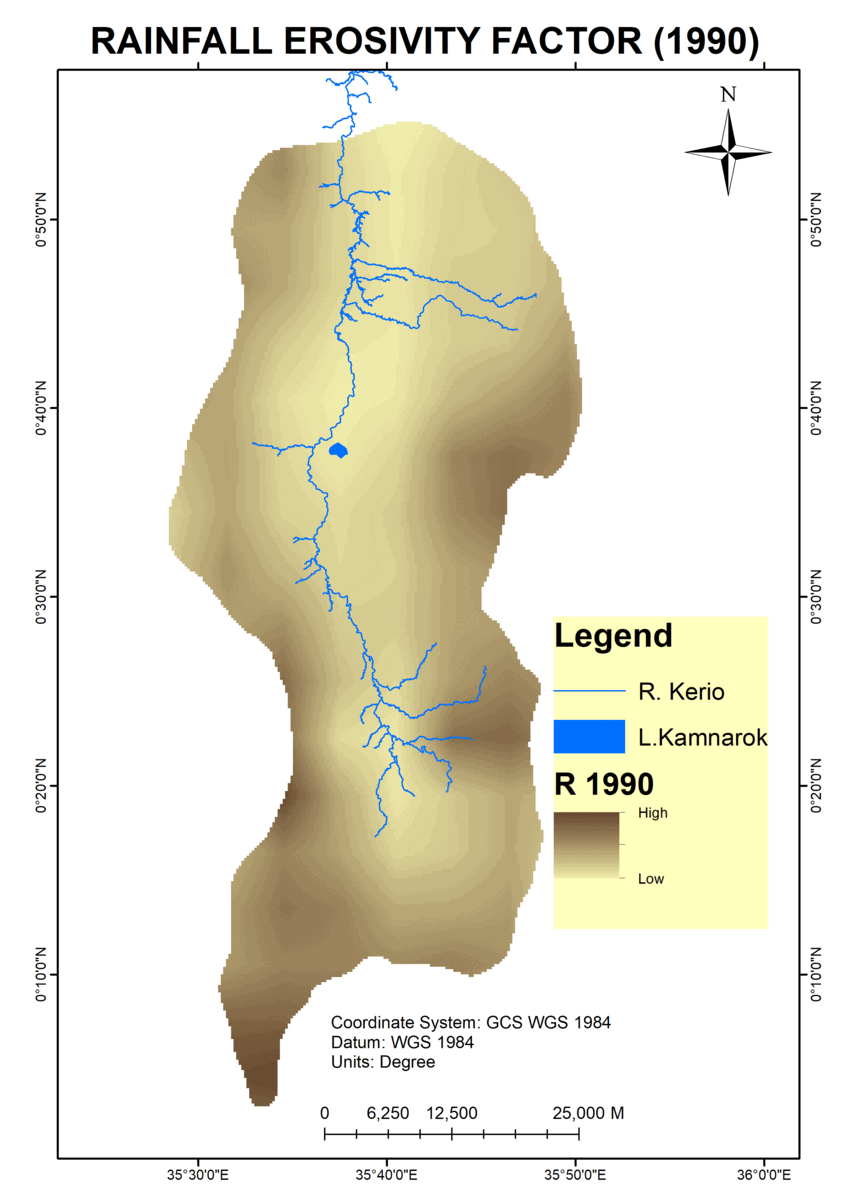
An analysis of Tanyai forest destruction from 1990 to 2020 in Kenya using Landsat images.
I used maximum likelihood algorithm in ENVI to classify the images.
TANYAI FOREST LOSS ANALYSIS(1990-2020)
An analysis of Tanyai forest destruction from 1990 to 2020 in Kenya using Landsat images.
I used maximum likelihood algorithm in ENVI to classify the images.
More by John Wahome Gathoni
You might also like
We're a place where geospatial professionals showcase their works and discover opportunities.