
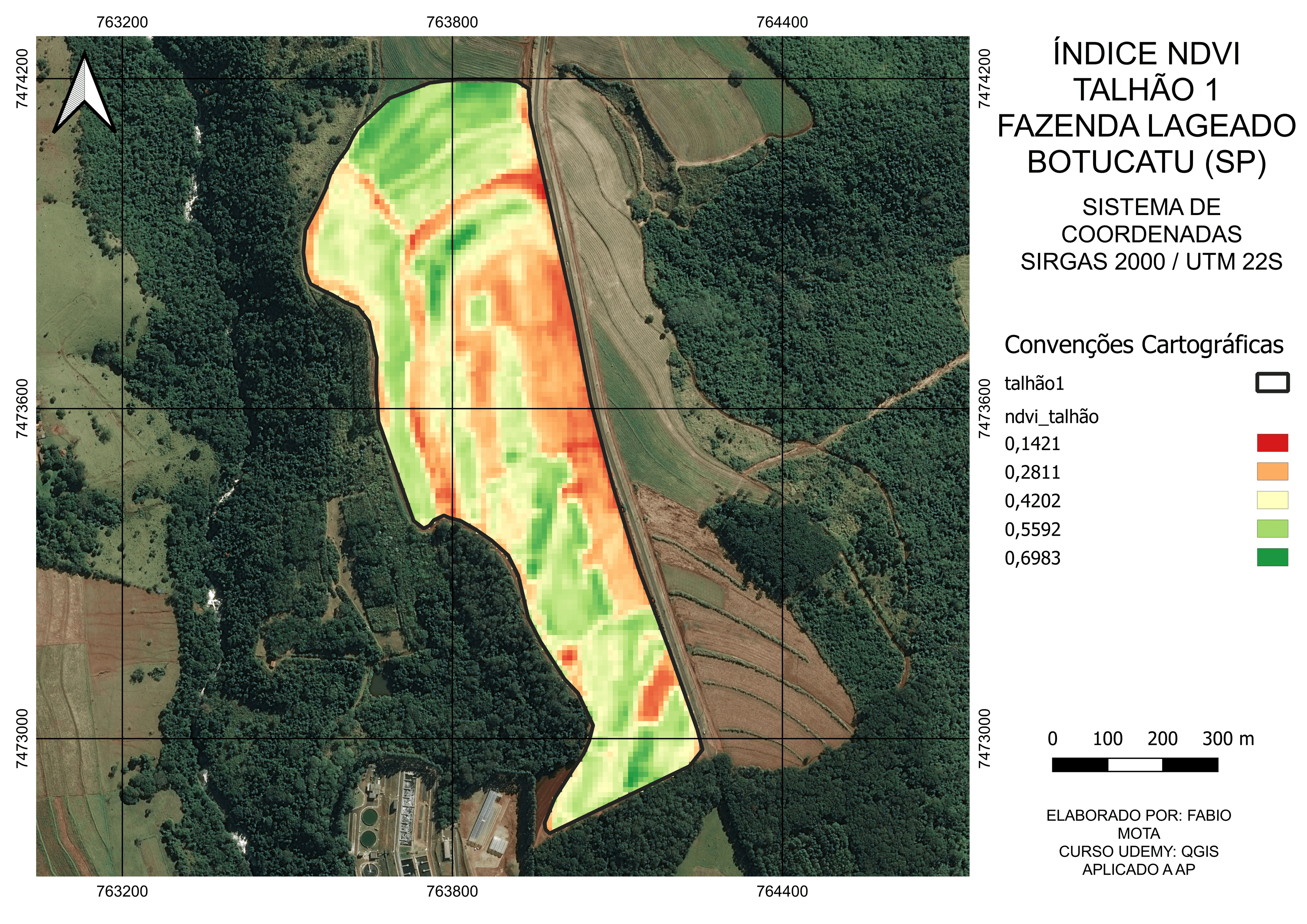
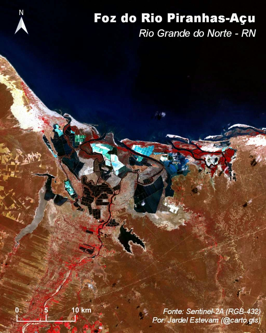
This map was made using bands 5 and 4 of Landsat 8 images from USGS.
NDVI Map for Agricultural
Tools used
QGIS
More by Fabio Henrique Nunes Mota

You might also like


Join the community!
We're a place where geospatial professionals showcase their works and discover opportunities.