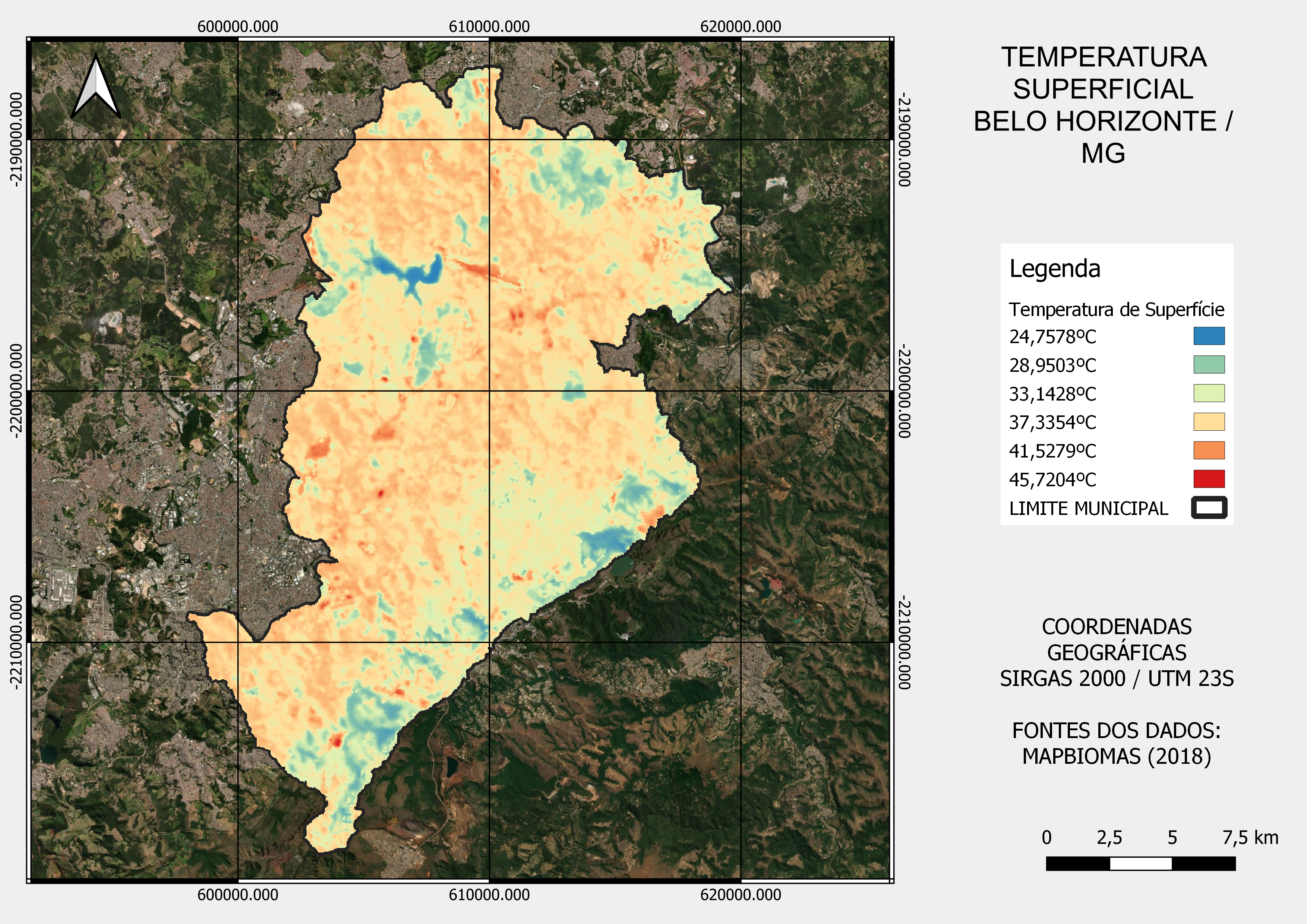
Surface Temperature /Belo Horizonte City

Tools used
Google Earth Engine(GEE)QGIS
More by Fabio Henrique Nunes Mota

You might also like


Join the community!
We're a place where geospatial professionals showcase their works and discover opportunities.
Surface Temperature /Belo Horizonte City
More by Fabio Henrique Nunes Mota
You might also like
We're a place where geospatial professionals showcase their works and discover opportunities.