.svg "Keran Nkongolo")
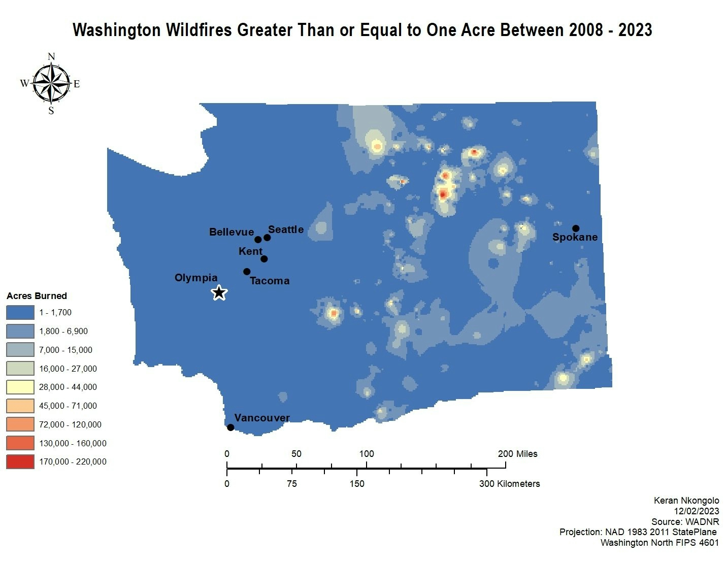
This project looked into the distribution of wildfires in the state of Washington between 2008 - 2023 greater than one acre. IDW was utilized to look of wildfires and based on the results most wildfires in the state tend to burn between 1 - 1,700 acres with a few burning more than that.
Washington WF Over 1 Acre
Plug-ins used
ArcGISArcMapSpatial analyst
tags
ArcMap
More by Keran Nkongolo


You might also like


Join the community!
We're a place where geospatial professionals showcase their works and discover opportunities.