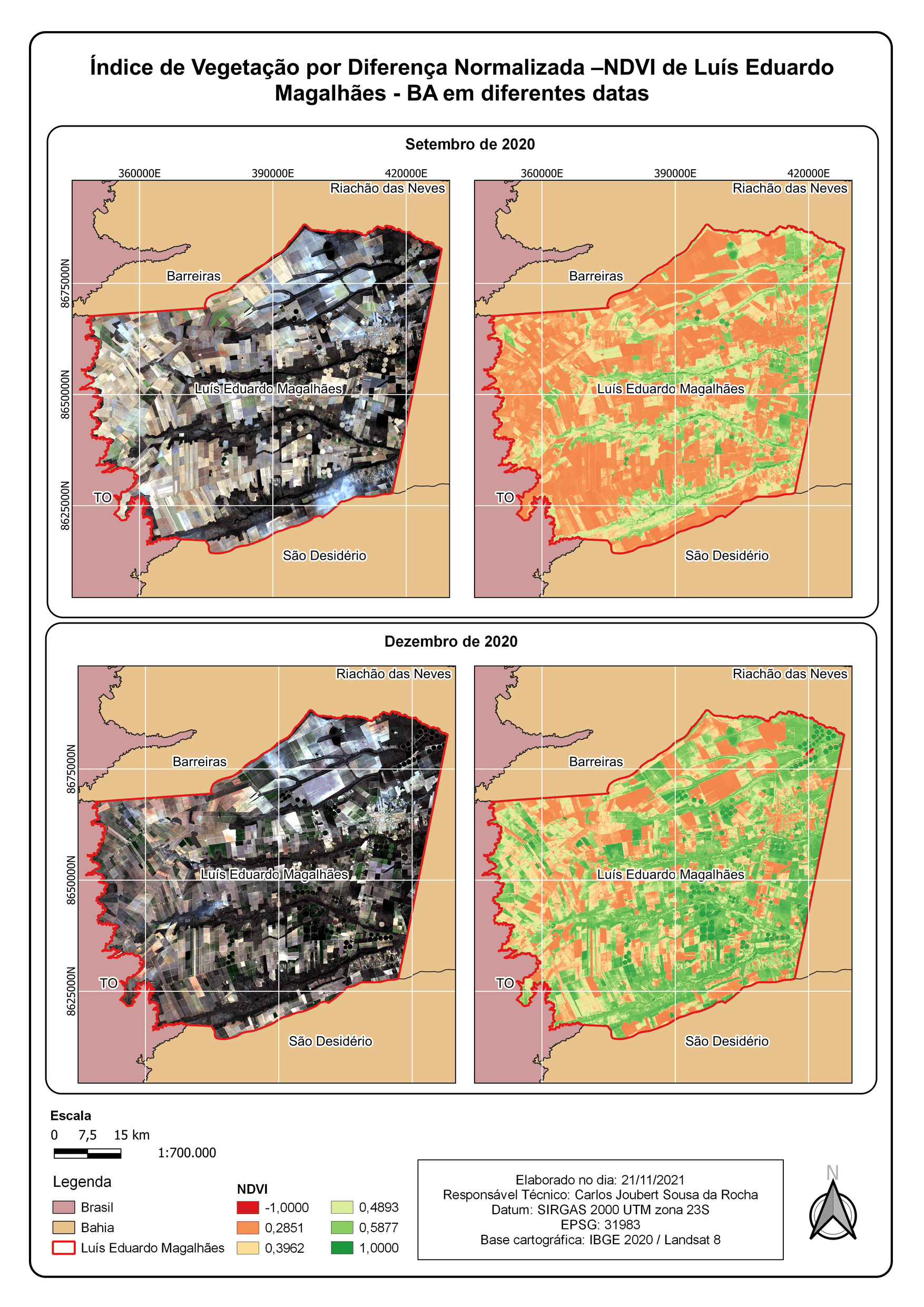
OBJECTIVE
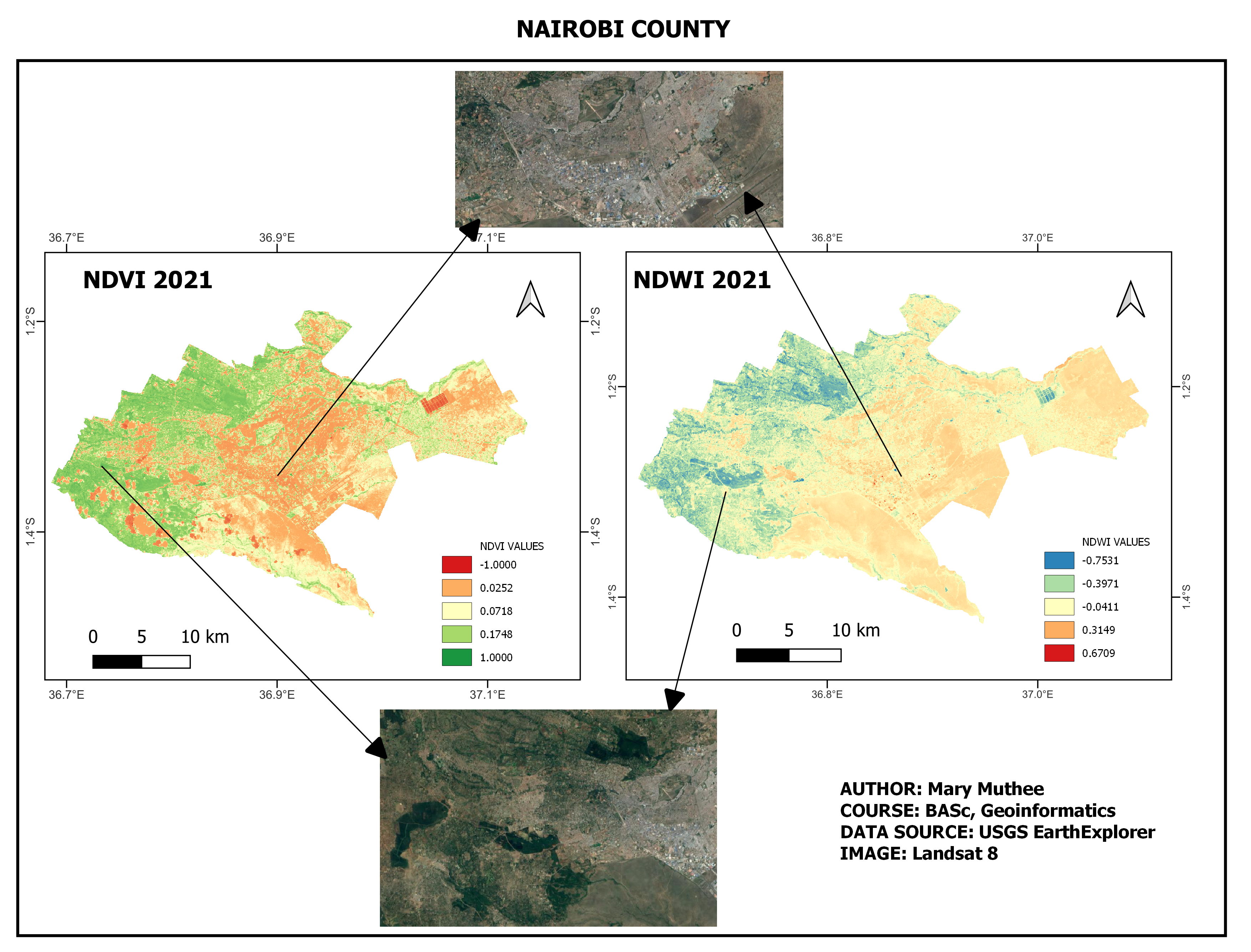
The main aim of the project was to monitor how vegetation is spread out in the county as well as identifying the built up area index . I used the Landsat imagery specifically Landsat 8 which I downloaded from the USGS EarthExplorer.
RESULTS
Areas that had a high NDVI value had a lower NDBI value
Areas with low NDVI value had a higher NBI value
CONCLUSION
The growth of vegetation is dependent on the urbanization