
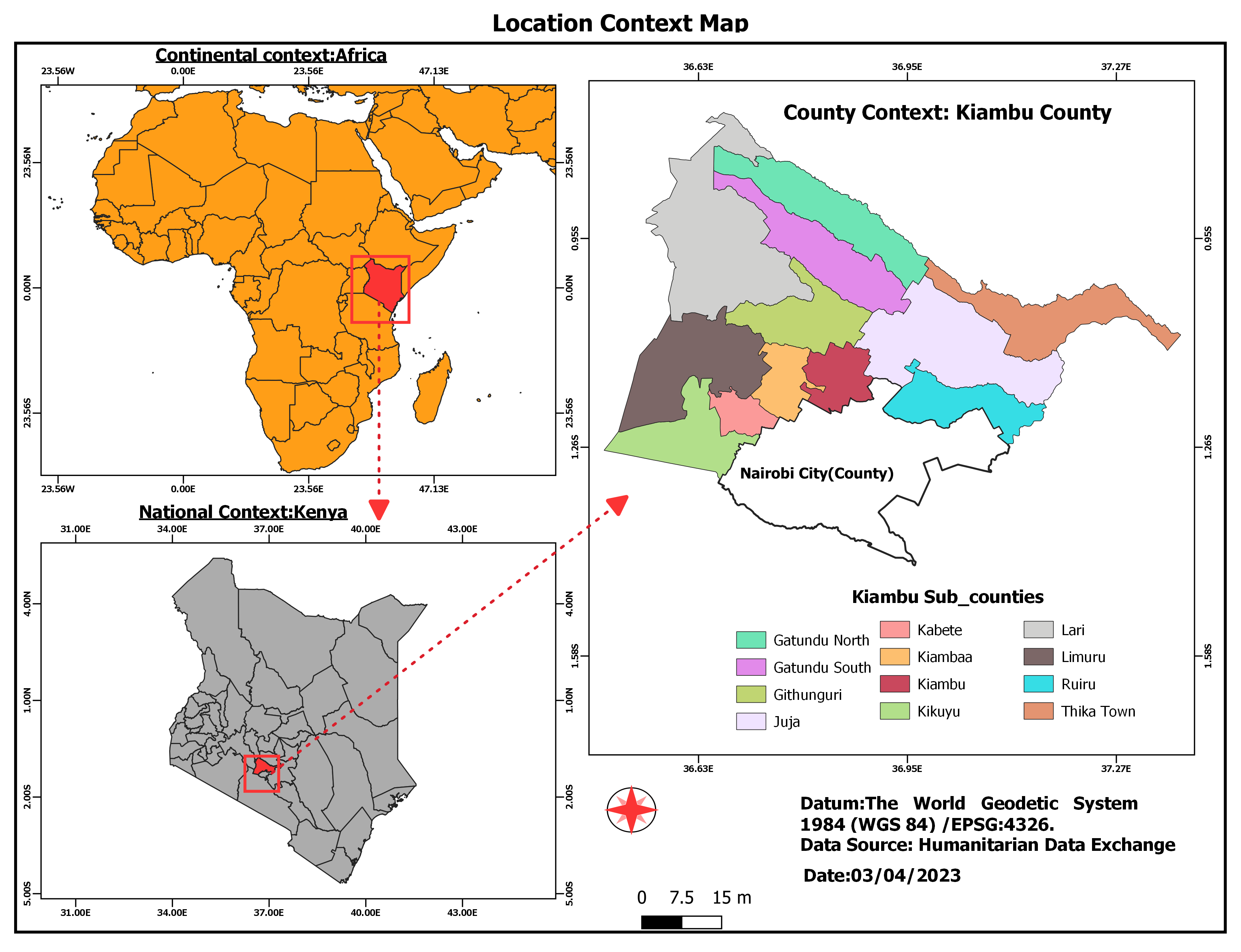
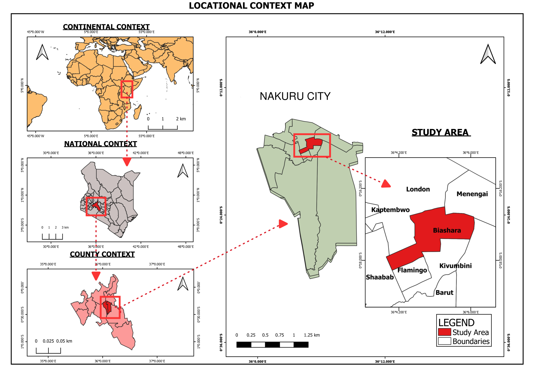
I created a locational context map for Kiambu County. The purpose of a locational context map is to provide a comprehensive overview of a location and its surroundings
LOCATIONAL CONTEXT MAP FOR KIAMBU COUNTY
Tools used
QGIS
Plug-ins used
QGIS
tags
#gismapping#spatialAnalyst #gis
More by Mary Muthee
You might also like


_2_5005765.jpg&w=48&q=40 "Poliana Marilia da Silva Mello Betella dos Santos")


Join the community!
We're a place where geospatial professionals showcase their works and discover opportunities.