To represent the hypsometry, data from the National Institute for Space Research of Brazil, with 30 meters of spatial resolution, were used.
The municipal delimitation provided by the Brazilian Institute of Geography and Statistics was also used.
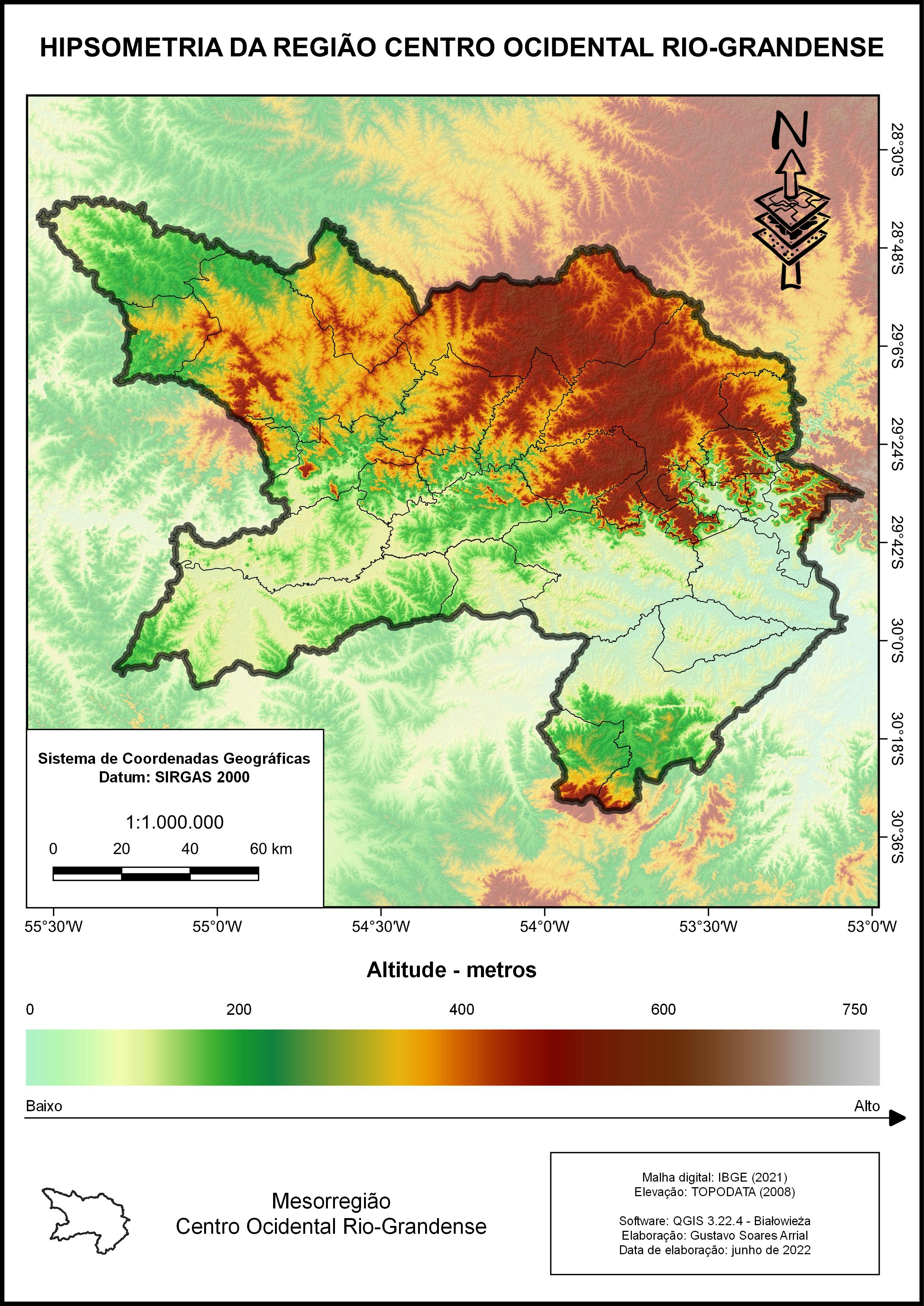
Hypsometry of the central region of RS
To represent the hypsometry, data from the National Institute for Space Research of Brazil, with 30 meters of spatial resolution, were used.
The municipal delimitation provided by the Brazilian Institute of Geography and Statistics was also used.
More by Gustavo Soares Arrial
You might also like
We're a place where geospatial professionals showcase their works and discover opportunities.


-1.png&w=3840&q=100)


_SK%2520(1).jpg&w=3840&q=100)