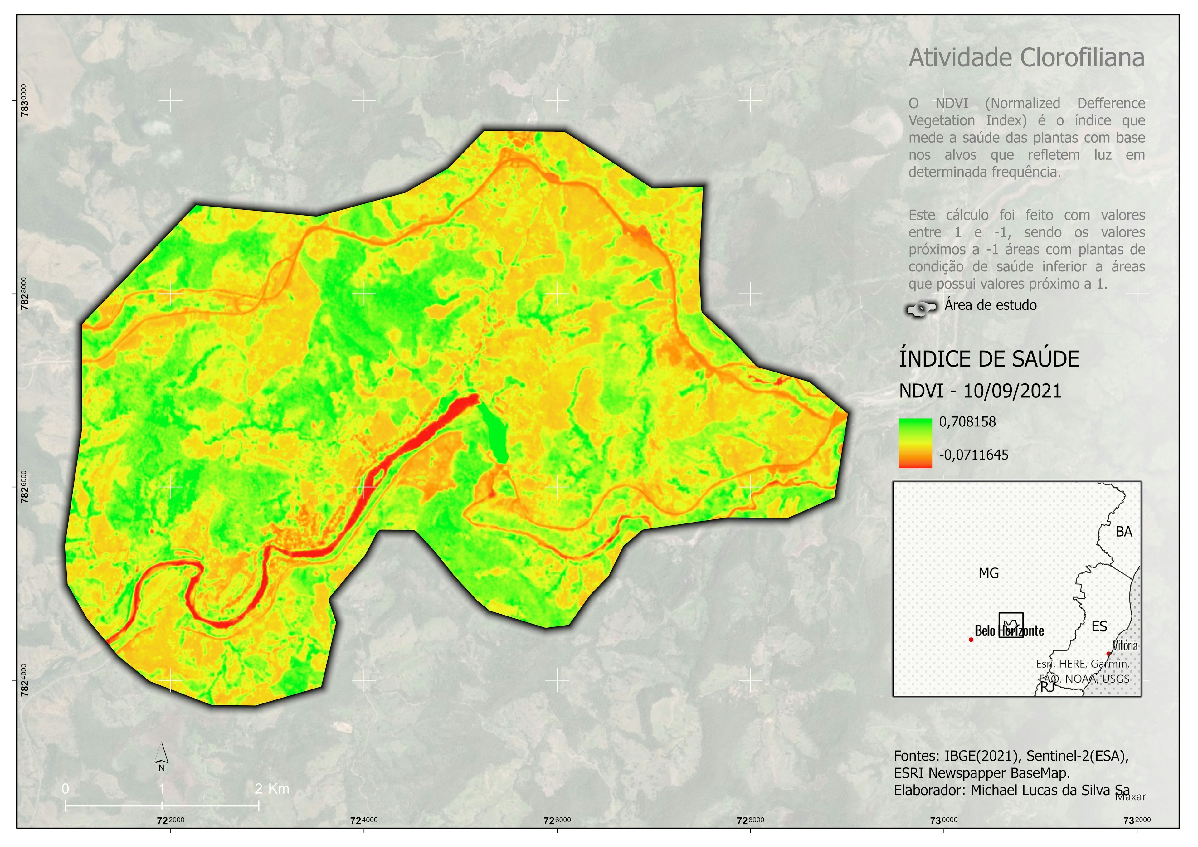
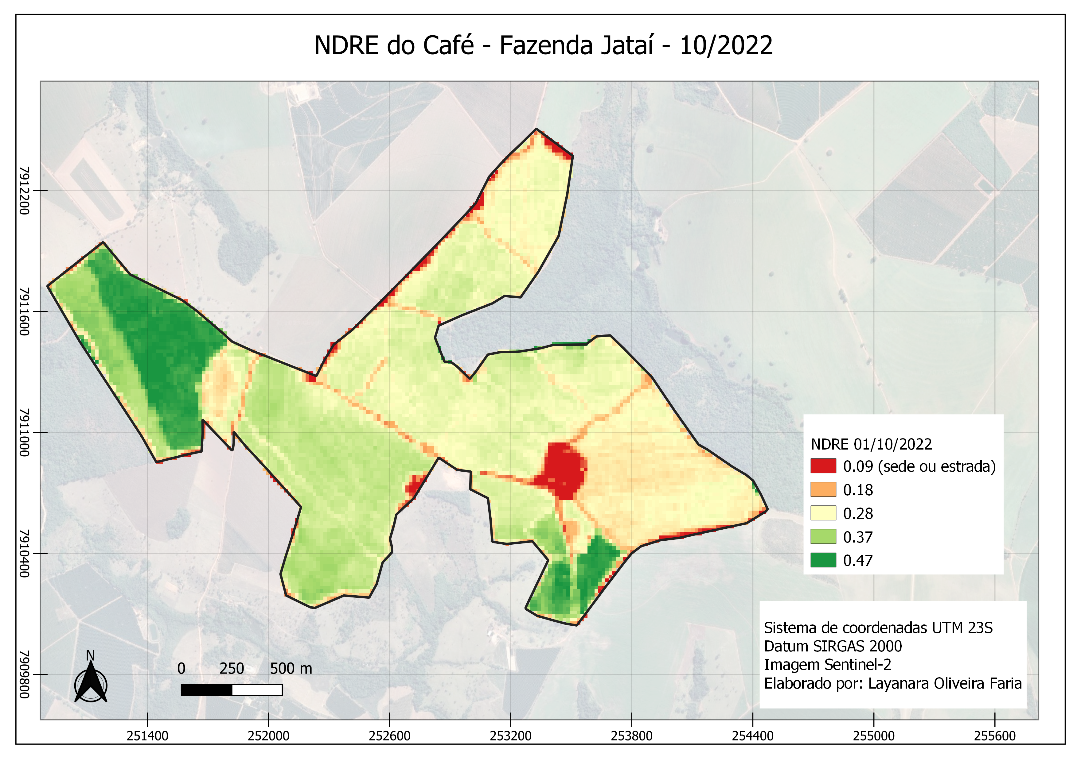
Sign up or log in to your Spatialnode account.

Takes less than a few seconds.

NDVI

MICHAEL LUCAS DA SILVA SA
MICHAEL LUCAS DA SILVA SA•

January 21, 2022

NDVI

Tools used

ArcGIS Pro

More by MICHAEL LUCAS DA SILVA SA

ÁREAS POTENCIAIS
ÁREAS POTENCIAIS
5
Mapa Uso e Ocupação
Mapa Uso e Ocupação
6
Mapa artístico
Mapa artístico
9
Mapa Hipsométrico
Mapa Hipsométrico
11
Mapa de Imóveis
Mapa de Imóveis
3
Localização de Unidades de Conservação
10
Carta Topográfica
Carta Topográfica
7
Hipsometria divisas
Hipsometria divisas
89

You might also like

3D Map of Idi Hill
Lukumon Lateef
3D Map of Idi Hill
Lukumon Lateef
15
Crater Lake
Craig Tolliver
Crater Lake
Craig Tolliver
13
LiDAR and 3-dimensional models mass
Marta Rueda Pasadas
LiDAR and 3-dimensional models mass
Marta Rueda Pasadas
13
Vancouver 100 Hectare Site Analysis
Satyam Soni
Vancouver 100 Hectare Site Analysis
Satyam Soni
81
Land surface temperature
Katalin Peter
Land surface temperature
Katalin Peter
12
Shaded relief map of Northeastern Nigeria
Balogun Temitope
Shaded relief map of Northeastern Nigeria
Balogun Temitope
431
Lagos LGA Road Connectivity Ratio Map
Omoniyi
Lagos LGA Road Connectivity Ratio Map
Omoniyi
92
Data driven web application
Bertrand Lobo
Data driven web application
Bertrand Lobo
113
EVSE Locations in Wenatchee
Adam O Dolce
EVSE Locations in Wenatchee
Adam O Dolce
24
Sand mining in Rio Pardo
Fernando Santos
Sand mining in Rio Pardo
Fernando Santos
9
The Connecticut River Watershed
Konstantinos Gouzias
The Connecticut River Watershed
Konstantinos Gouzias
19
Built up areas of Asia
Ayeisha Sheldon
Built up areas of Asia
Ayeisha Sheldon
100

Join the community!

We're a place where geospatial professionals showcase their works and discover opportunities.

Sign Up for free