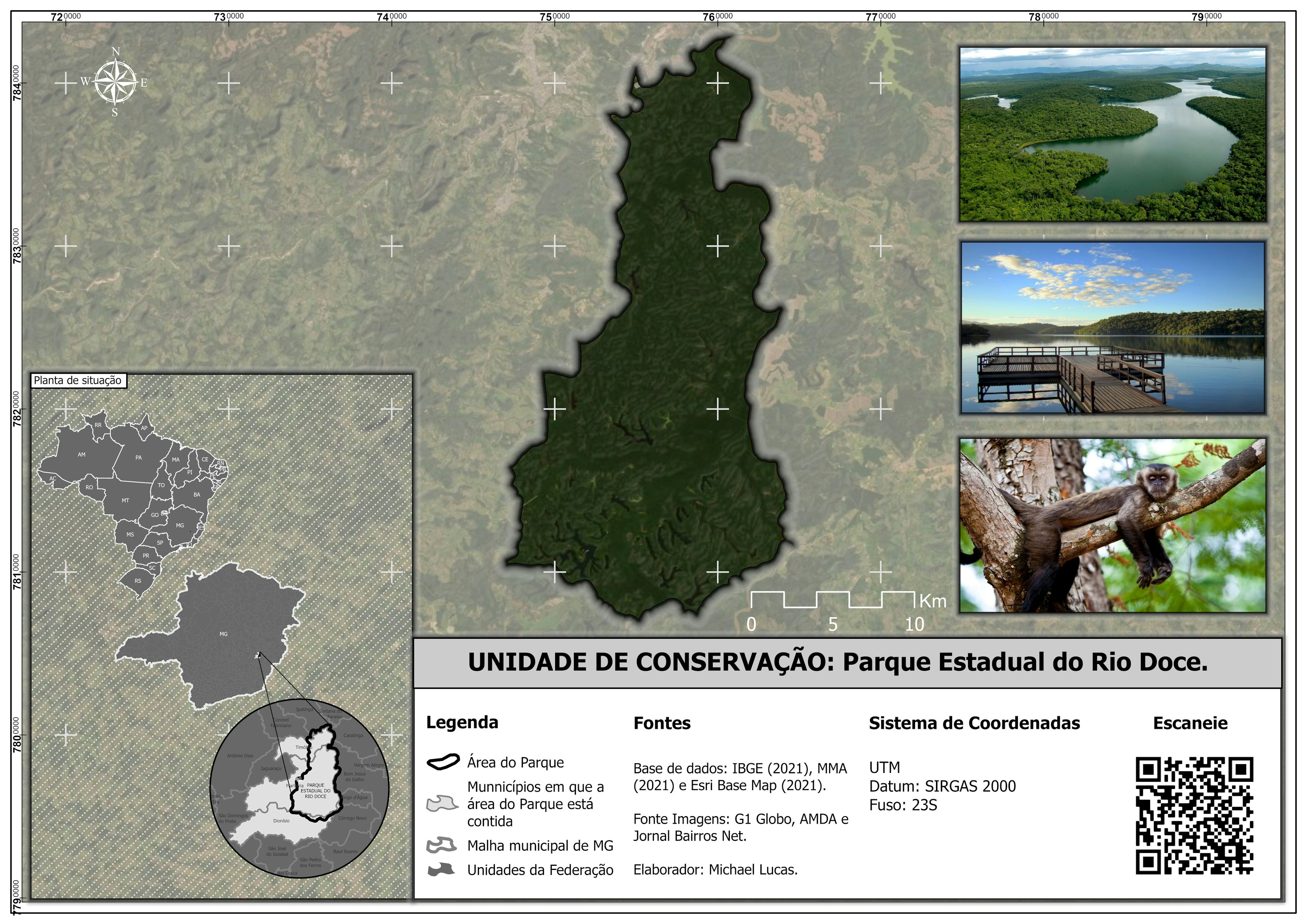
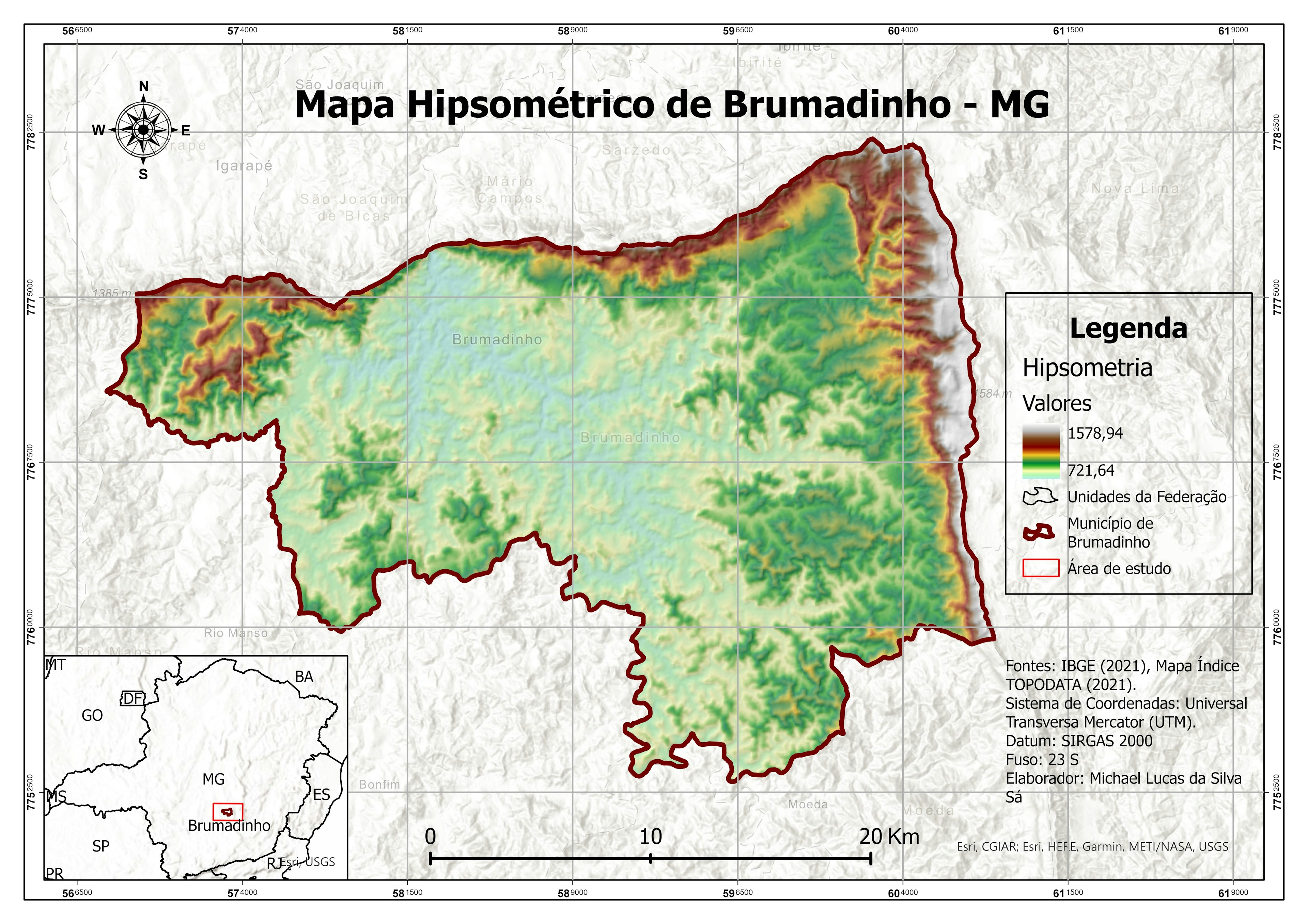
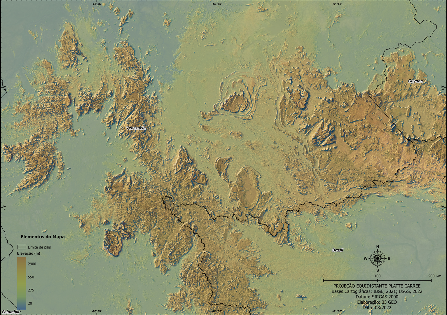
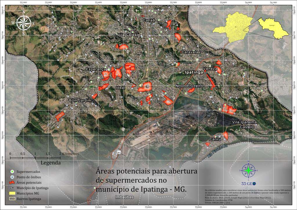
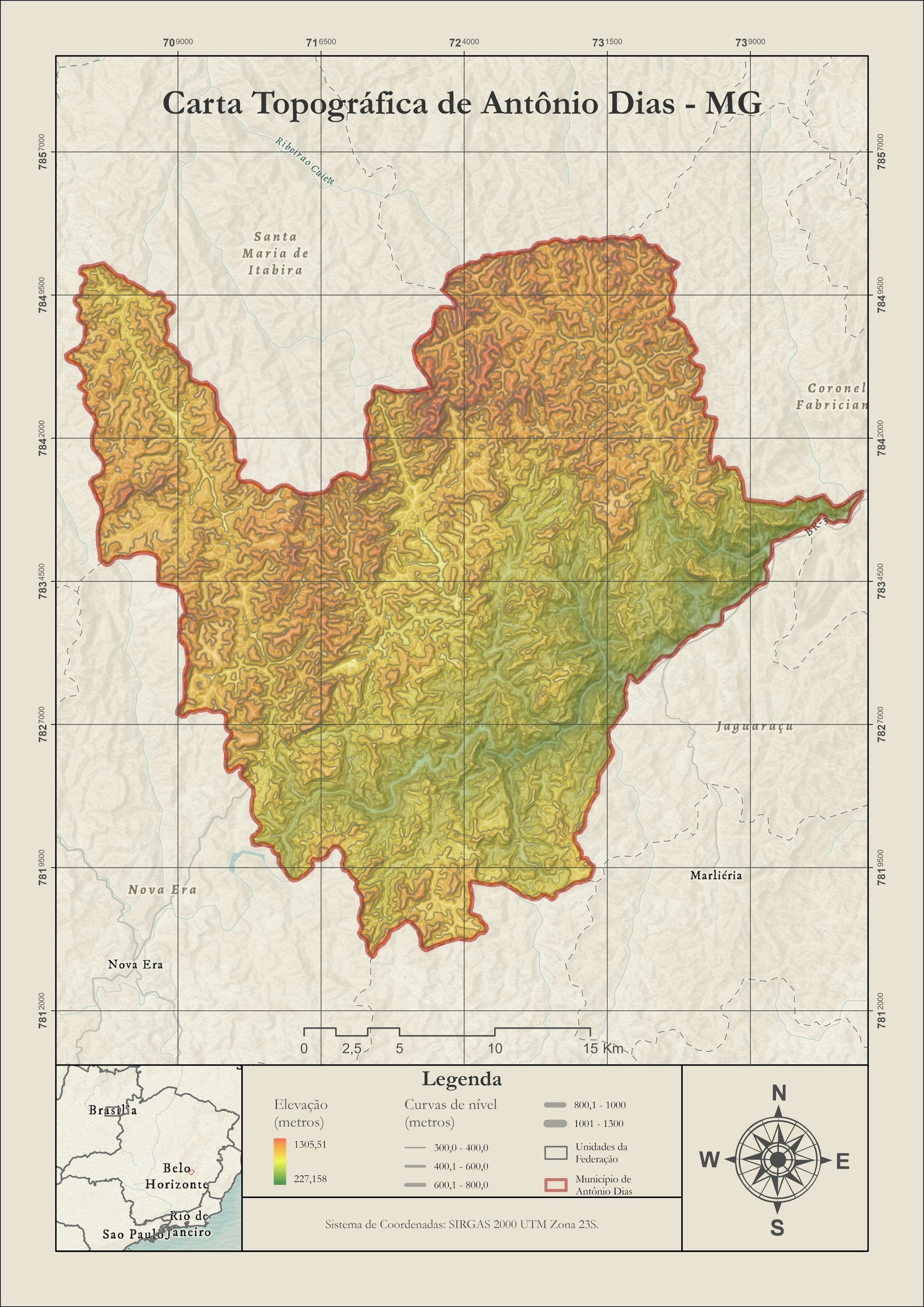
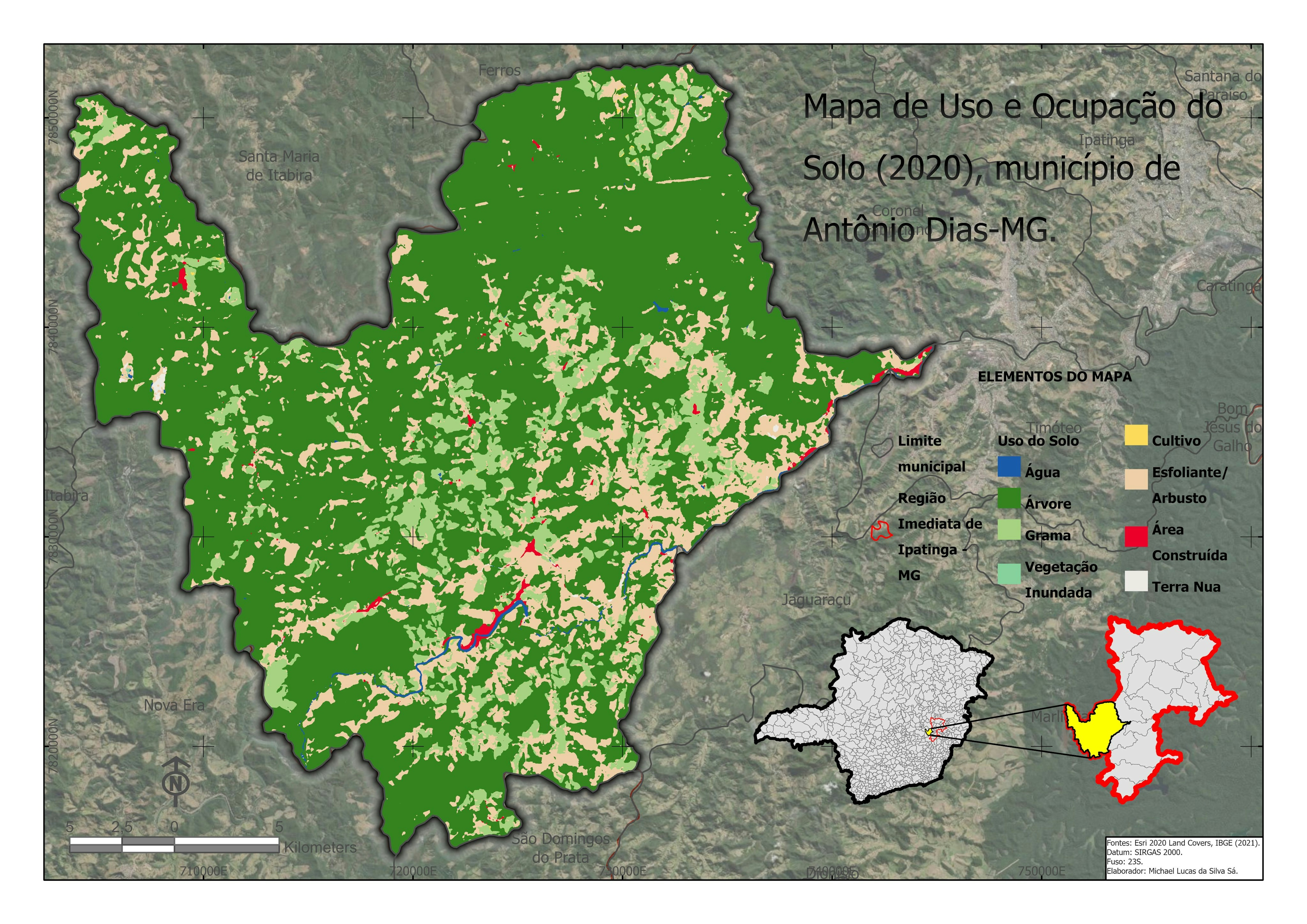
Localização de Unidades de Conservação

Tools used
ArcGIS Pro
Plug-ins used
Esri
tags
Esri
More by MICHAEL LUCAS DA SILVA SA

You might also like


Join the community!
We're a place where geospatial professionals showcase their works and discover opportunities.