
This project is part of a learning journey dedicated to the experimental joint use of free and open-source tools (QGIS+Blender) for the production of 3D-like map visualizations.
Methodology
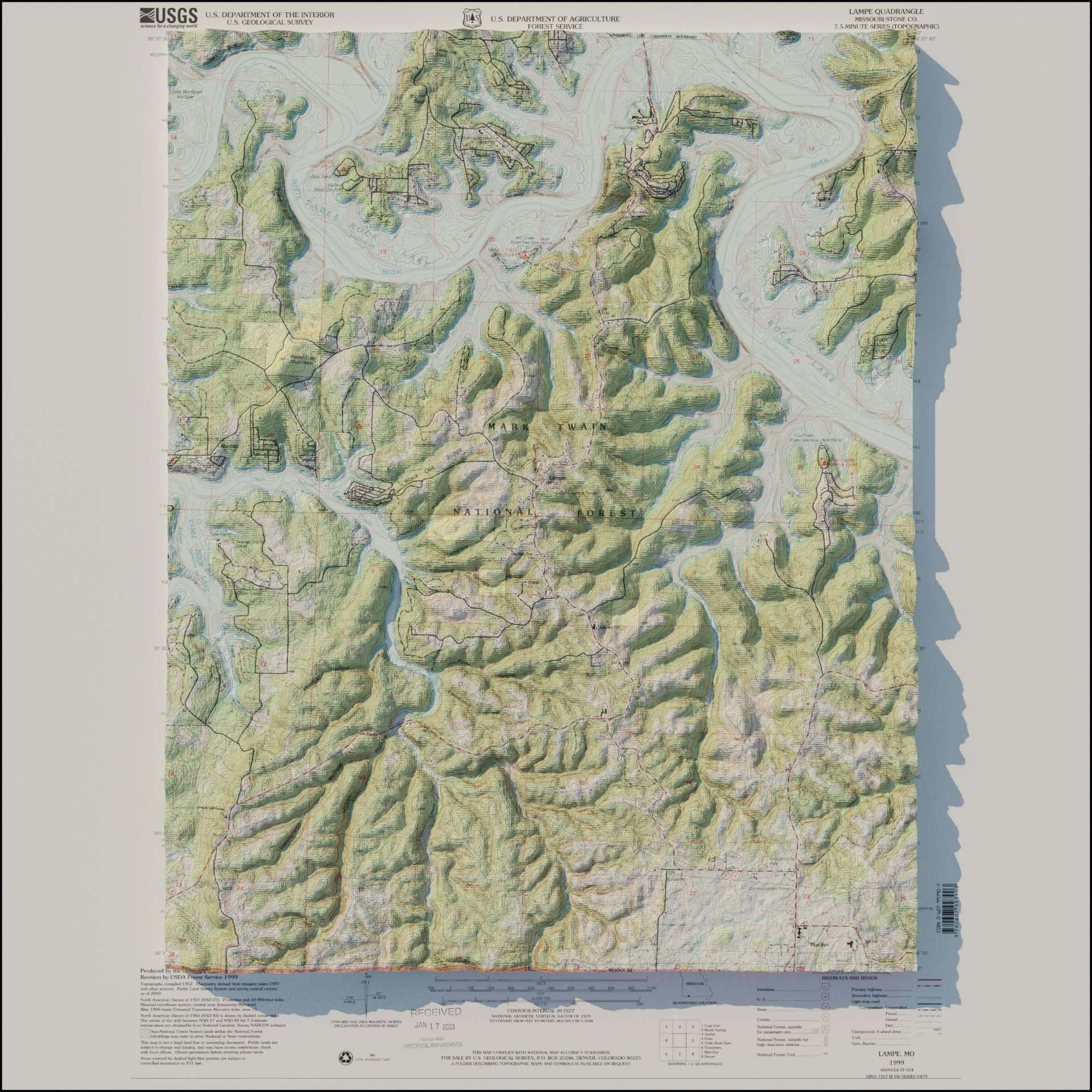
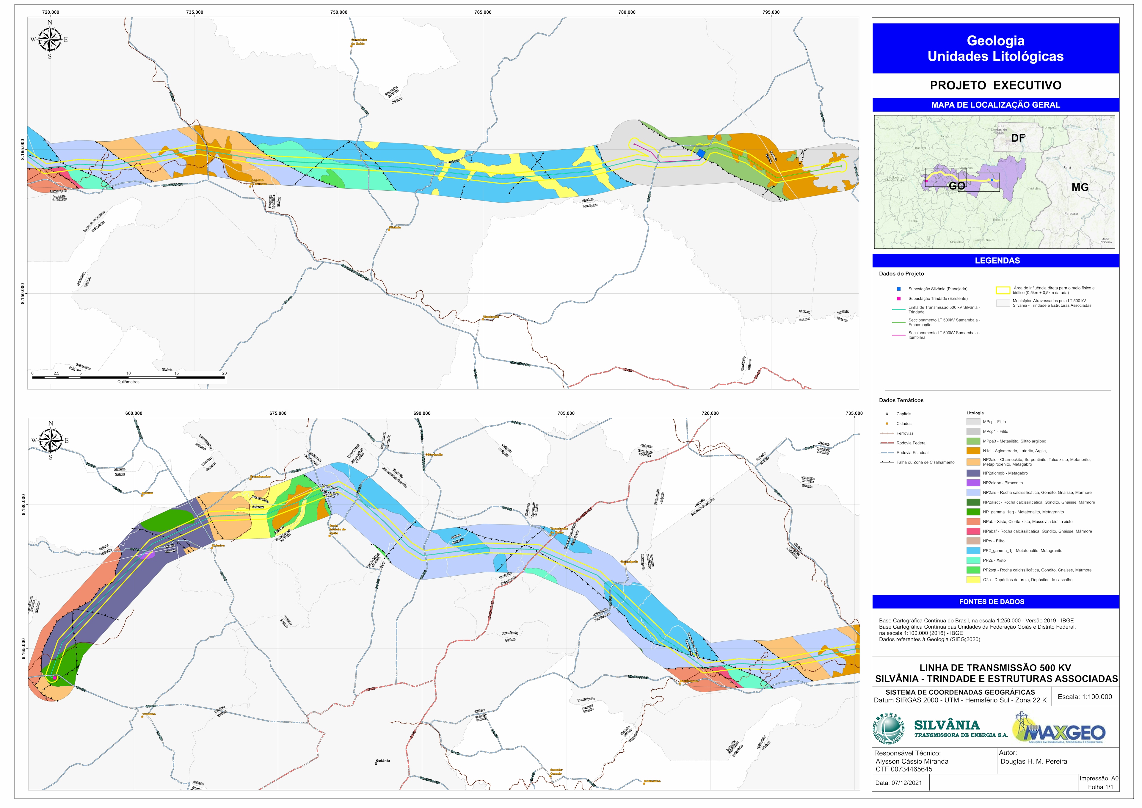
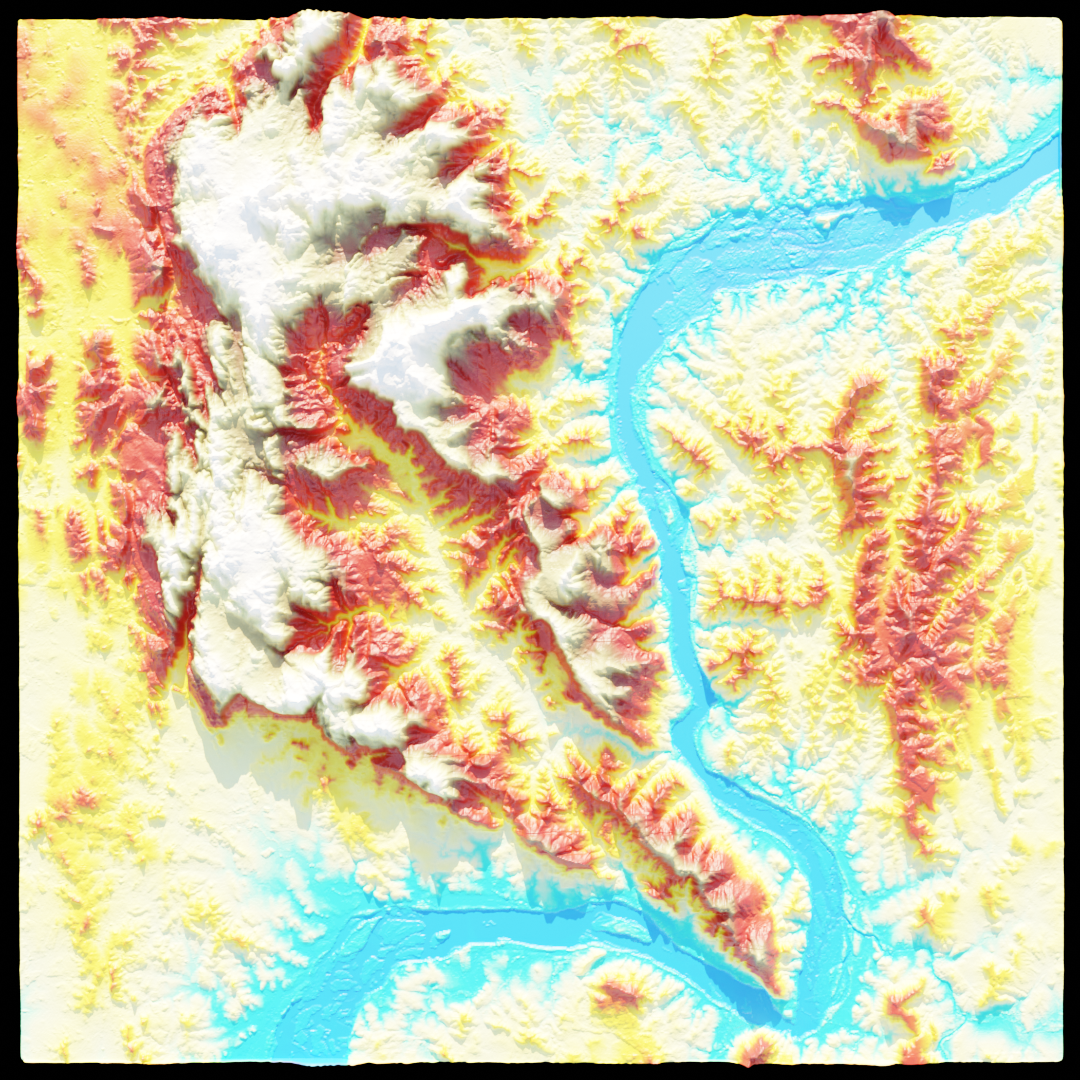
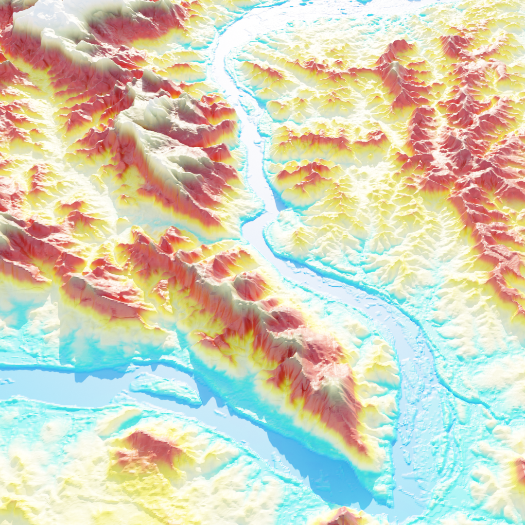
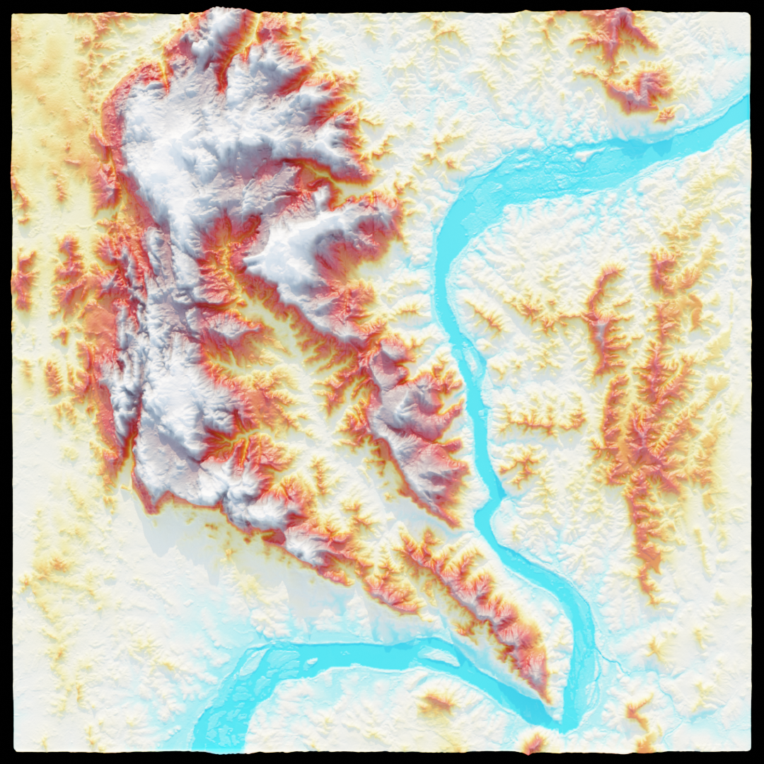
The original 1999 georeferenced map from USGS was downloaded from the official web repository and application. The area of Lampe, Missouri (US), was chosen (because the mapmaker really appreciates the landscapes of Ozark lakes).
Then, the USGS quadrangle was analysed in QGIS and compared to the Digital Elevation Model of the area downloaded through the Shuttle Radar Topographic Mission (SRTM) plugin.
The exported maps (USGS and DEM ones) then served as input for the 3D modeling in the Blender environment. Modifiers and textures were set and light rendering operations completed the final output with the original map and the shaded relief.
Inspirations and useful links
The map was heavily inspired by Daniel P. Huffman and Scott Reinhard mapmapking works.
During the process, several tutorials and videos gave useful tips and hints on the look and the rendering options, in particular:
- "Creating Shaded Relief in Blender" blog post by Daniel Huffman
- QGIS and Blender tutorial on YouTube by Kals Karlsson
- 3D Vintage Map video series on YouTube by John Nelson
Feel free to contact me through the profile link if you'd like to know more about the process of making this map!
High Resolution map here


.svg "Keran Nkongolo")


