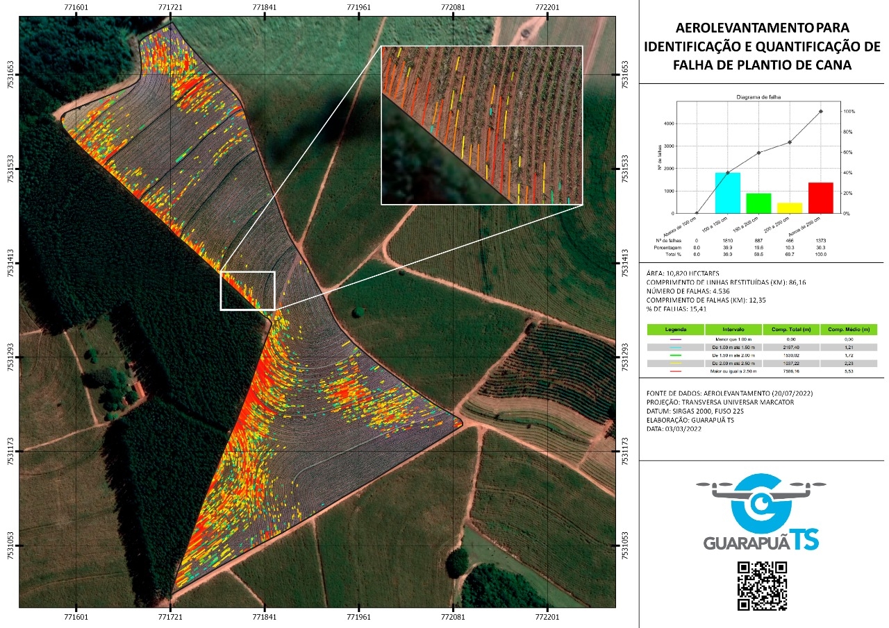
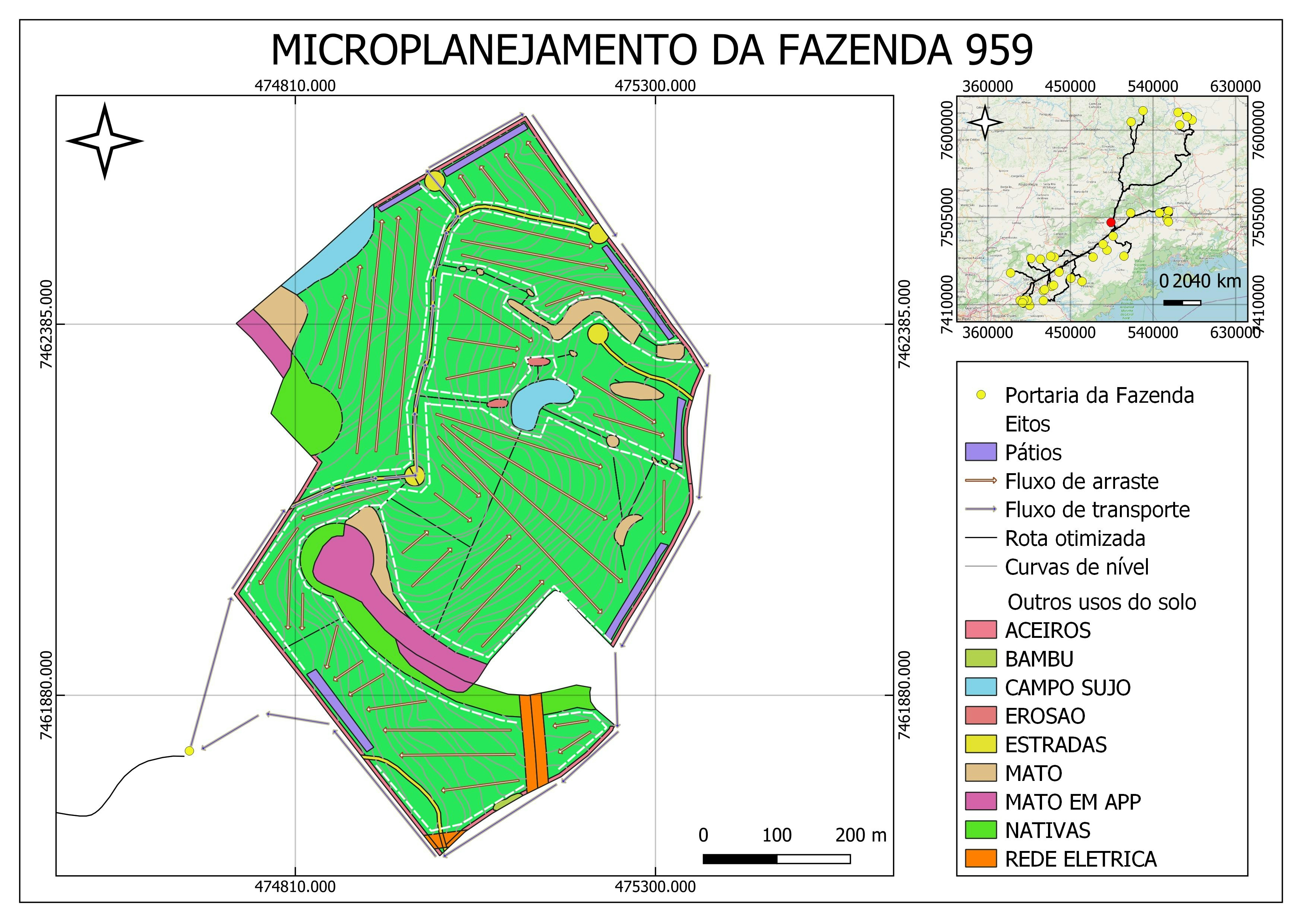
Trabalho realizado para perícia judicial.
- Aerolevantamento: Drone Mavic Pro 2
- GSD: 3,5 pix/cm²
- Altura de voo: 120 mt
- Espaçamento: 80x80
- Processamento: Agisoft Metashape
- Layout: QGIS
Levantamento de falha em cana-de-açúcar
Trabalho realizado para perícia judicial.
- Aerolevantamento: Drone Mavic Pro 2
- GSD: 3,5 pix/cm²
- Altura de voo: 120 mt
- Espaçamento: 80x80
- Processamento: Agisoft Metashape
- Layout: QGIS
More by Diogo Henrique Rodrigues Junior
You might also like
We're a place where geospatial professionals showcase their works and discover opportunities.


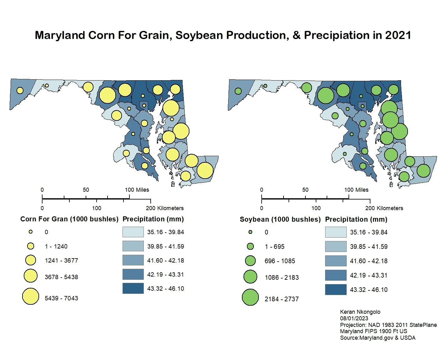
.svg "Keran Nkongolo")