
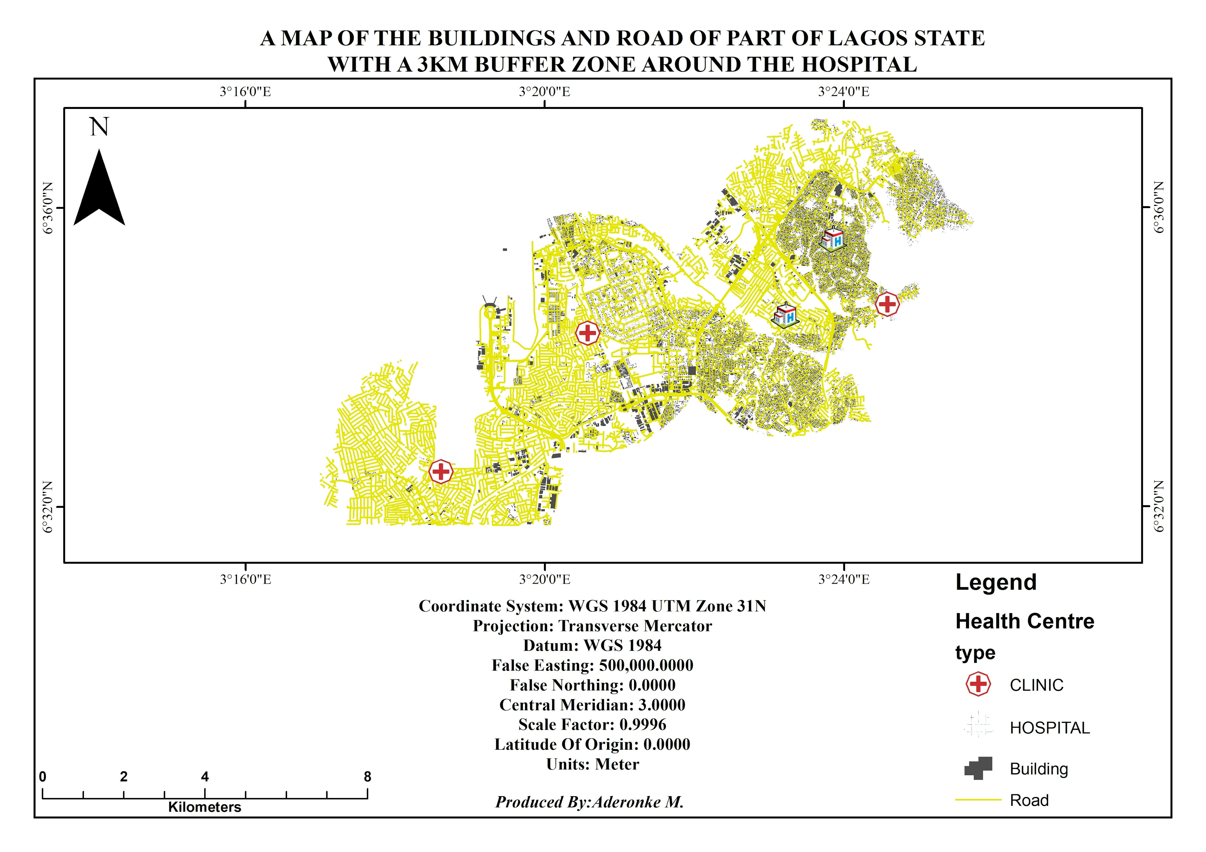
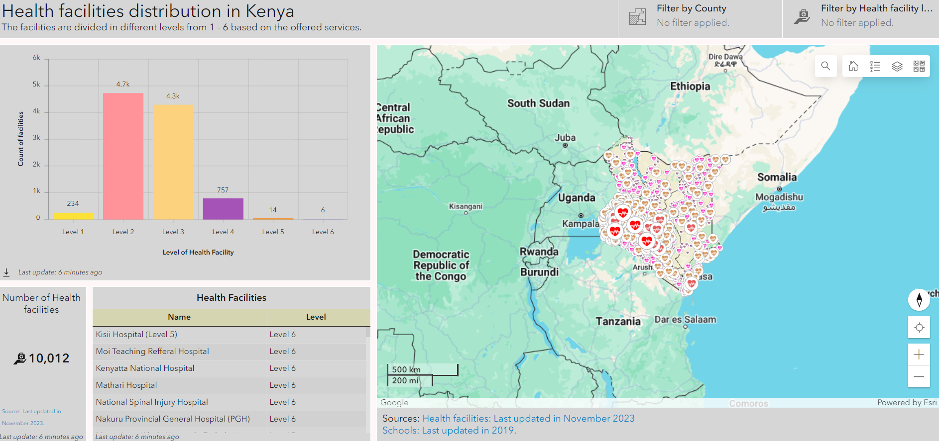
Road, Hospital and Building data from Open street Map.
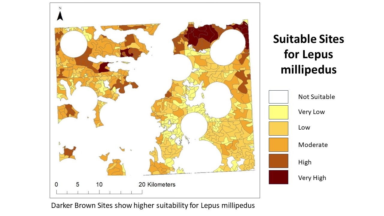
Single Buffer Analysis.
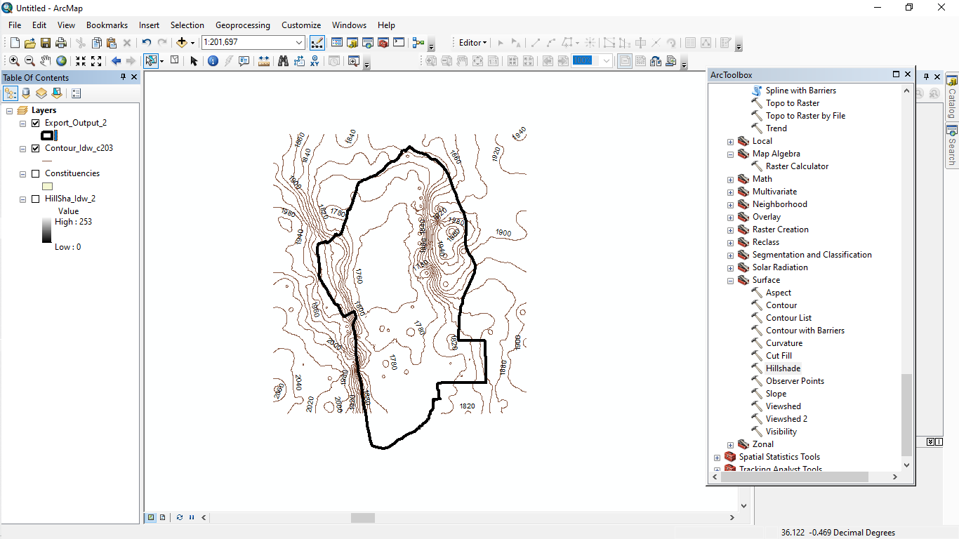
Tools used
ArcMap
Plug-ins used
buffermergeQuery
tags
bufferGISOpenStreetMapSpatial Analysis

You might also like


_9083060.png&w=3840&q=100)


Join the community!
We're a place where geospatial professionals showcase their works and discover opportunities.