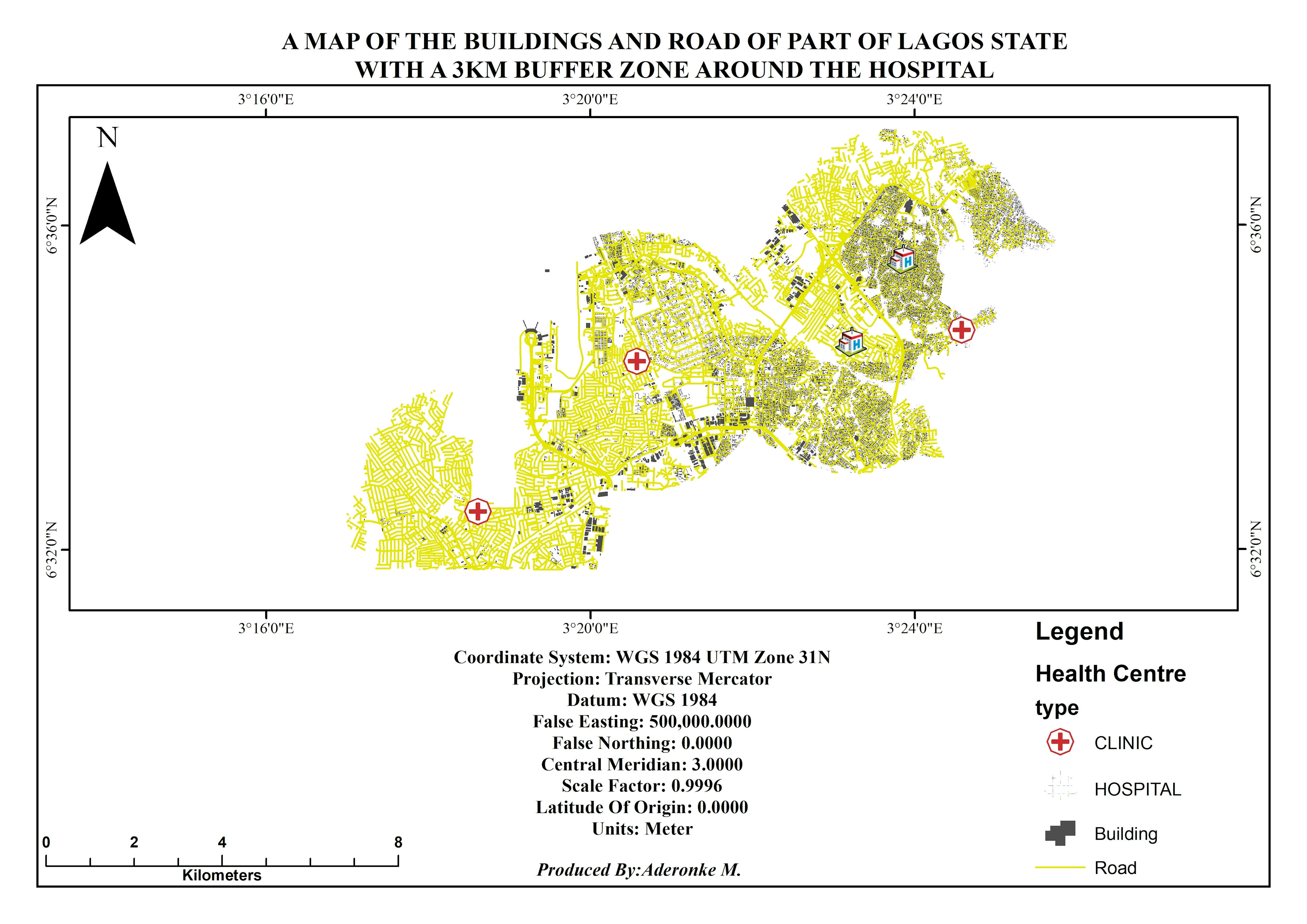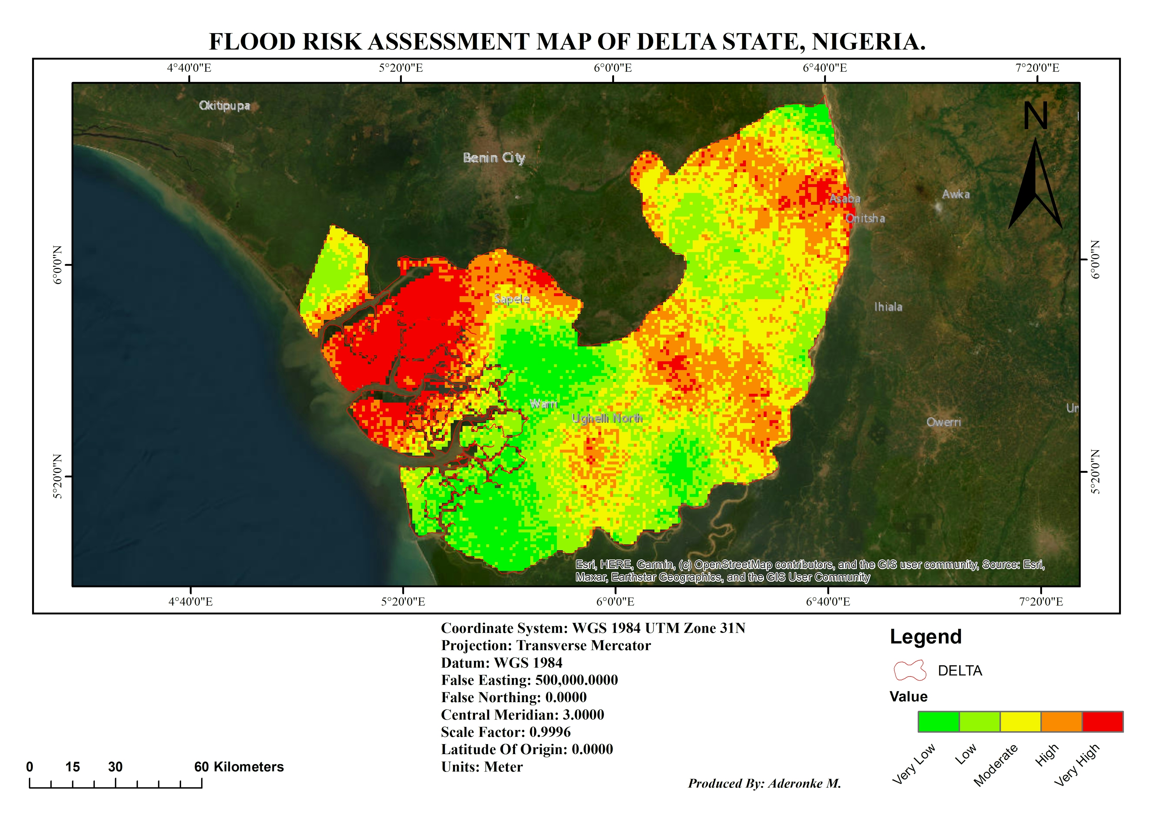
The following criteria of the study area were used:
Rainfall
soil
Digital Elevation Model/Slope
Land cover
River data
The data were put in raster format and overlay using weighted analysis tool.
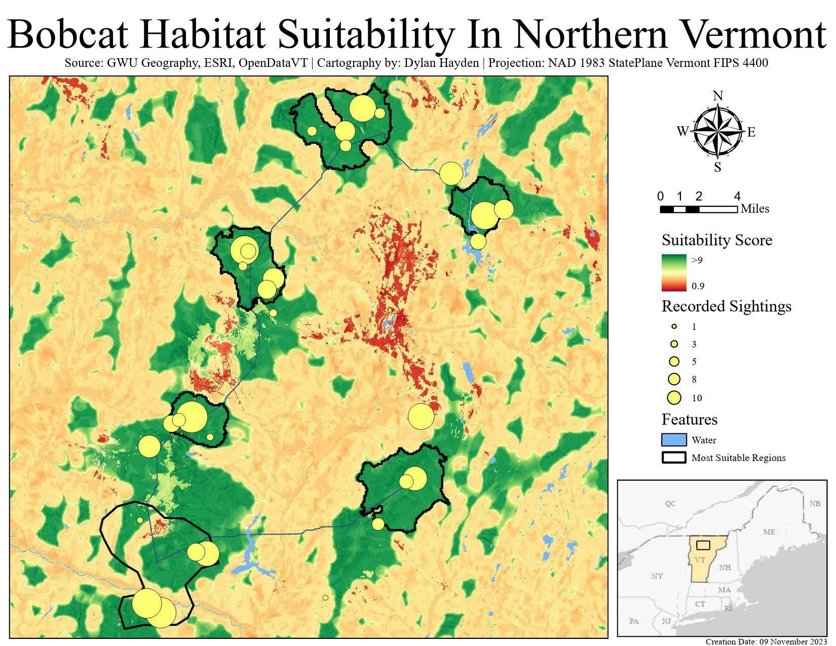
FLOOD RISK ASSESSMENT MAP
The following criteria of the study area were used:
Rainfall
soil
Digital Elevation Model/Slope
Land cover
River data
The data were put in raster format and overlay using weighted analysis tool.
You might also like
We're a place where geospatial professionals showcase their works and discover opportunities.