Sign up or log in to your Spatialnode account.

Takes less than a few seconds.

Land Cover Maps

Ananda Rianti Dewi
Ananda Rianti Dewi•

February 21, 2022

Land Cover Maps

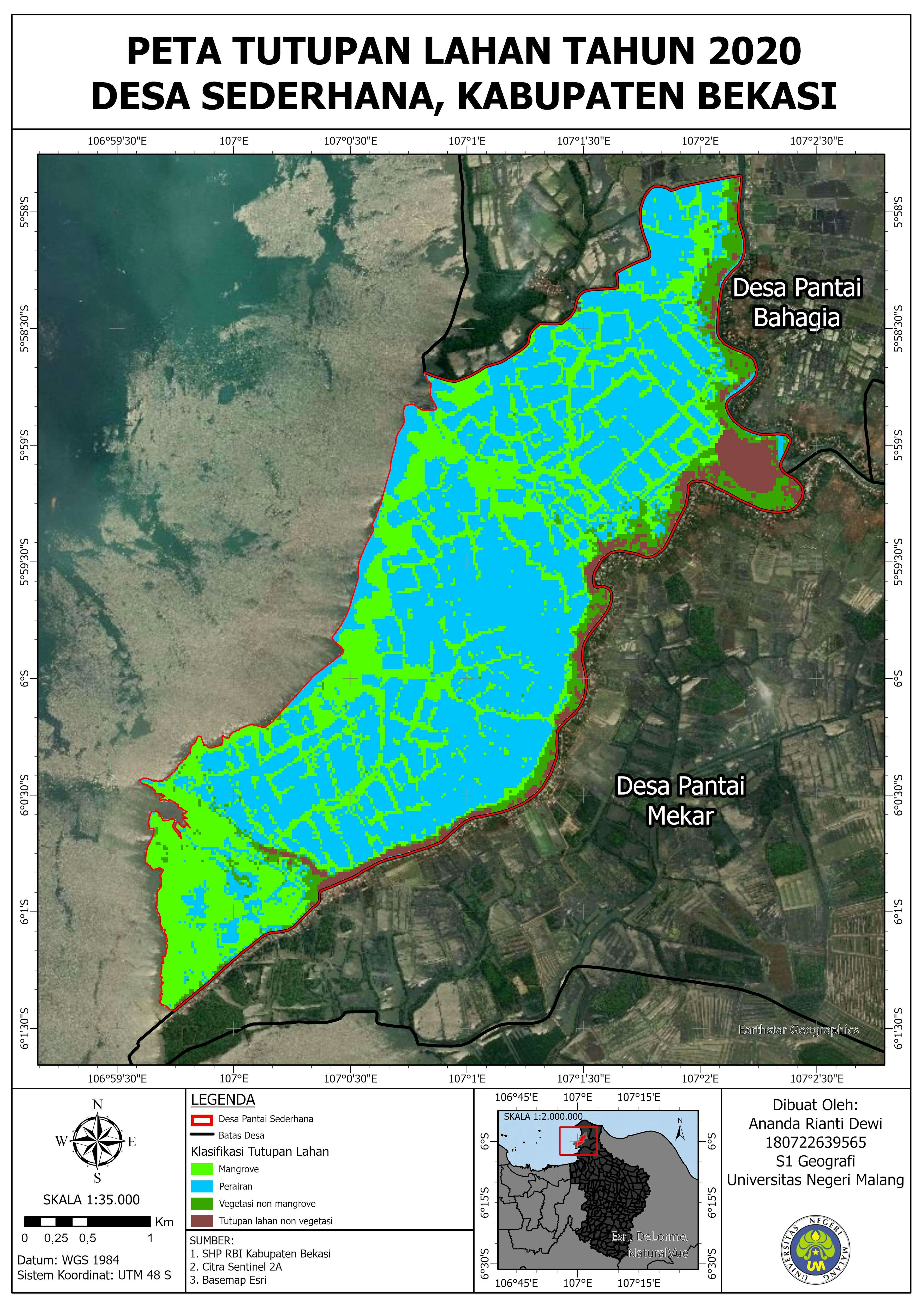
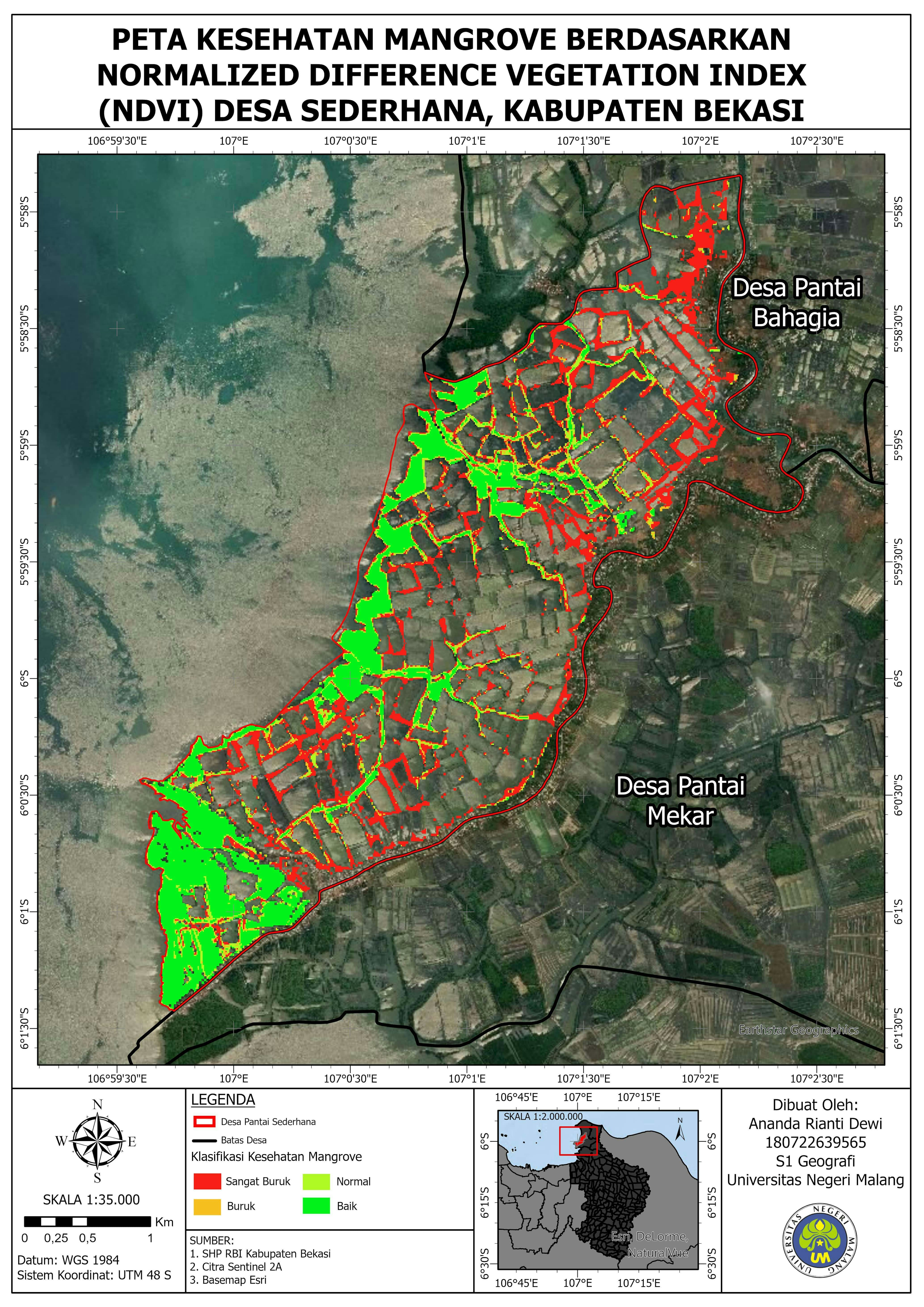
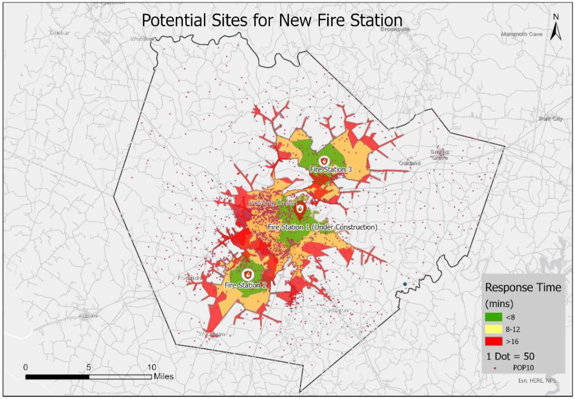
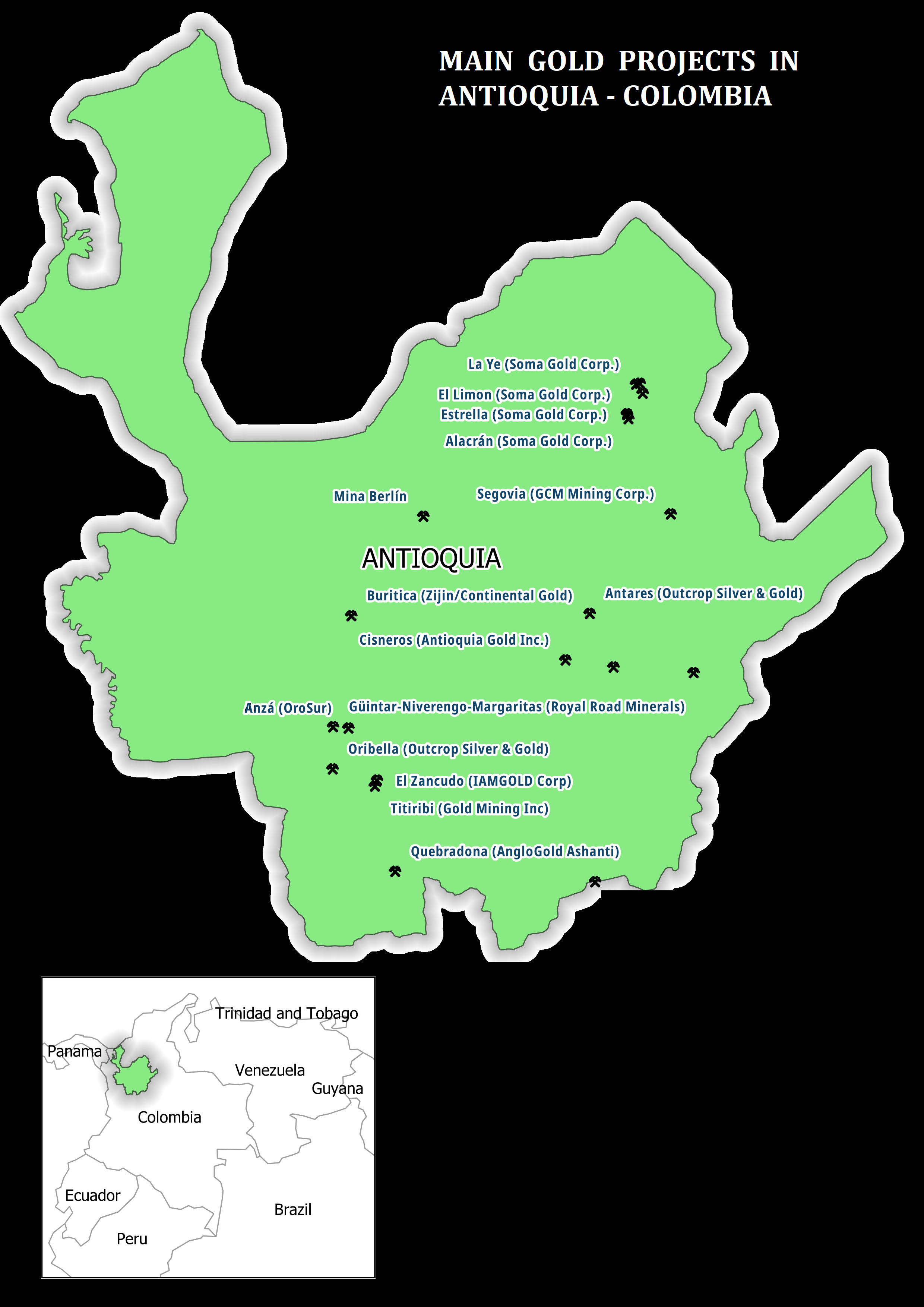
Land Cover Map 2020 of Sederhana Village, Bekasi Regency, West Java, Indonesia


Tools used

ArcGIS Pro

Plug-ins used

Support Vector Machine (SVM)

tags

Sentinel 2AVillage

More by Ananda Rianti Dewi

Land Surface Temperature Map
54
NDVI Time Series Visualization
115
Industrial Area Potential
7
Mangrove Vegetation Health Index
15

You might also like

Watershed Delineation
Rabi Elabor
Watershed Delineation
Rabi Elabor
17
School-Hospital Network Map
Kingsley Onyenwere
School-Hospital Network Map
Kingsley Onyenwere
31
Ground Water Vulnerability Index
Marvin Ayeh
Ground Water Vulnerability Index
Marvin Ayeh
12
Zoneamento - ADA
ALINE GRAZIADEI FERNANDES
Zoneamento - ADA
ALINE GRAZIADEI FERNANDES
590
Mapa de Área de Preservação Permanente
Mauricio Matheus
Mapa de Área de Preservação Permanente
Mauricio Matheus
36
Iceland
Kareen Bröker
Iceland
Kareen Bröker
50
Mapa simple de localización
Miriela Ulloa Santana
Mapa simple de localización
Miriela Ulloa Santana
33
Vuyani Mondli Buthelezi
Dump Sites
Vuyani Mondli Buthelezi
13
Mapa de Localização/Localization map
Ronald Noutcheu
Mapa de Localização/Localization map
Ronald Noutcheu
9
Food Desert Identification in Atlanta
Dane Lewandowski
Food Desert Identification in Atlanta
Dane Lewandowski
28
Boulder County Road Network
Adam O Dolce
Boulder County Road Network
Adam O Dolce
26
Tourism Map of Uyo
Iniobong Benson
Tourism Map of Uyo
Iniobong Benson
127

Join the community!

We're a place where geospatial professionals showcase their works and discover opportunities.

Sign Up for free