
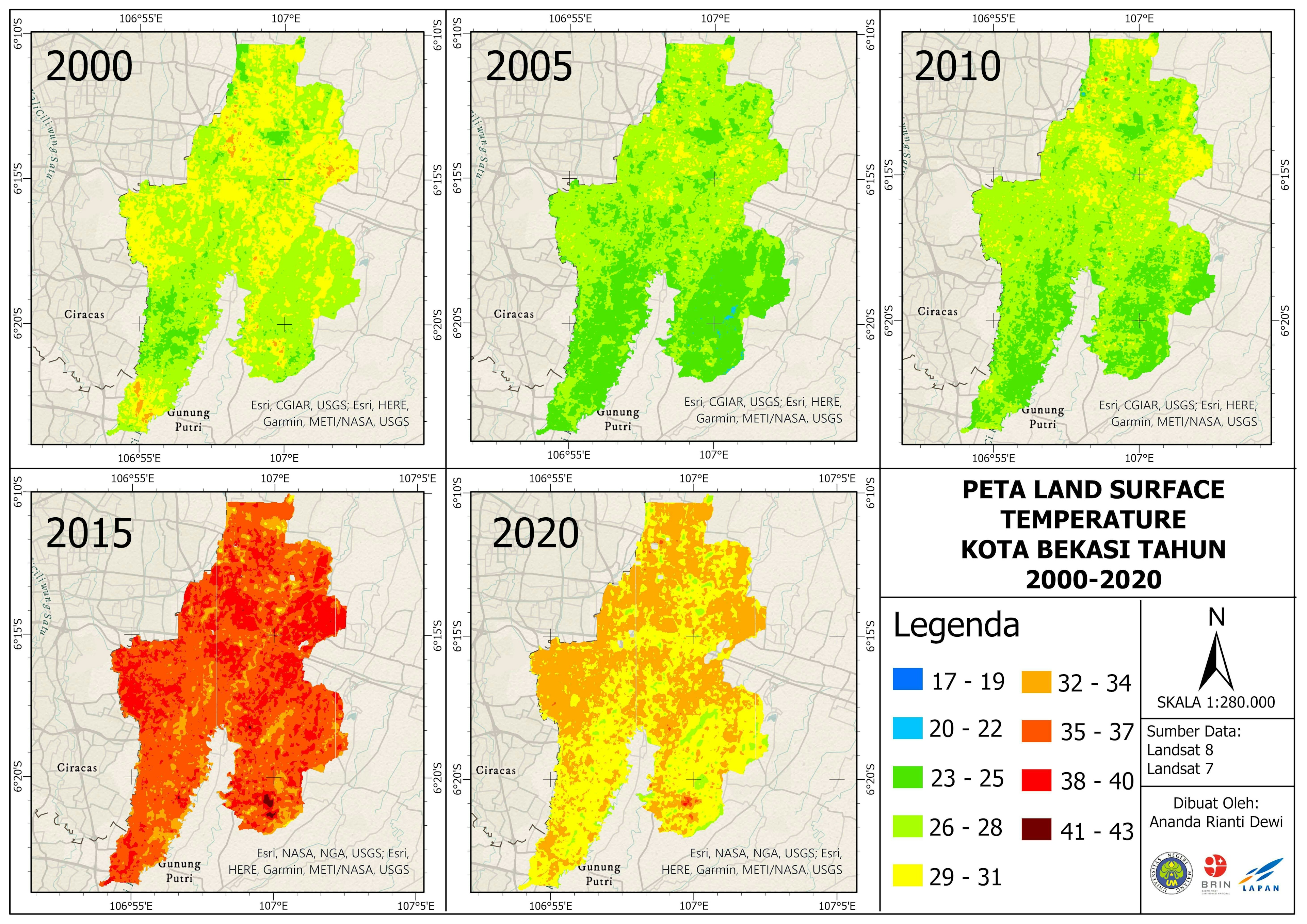
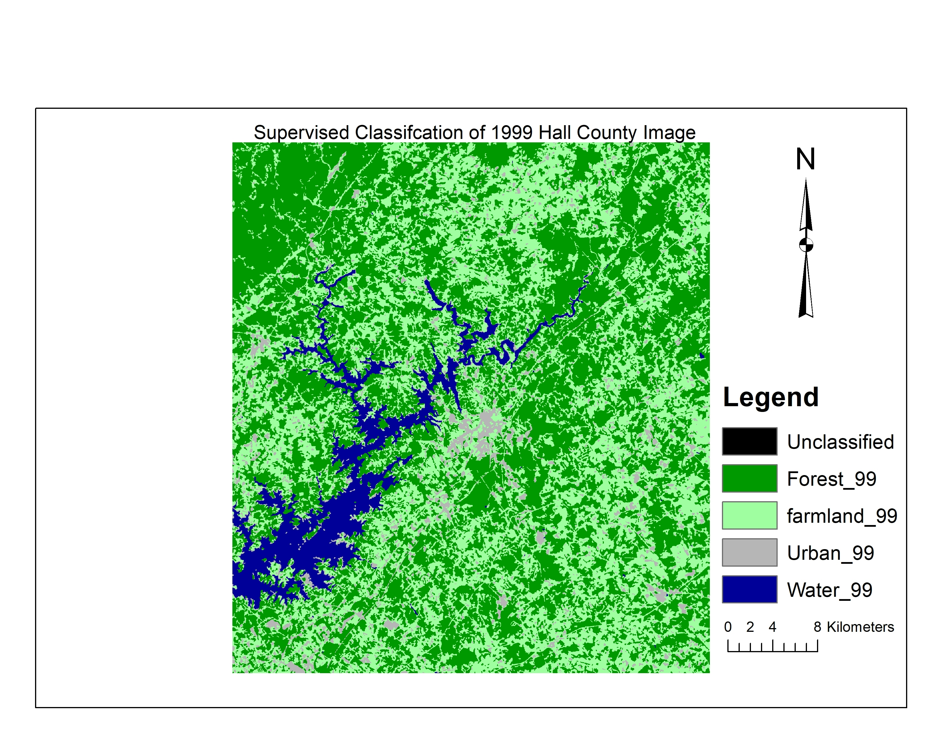
Land Surface Temperature Map of Bekasi City 2000-2020, from Landsat 7 dan 8.
Created using GEE and ArcGIS
Land Surface Temperature Map
Tools used
ArcGIS ProGoogle Earth Engine(GEE)
Plug-ins used
Data VisualizationEsriGoogle Earth Engine(GEE)
tags
Data VisualizationSpatial analyst
More by Ananda Rianti Dewi

You might also like


Join the community!
We're a place where geospatial professionals showcase their works and discover opportunities.