
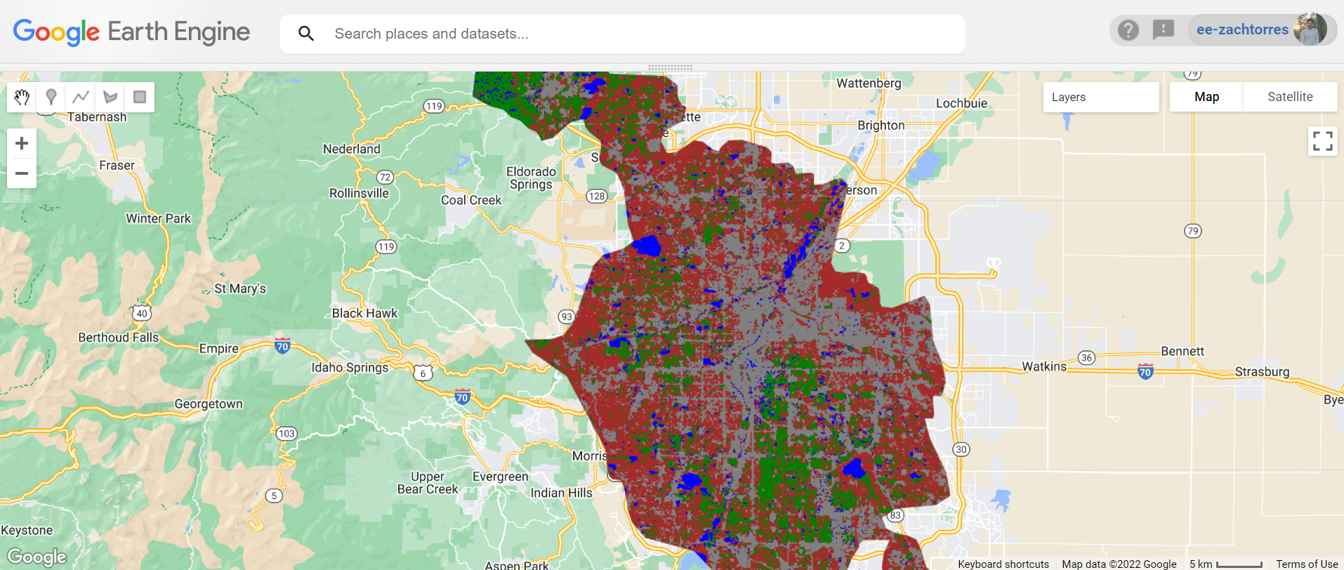
In this project, I called the Google Earth Engine API within the JavaScript code editor to use cloud and date filtered imagery from Sentinel-2 . I then built training data points and added to the feature engineering table for improved supervised classification of landcover compared to training data on reflectance values at points alone.
My workflow is outlined below:
- Import Urban Areas feature collection and filter system:index to desired feature
- Import ALOS elevation surface model
- Import Sentinel-2 harmonized data
- Run cloud mask
- Filter the image collection to desired date, bounds, and bands
- Define a median and clipped Sentinel-2 composite
- Define visualization parameters
- Add composite to map
- Create training data points for four classes as feature collections and export to Assets
- Add relevant indices bands to composite image
- Add elevation and slope bands from ALOS to composite
- Normalize the data
- Merge the classifications as individual GCPs
- Train a classifier
- Classify the improved composite image and add new layer to map
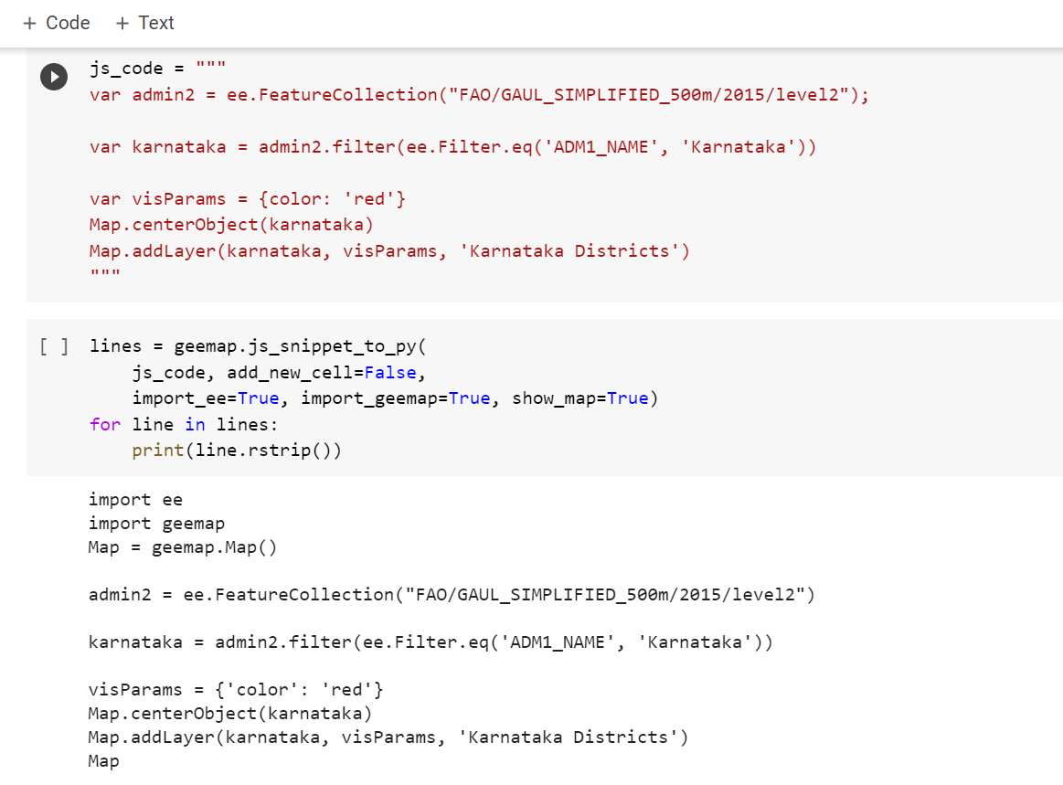
Check out the demo link below to review and run my script.


.png&w=3840&q=100)
