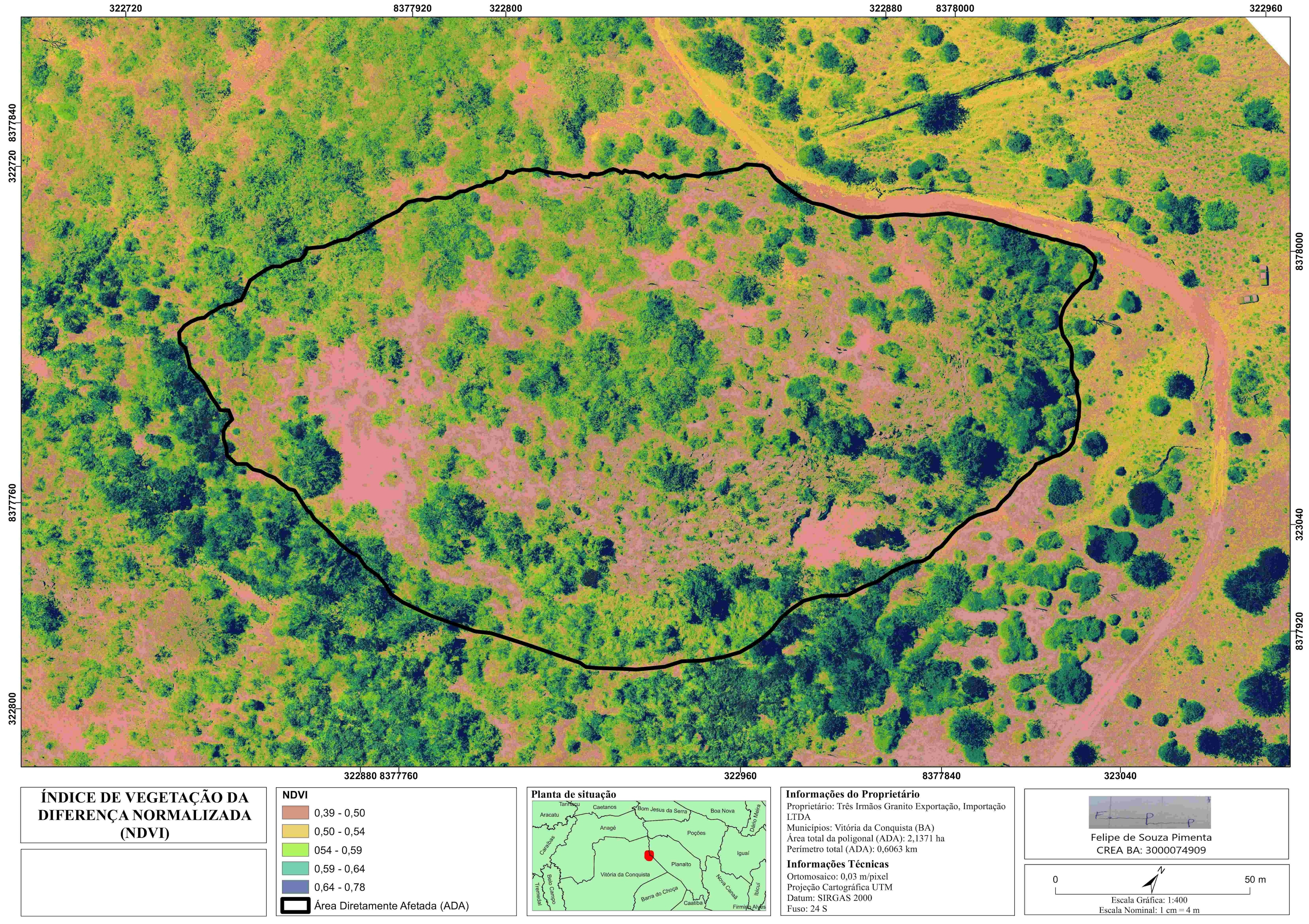
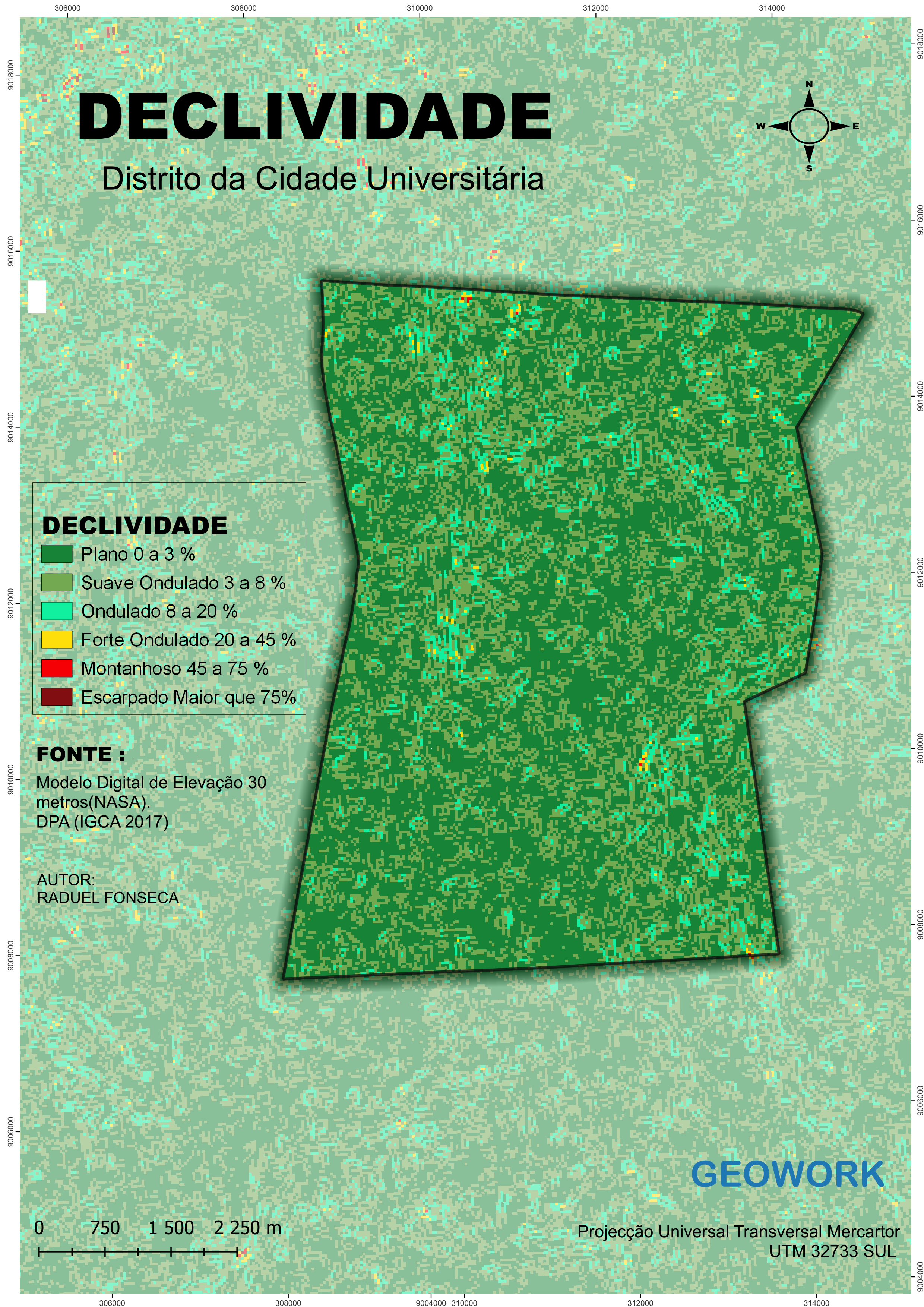
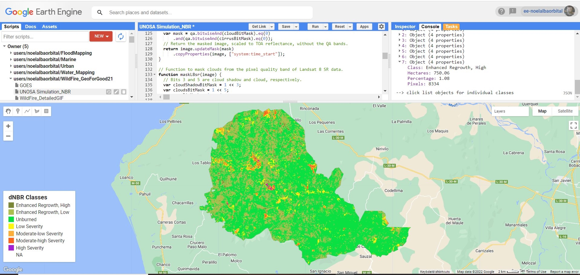
Sign up or log in to your Spatialnode account.

Takes less than a few seconds.

Categorias de NDVI

Felipe Pimenta
Felipe Pimenta•

April 07, 2022

Categorias de NDVI

Tools used

Metashape

Plug-ins used

Metashape

tags

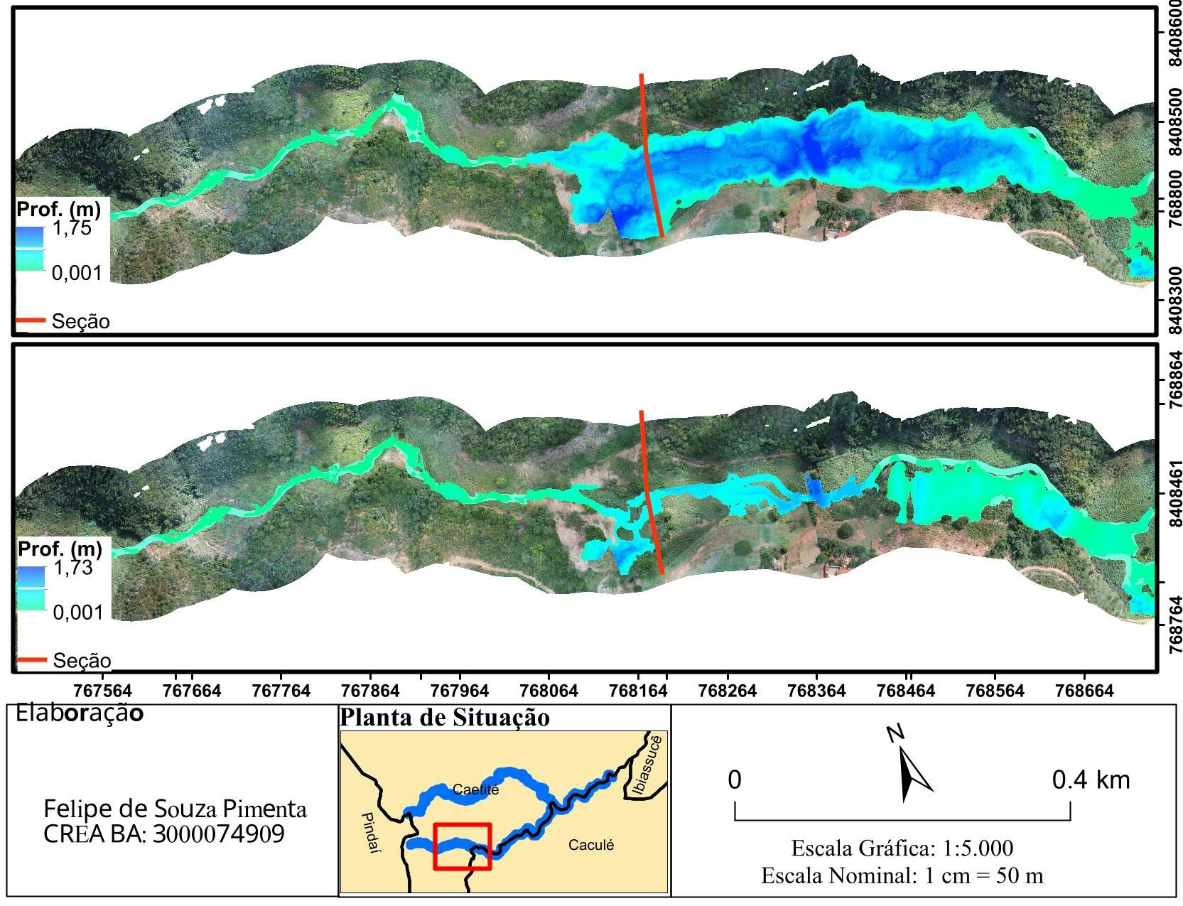
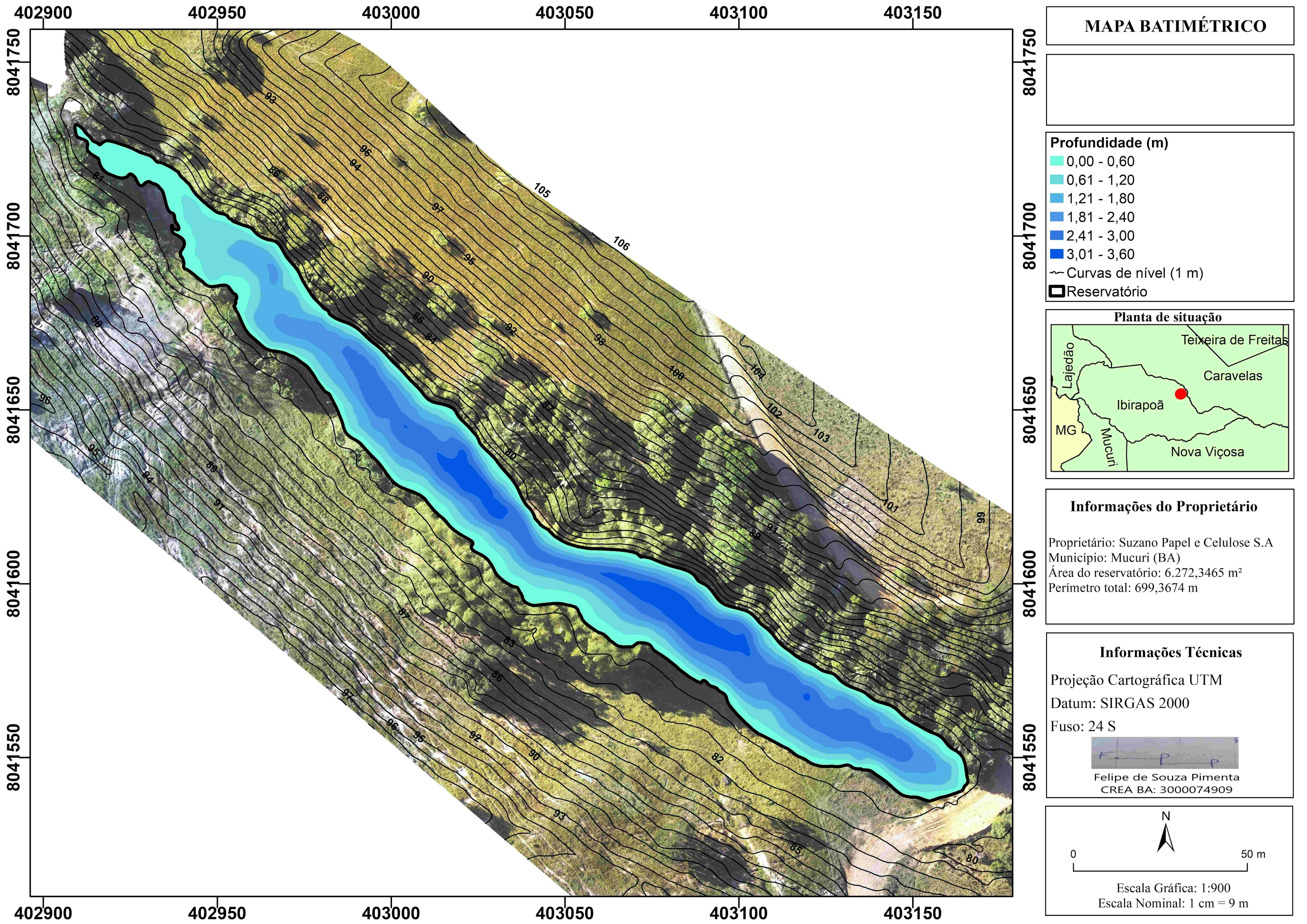
AerofotogrametriaDroneMetashapeOrtofoto

More by Felipe Pimenta

Modelagem hidrodinâmica de cursos d'água
116
Mapa Batimétrico de reservatório
131
Categorias de distâncias de imóveis (m)
14
Aterro e Corte
Aterro e Corte
20
Zoneamento Urbano de Salvador
336
Modelagem Hidrodinâmica de cursos d'água
40

You might also like

Where's a dunny down under? #Australia
Ayeisha Sheldon
Where's a dunny down under? #Australia
Ayeisha Sheldon
60
Ecotourism Suitabilty Modelling with AHP
Joseph Aro
Ecotourism Suitabilty Modelling with AHP
Joseph Aro
1.7K
Least-Cost Path Modeling
Yuxin (Sienna) He
Least-Cost Path Modeling
Yuxin (Sienna) He
22
COVID-19 DISTRIBUTION MAP
Oswald Onimhawo
COVID-19 DISTRIBUTION MAP
Oswald Onimhawo
16
Echo Lake Pollutant Load Modeling
Shrithik S
Echo Lake Pollutant Load Modeling
Shrithik S
10
Dane Nepal Capstone Glacier Lake Flood
Dane Lewandowski
Dane Nepal Capstone Glacier Lake Flood
Dane Lewandowski
15
Interlaken with RayShader
Adriana Calderon
Interlaken with RayShader
Adriana Calderon
25
Jefferson County Tax Income
Sean Willis
Jefferson County Tax Income
Sean Willis
61
Thematic 3D Scene
Zach Torres
Thematic 3D Scene
Zach Torres
46
ROUTE NETWORK ANALYSIS
Dee Geodata Sage
ROUTE NETWORK ANALYSIS
Dee Geodata Sage
12
Sistema Hidrográfico Simplificado
Ariel Horst
Sistema Hidrográfico Simplificado
Ariel Horst
9
2b: Distance Between Lima to Rio
carson allen
2b: Distance Between Lima to Rio
carson allen
16

Join the community!

We're a place where geospatial professionals showcase their works and discover opportunities.

Sign Up for free