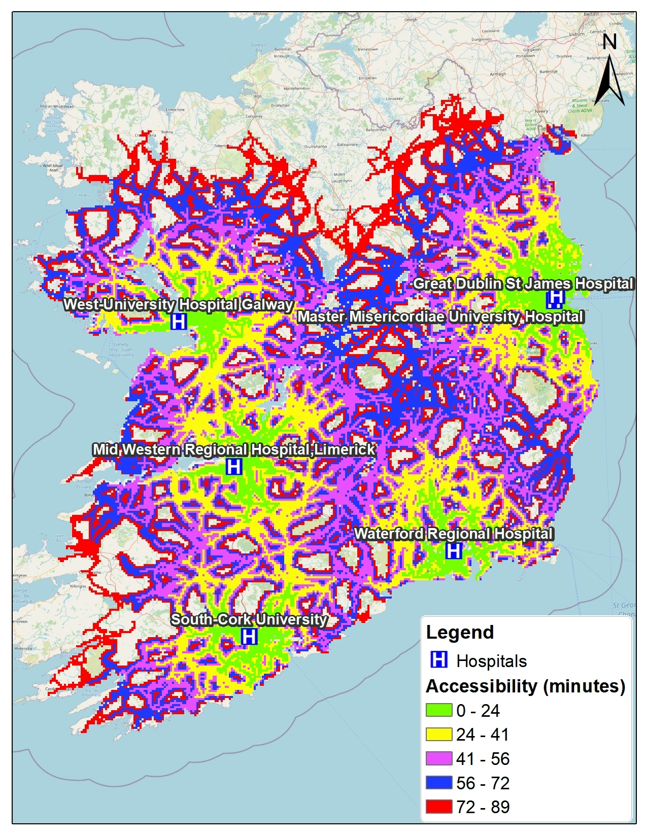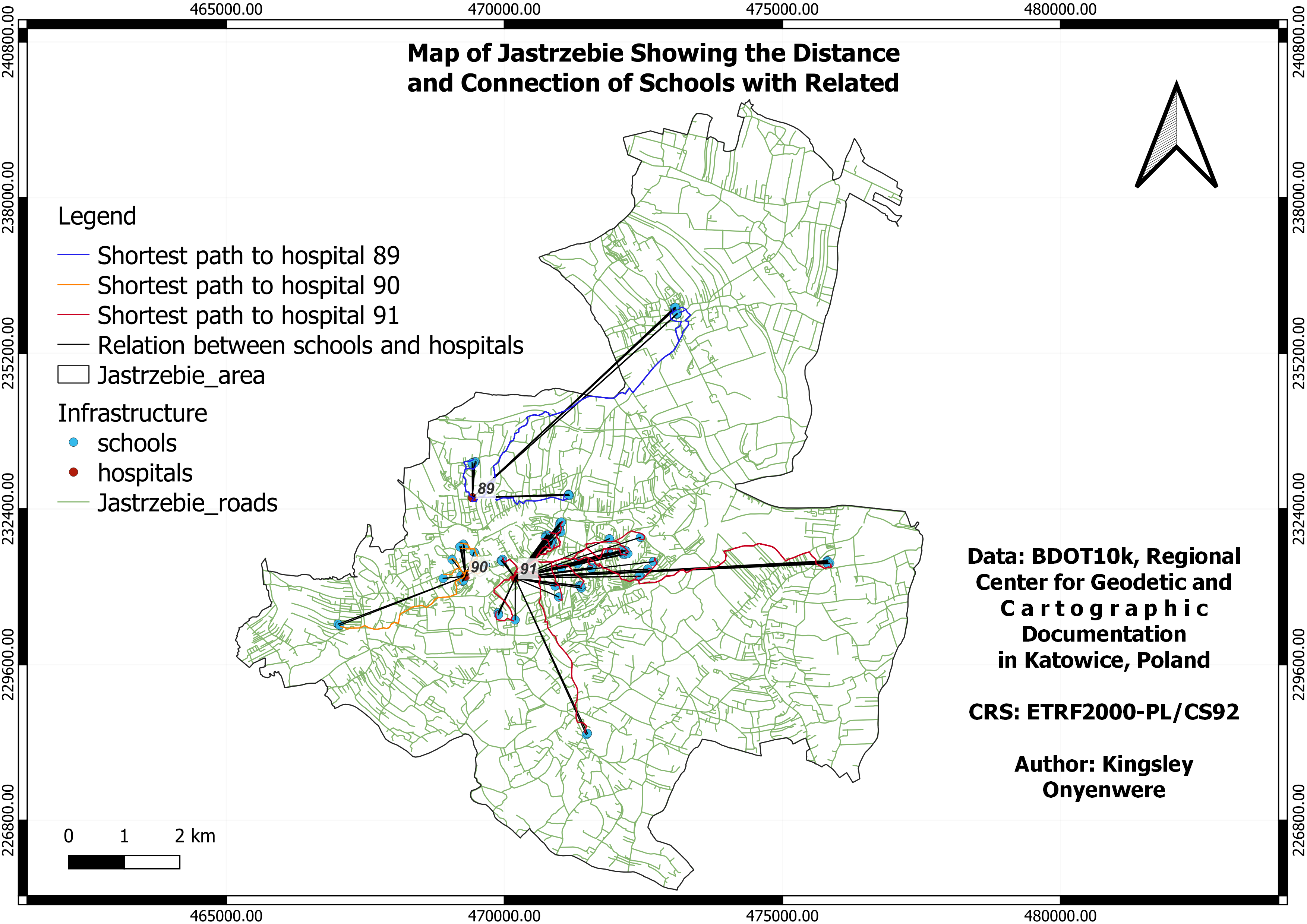
Data Source:
The data was obtained from the polish geoportal database of buildings, structures and equipment, Classification of objects BDOT10k.
Code name; BUBD.
Object Class; Buildings
BUBD 15: Building of Schools and Research Institutes
BUBD 16: Building of hospitals and medical facilities
Method and Result:
The methods involved using QGIS to analyze data related to, roads networks, schools, and hospitals. The process included data preparation, generalization of buildings to centroids, and establishing the shortest path between schools and hospitals.
The results were visualized through a table and an SQL query that determined the relationships between schools and their closest hospitals.
The final output was presented as a map illustrating these relationships.


.svg "Keran Nkongolo")