Sign up or log in to your Spatialnode account.

Takes less than a few seconds.

MAPA DOS BIOMAS DO BRASIL

Jonatha Iuri
Jonatha Iuri•

December 28, 2022

MAPA DOS BIOMAS DO BRASIL

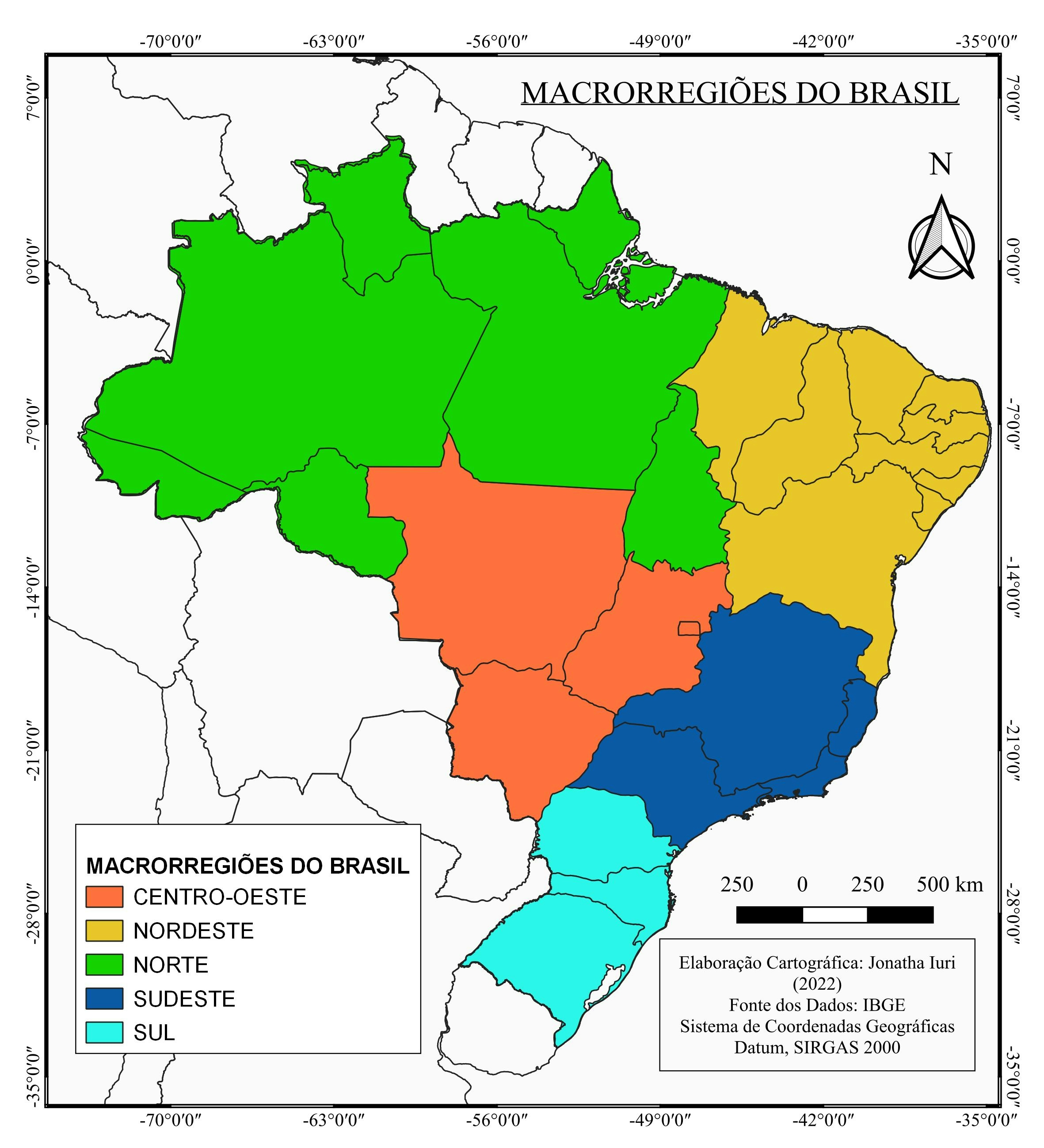
Mapa temático dos biomas do Brasil


Tools used

QGIS

Plug-ins used

HCMGIS

tags

BiomasGISmapabiomasmapatematicoQGIS

More by Jonatha Iuri

MAPA MULTIESCALAR DE LOCALIZAÇÃO UIRAÚNA
97
MAPA DE LOCALIZAÇÃO ESCOLA-CAMPO / PB
13
Mapa do município de Joca Claudino/PB
54
MAPA GEOLÓGICO DO MUNICÍPIO DE UIRAÚNA
20
MAPA DAS MACRORREGIOES DO BRASIL
60
Mapa dos municípios comunidades tr da PB
65
MAPA DOS TIPOS DE SOLOS DE UIRAÚNA
41
MAPA DOS ABALOS SÍSMICOS DE UIRAÚNA/PB
16
MAPA HIPSOMÉTRICO DA CIDADE DE UIRAÚNA
32
MAPA DAS REGIÕES INTERMEDIÁRIAS PARAÍBA
99
MAPA DE LOCALIZAÇÃO DE UIRAÚNA/PB
162
MAPA DAS ASDs DO ESTADO DA PARAÍBA
24

You might also like

Land Cover Change in Krasnoyarsk Krai
Hugo He
Land Cover Change in Krasnoyarsk Krai
Hugo He
13
Firearm Mortality Rate & Presidency 2020
Jonathan Correa Varela
Firearm Mortality Rate & Presidency 2020
Jonathan Correa Varela
17
PFAS detected in New Jersey's water
Ana Luisa Soares
PFAS detected in New Jersey's water
Ana Luisa Soares
19
Food Truck Suitability Model
Anna
Food Truck Suitability Model
Anna
14
Single Buffer Analysis.
Aderonke ADETORO
Single Buffer Analysis.
Aderonke ADETORO
17
ground water
Hashimu Misanya
ground water
Hashimu Misanya
107
Imagery - Steen's Mountain
Sherri Michl
Imagery - Steen's Mountain
Sherri Michl
73
(Field Work) Insti Maps for Libmanan LGU
Juan Carlos Gabriel Zacarias
(Field Work) Insti Maps for Libmanan LGU
Juan Carlos...
15
Desmatamento na APA Chapada do Araripe
Luiz Prado
Desmatamento na APA Chapada do Araripe
Luiz Prado
198
School-Hospital Network Map
Kingsley Onyenwere
School-Hospital Network Map
Kingsley Onyenwere
32
Concetração de óbitos de Covid-19 (2020)
WILLIAN S. SANTOS 🇧🇷
Concetração de óbitos de Covid-19 (2020)
WILLIAN S....
16
Uso e ocupação de solo de Pouso Alegre
Gabriel Martins Corrêa
Uso e ocupação de solo de Pouso Alegre
Gabriel Martins Corrêa
97

Join the community!

We're a place where geospatial professionals showcase their works and discover opportunities.

Sign Up for free