Sign up or log in to your Spatialnode account.

Takes less than a few seconds.

MAPA DOS TIPOS DE SOLOS DE UIRAÚNA

Jonatha Iuri
Jonatha Iuri•

November 28, 2023

MAPA DOS TIPOS DE SOLOS DE UIRAÚNA

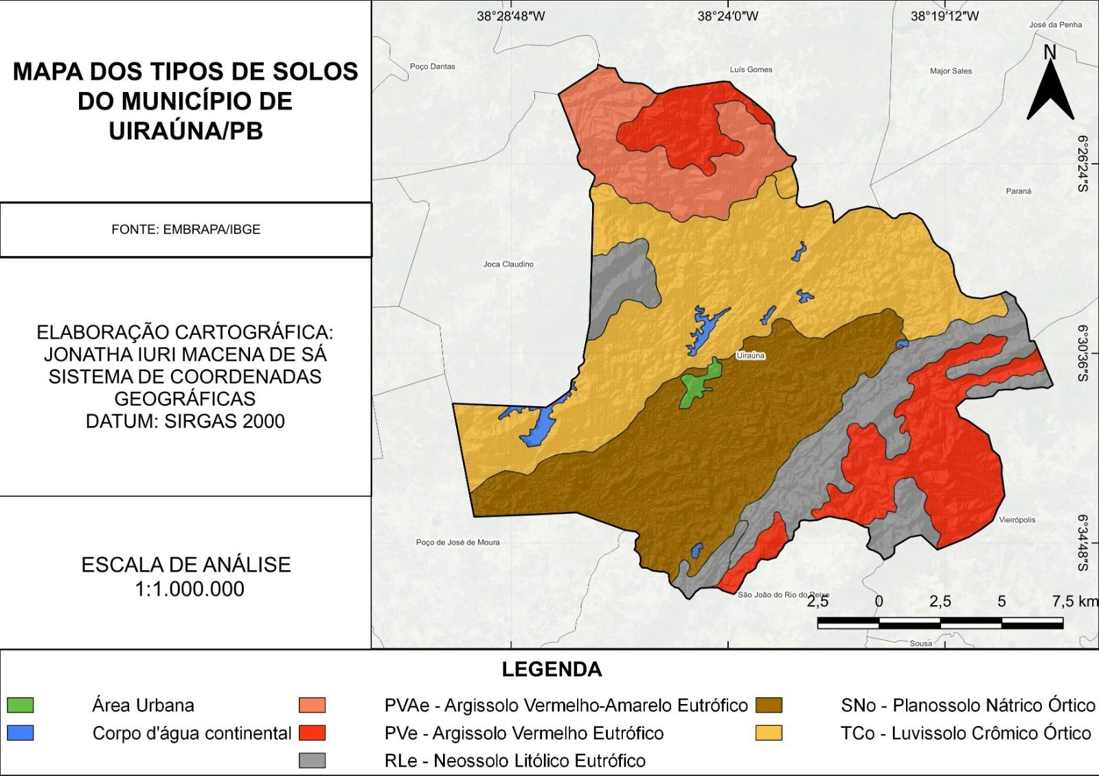
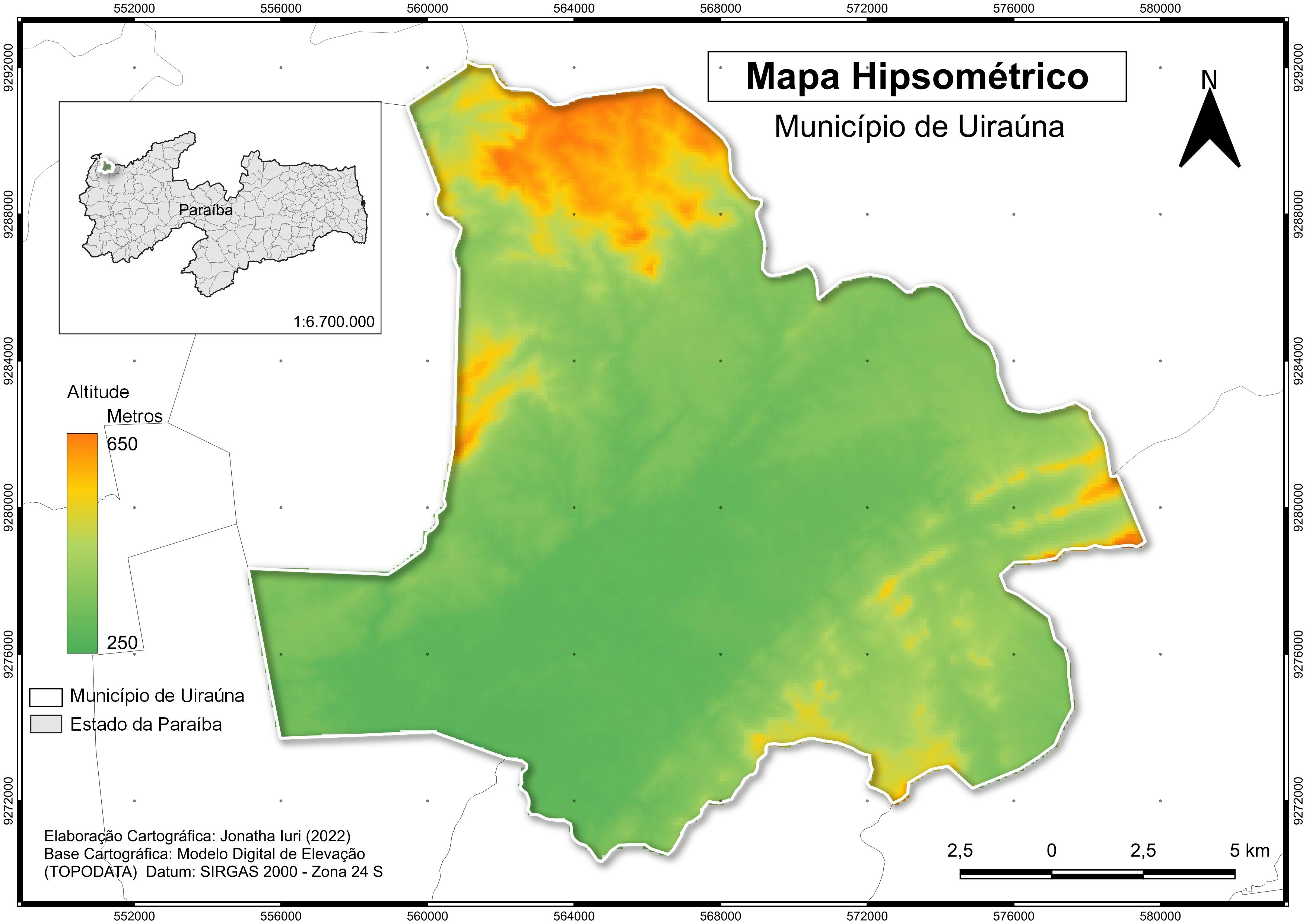
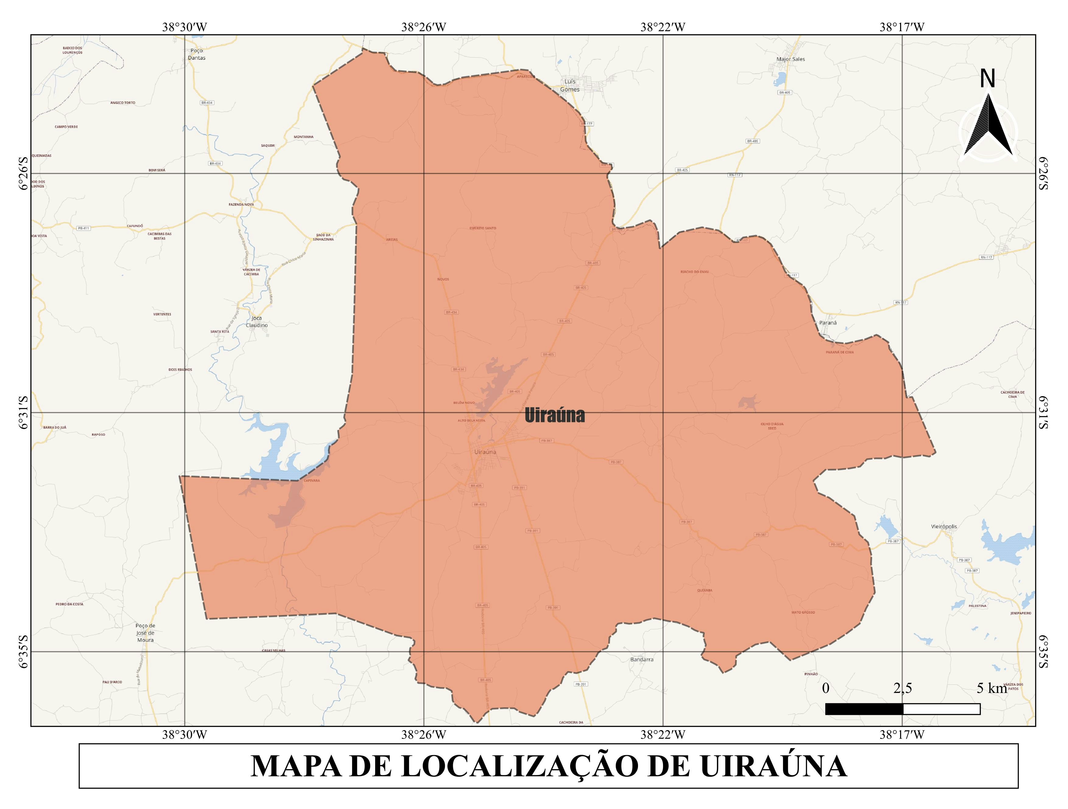
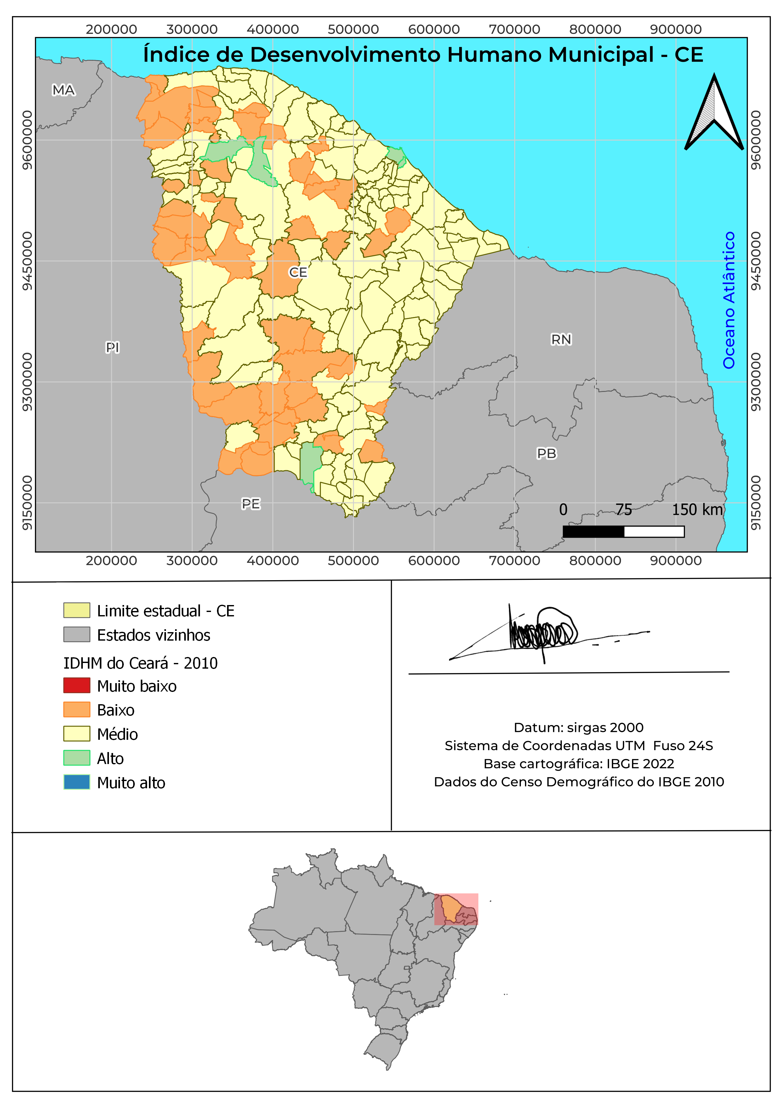
Este mapa tem como objetivo descrever os tipos de solos do município de Uiraúna


Plug-ins used

HCMGIS

tags

MAPAmapatematico#ParaíbasolosUiraúna

More by Jonatha Iuri

Mapa dos municípios comunidades tr da PB
53
MAPA DOS BIOMAS DO BRASIL
18
MAPA DAS REGIÕES IMEDIATAS DA PARAÍBA
556
MAPA DE LOCALIZAÇÃO DE UIRAÚNA/PB
159
MAPA HIPSOMÉTRICO DA CIDADE DE UIRAÚNA
30
MAPA DE LOCALIZAÇÃO ESCOLA-CAMPO / PB
12
MAPA MULTIESCALAR DE LOCALIZAÇÃO UIRAÚNA
97
MAPA DOS ABALOS SÍSMICOS DE UIRAÚNA/PB
13
Mapa do município de Joca Claudino/PB
52
MAPA DE LOCALIZAÇÃO DE UIRAÚNA/PB
387
MAPA DAS MACRORREGIOES DO BRASIL
56
MAPA DAS ASDs DO ESTADO DA PARAÍBA
21

You might also like

Mapa de Perícia Ambiental
Giuliano Torrieri Nigro
Mapa de Perícia Ambiental
Giuliano Torrieri Nigro
26
Allentown, PA, Sanitary Sewer Design
Shrithik S
Allentown, PA, Sanitary Sewer Design
Shrithik S
7
Size of deforestation patches
Rayane Pacheco
Size of deforestation patches
Rayane Pacheco
82
Network Coverage Map
Kevin Potgieter
Network Coverage Map
Kevin Potgieter
548
Biomas de Minas Gerais
Alexandre Basílio Oliveira
Biomas de Minas Gerais
Alexandre Basílio Oliveira
29
LOCALIZAÇÃO DO MUNICÍPIO DE PARANAVAÍ-PR
Itamar Sateles de Sá
LOCALIZAÇÃO DO MUNICÍPIO DE PARANAVAÍ-PR
Itamar Sateles...
664
Temperature Heat Map - Argentina
Martin Nuñez Igarzabal
Temperature Heat Map - Argentina
Martin Nuñez Igarzabal
41
Satellite data for land cover mapping
Kareen Bröker
Satellite data for land cover mapping
Kareen Bröker
47
Ghana Night Lights Explorer
Daniel Narh Zuta
Ghana Night Lights Explorer
Daniel Narh Zuta
6
Topographical Map of Lagos Mainland
Emeka Ude
Topographical Map of Lagos Mainland
Emeka Ude
84
QGIS and Blender
Emilian
QGIS and Blender
Emilian
30
Land Surface Temperature variation
Eguagie-suyi Precious
Land Surface Temperature variation
Eguagie-suyi Precious
207

Join the community!

We're a place where geospatial professionals showcase their works and discover opportunities.

Sign Up for free