
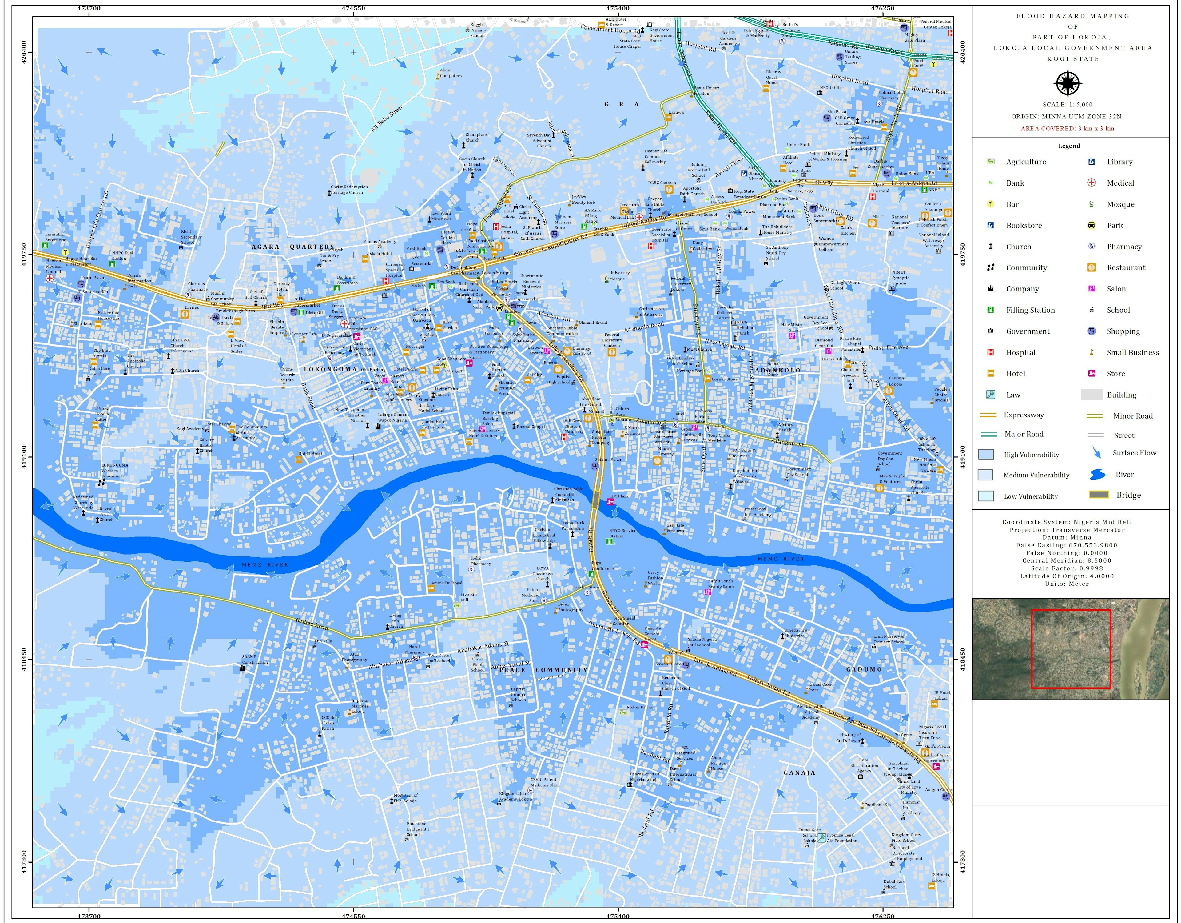
This is a flood hazard map of a part of Lokoja in Kogi State. Using Multi-Criteria Analysis, this map was produced to determine which areas are prone to flooding and the level of vulnerability. The darker the blue color, the more vulnerable. Some of the criteria considered include: elevation, slope, proximity to river and a few others. The map will help in planning for any future flood event in the area.
Flood Hazard Map of a Part of Lokoja
Plug-ins used
ArcGIS Online
tags
Flood HazardMulti-criteria analysis
More by Elizabeth Ugwu


You might also like


.svg "Kaitlyn Perham")


Join the community!
We're a place where geospatial professionals showcase their works and discover opportunities.