Sign up or log in to your Spatialnode account.

Takes less than a few seconds.

Study area map

Oladeji Muhammed
Oladeji Muhammed•

June 20, 2022

Study area map

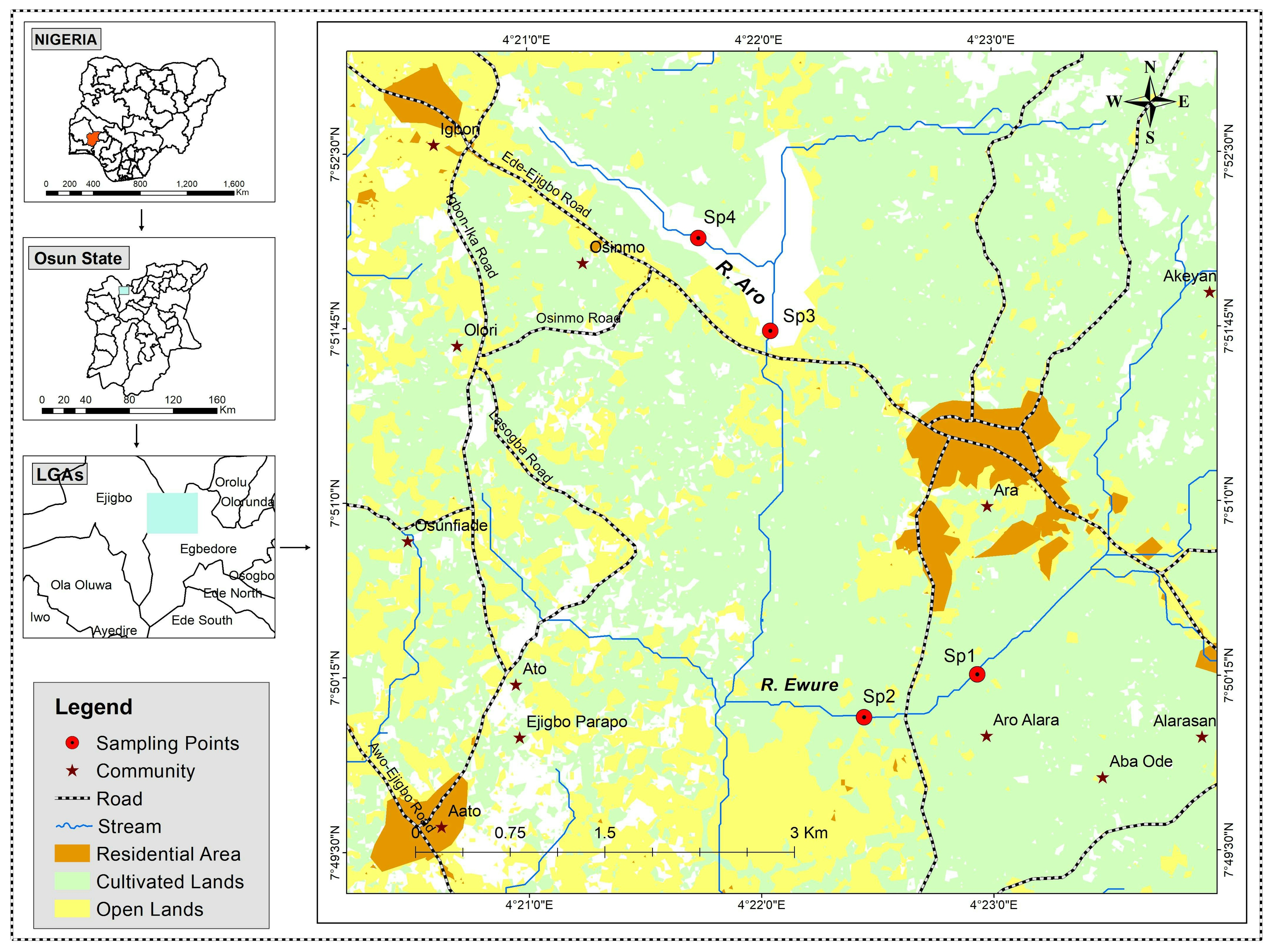
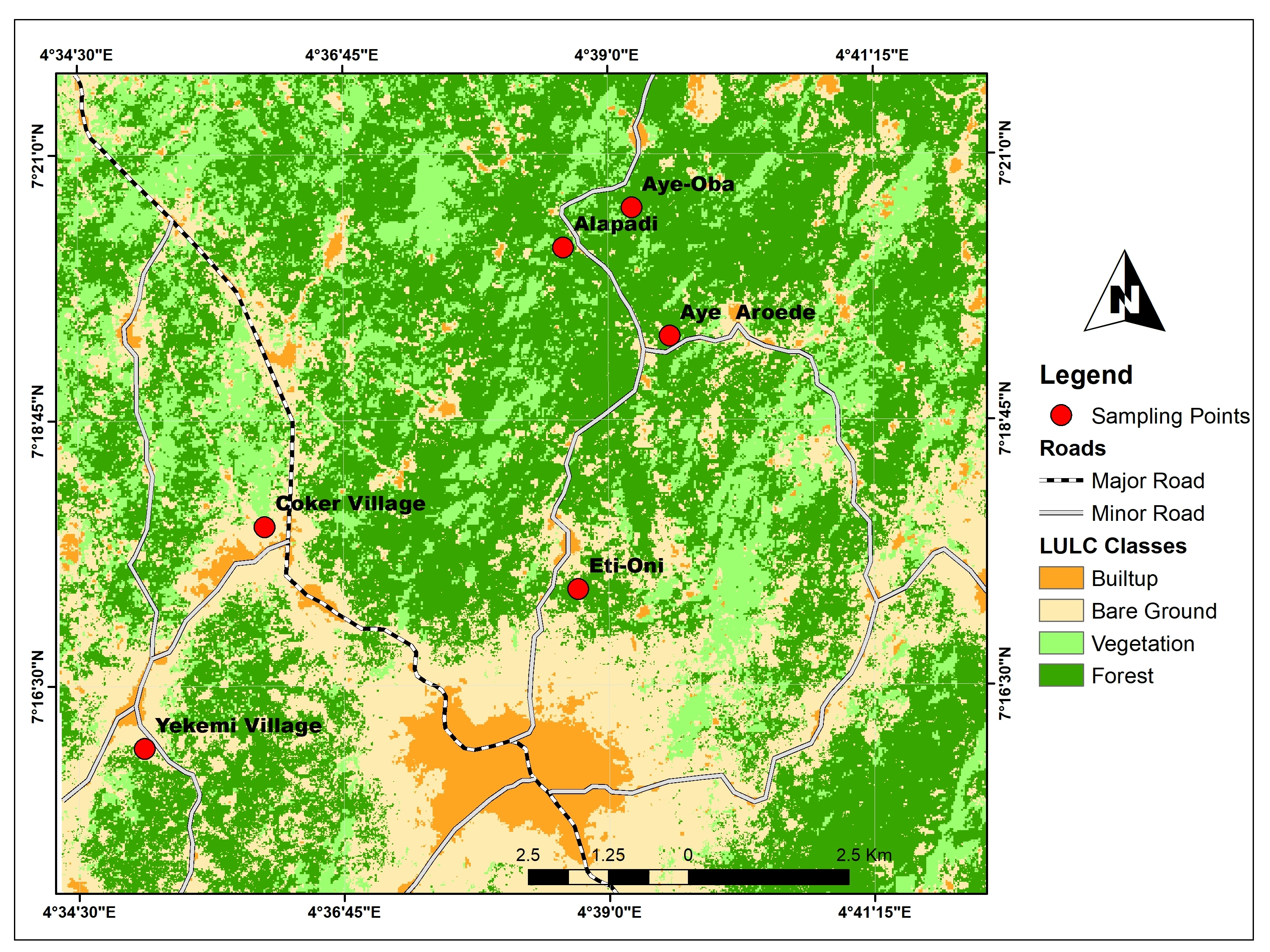
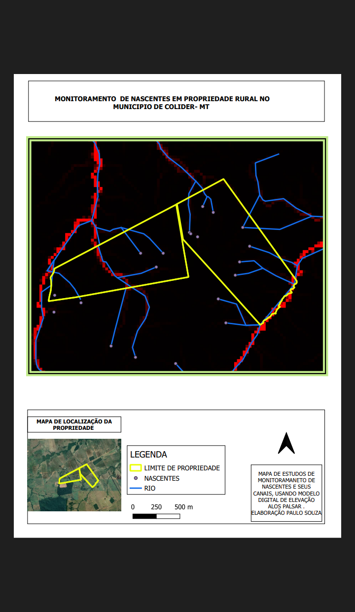
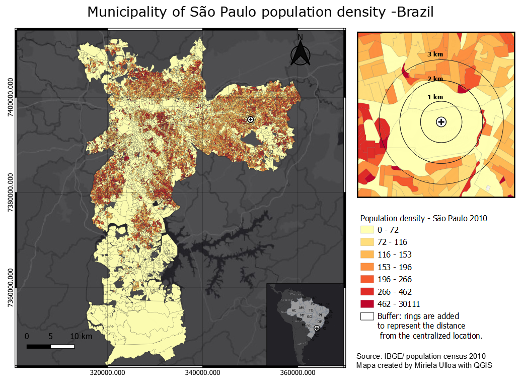
Water samples were collected on the field and sampling points were represented on a map.
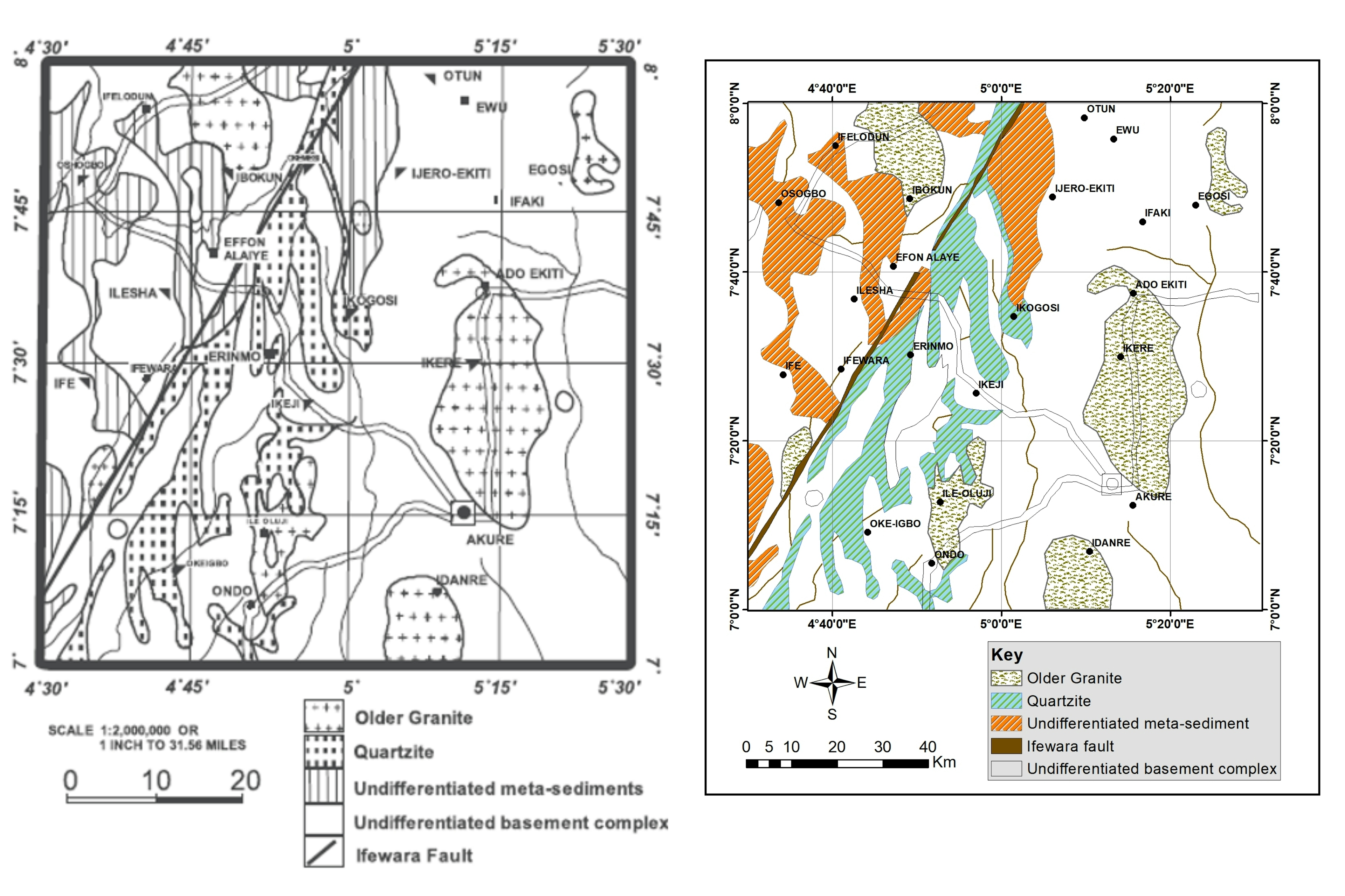
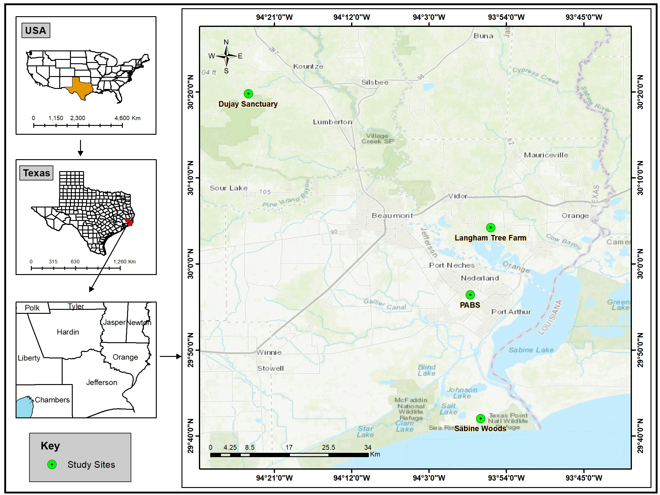

Tools used

ArcMapQGIS

Plug-ins used

Google Colab

tags

ArcMapQGIS

More by Oladeji Muhammed

Cartographer
Cartographer
96
Map Re-draw/Facelift
56
Dublin vacant dwellings
39
2019-2023 Global Covid-19 Dashboard
30
Study area map
Study area map
166
Data Visualisation using Matplotlib
37
LULLC Map of Ife South LGA
157
Proximity of dumpsite to lagoon in Lagos
14
Map Facelift
Map Facelift
33
ESRI Spatial Data Science Certification
50
Geology map of Oyo State facelift
169

You might also like

Mapping of hospitals within Cambodia
Noel Png
Mapping of hospitals within Cambodia
Noel Png
36
Education Level of Marion County
Jason Boatjri
Education Level of Marion County
Jason Boatjri
13
Canopy Cover by Zip Code
Sean Willis
Canopy Cover by Zip Code
Sean Willis
127
Dane Nepal Capstone Glacier Lake Flood
Dane Lewandowski
Dane Nepal Capstone Glacier Lake Flood
Dane Lewandowski
15
6 Best GIS Software for Businesses
Stewart Berry
6 Best GIS Software for Businesses
Stewart Berry
35
Bairros no entorno do Vale do Reginaldo
Priscila Andreza dos Santos Buarque
Bairros no entorno do Vale do Reginaldo
Priscila Andreza...
92
Accidents in Athens 3D
Panagiotis Bourlioufas
Accidents in Athens 3D
Panagiotis Bourlioufas
15
LAND SURFACE TEMPERATURE OF EGBEDA L.G
Rafiu, Kawiyu Omomayowa
LAND SURFACE TEMPERATURE OF EGBEDA L.G
Rafiu, Kawiyu Omomayowa
31
Water Lines in Portland
Troy Mills
Water Lines in Portland
Troy Mills
4
Deforestation rate out of CAR overlap
Rayane Pacheco
Deforestation rate out of CAR overlap
Rayane Pacheco
58
City of Bend, OR: Wildfire Exposure Map
Tate Ewing
City of Bend, OR: Wildfire Exposure Map
Tate Ewing
43
Carta de Uso e Ocupação do Solo
RODRIGO DE ARAUJO BELOTE
Carta de Uso e Ocupação do Solo
RODRIGO DE...
7

Join the community!

We're a place where geospatial professionals showcase their works and discover opportunities.

Sign Up for free