
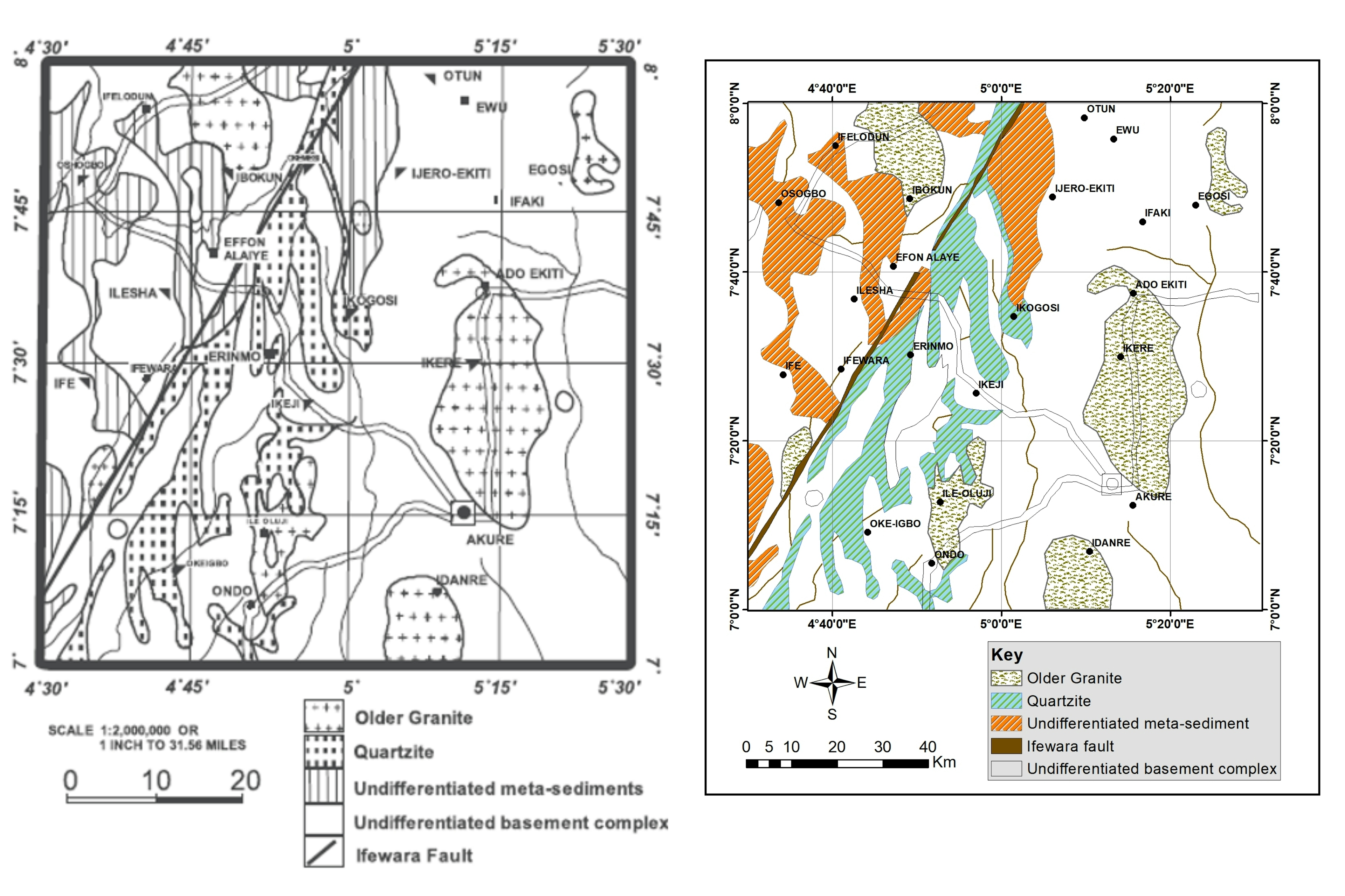
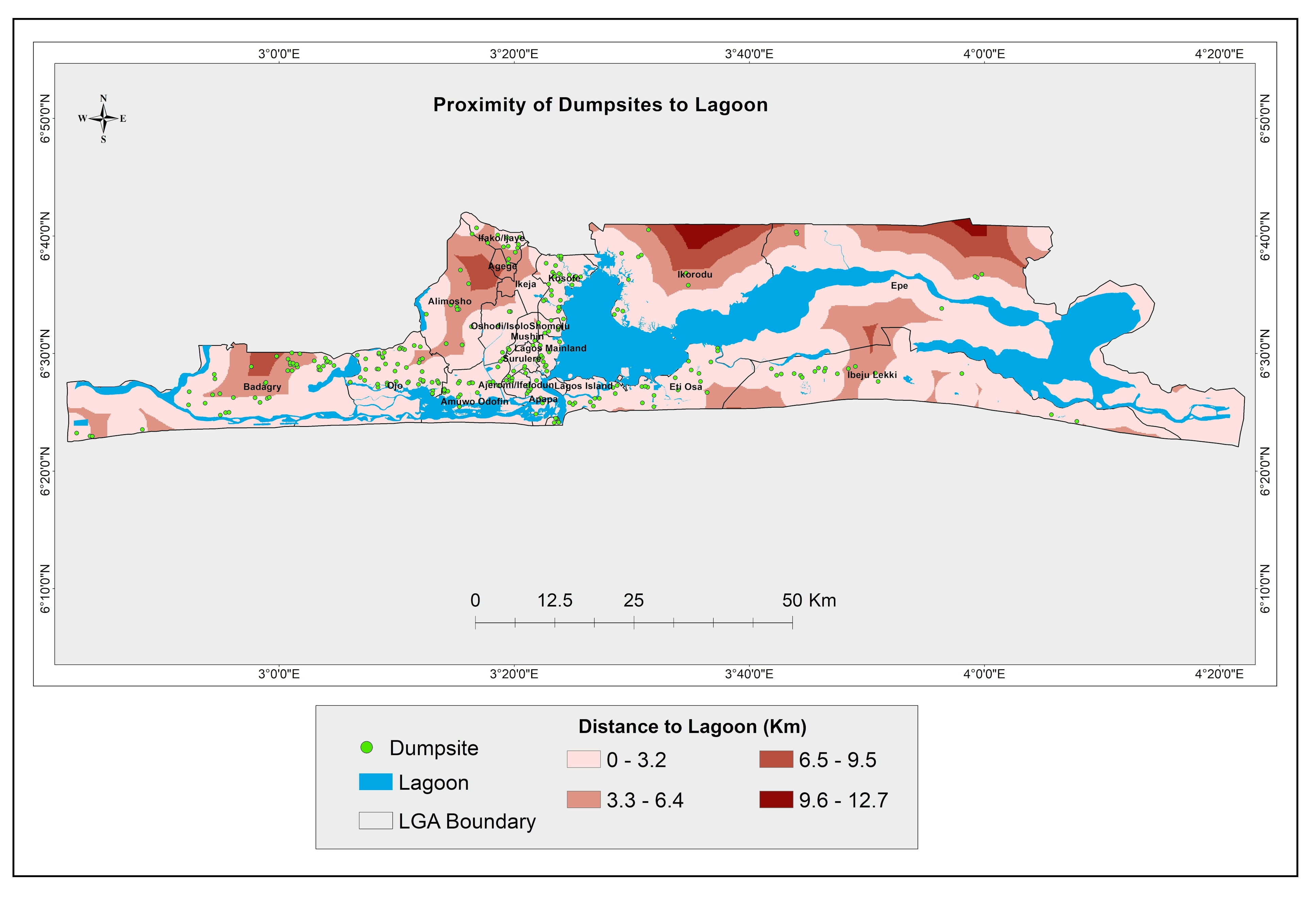
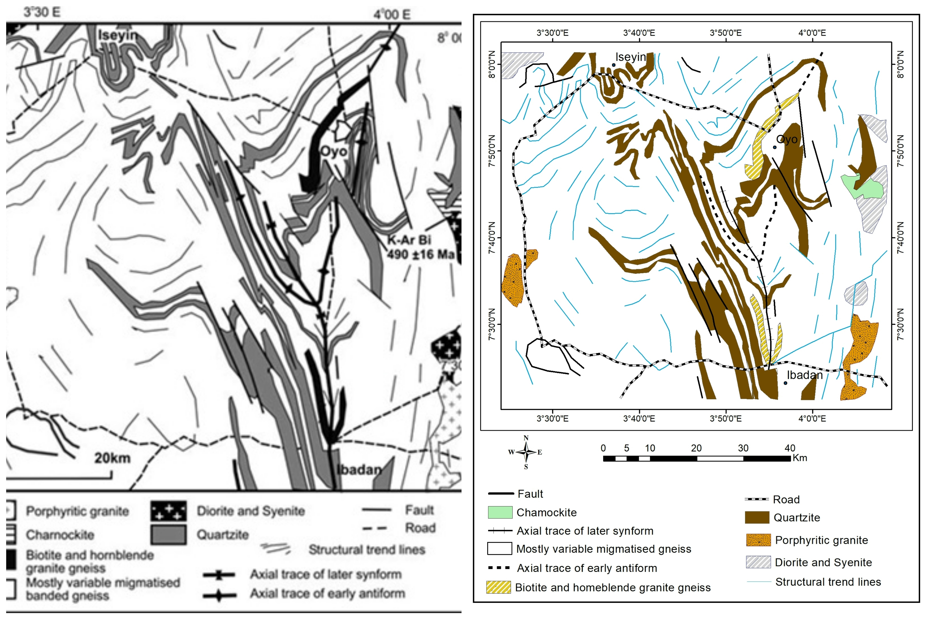
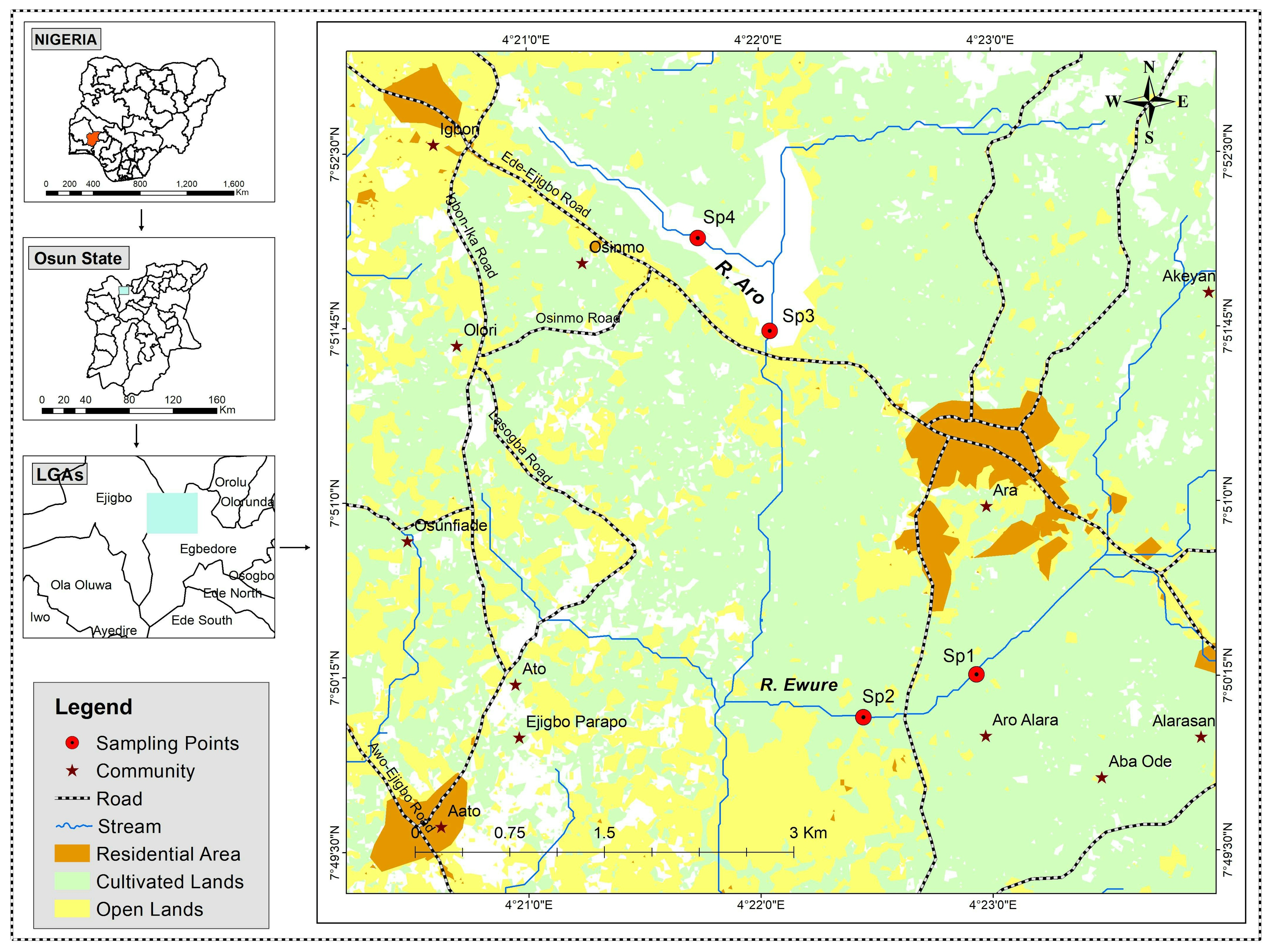
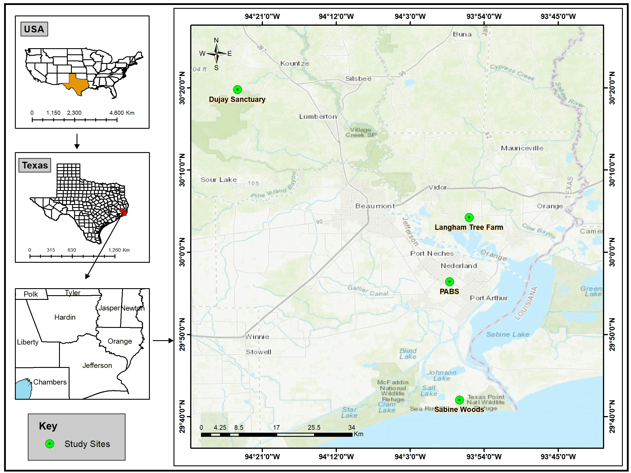
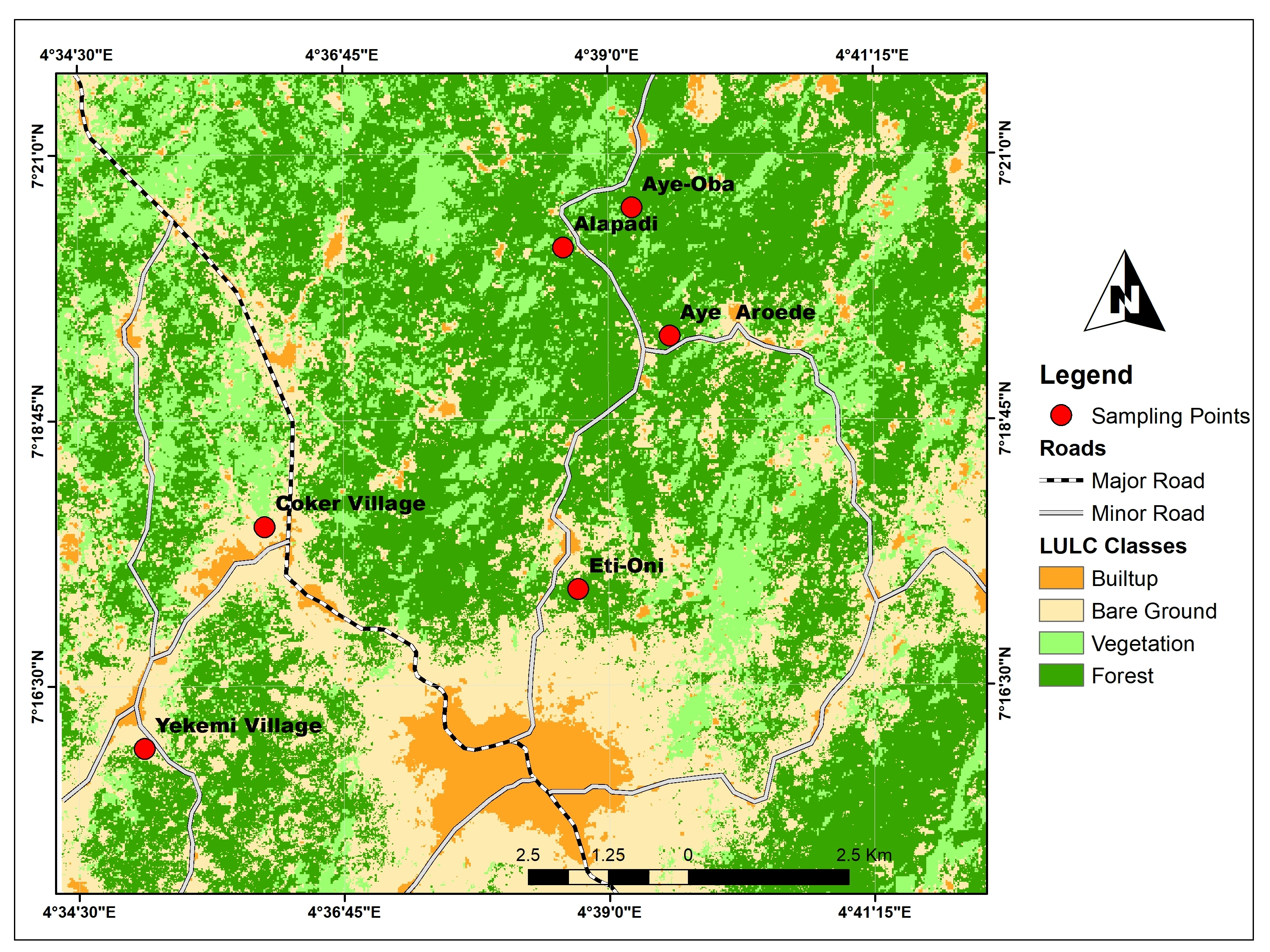
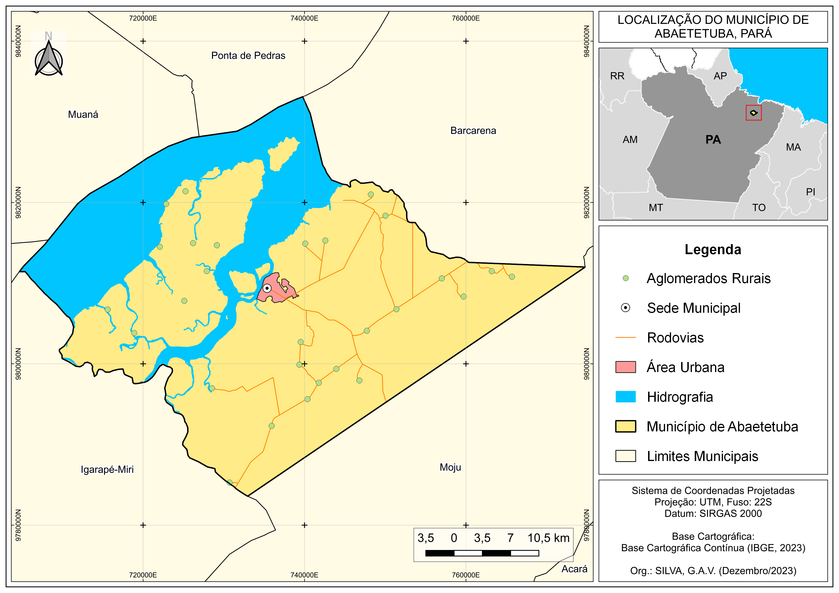
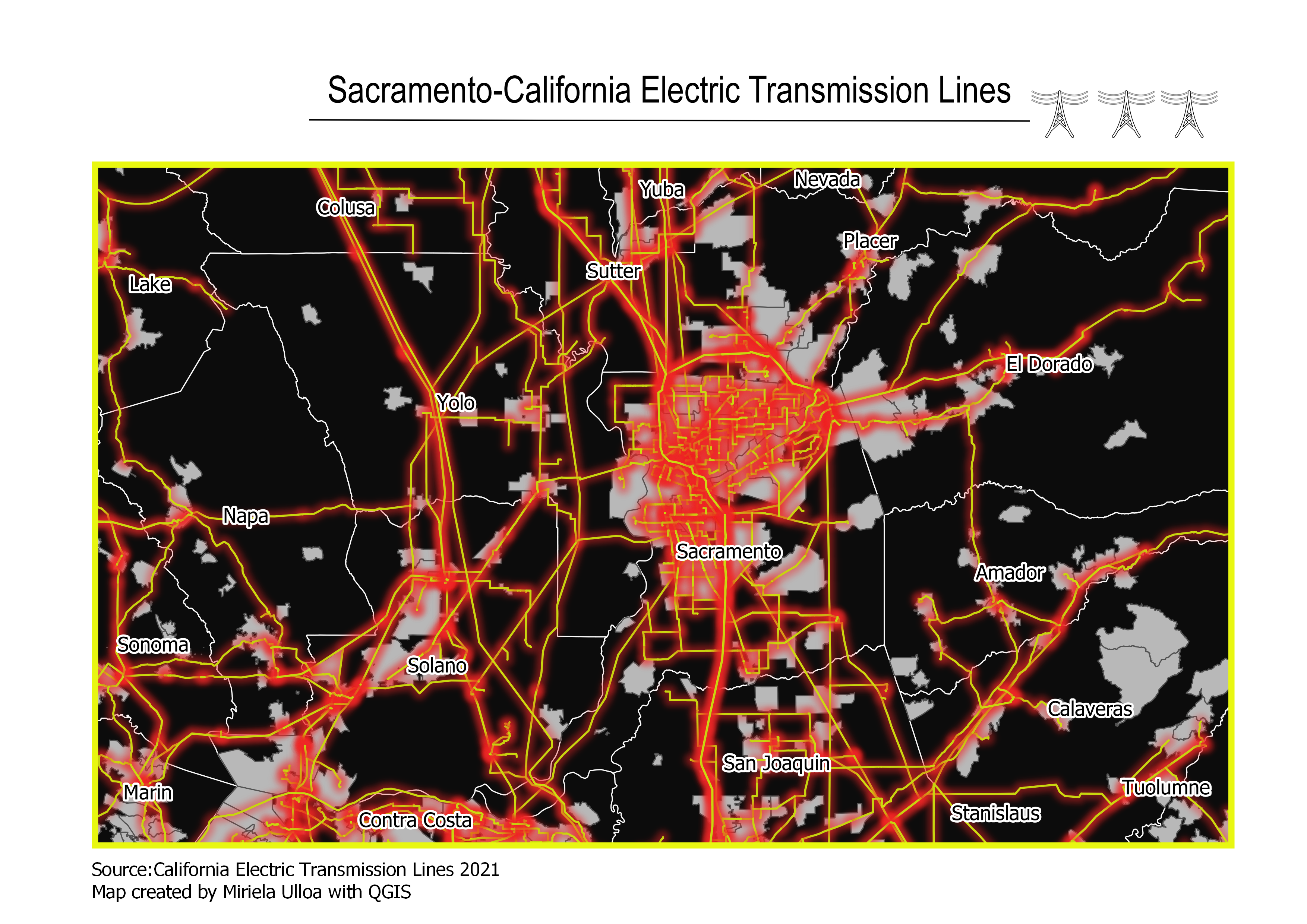
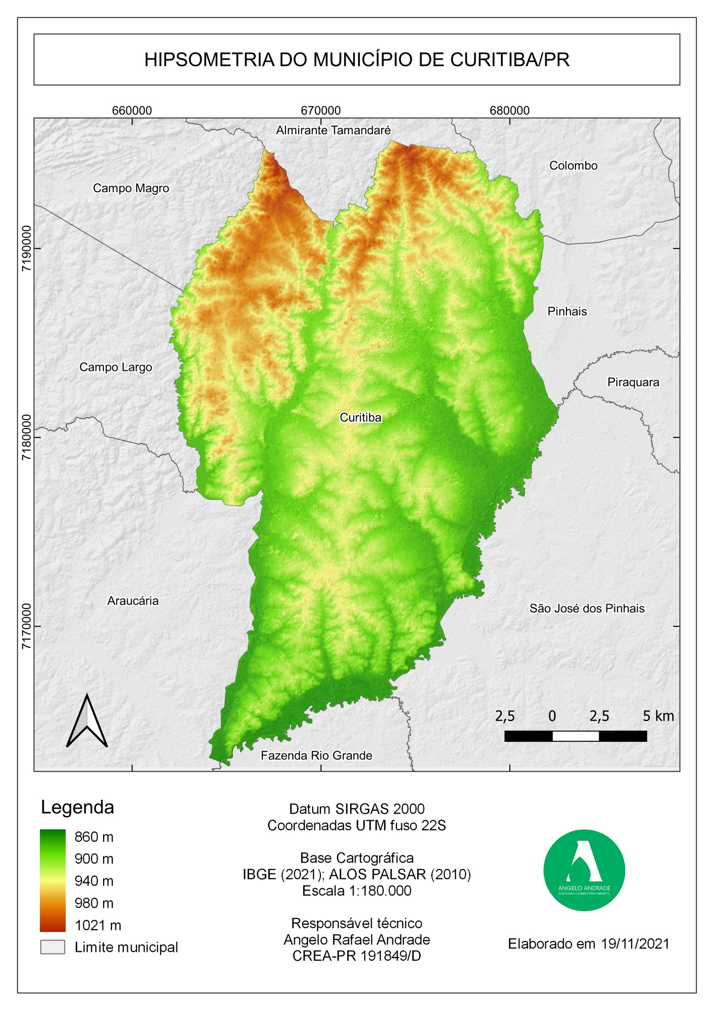
A black and white map was reproduced to have colours and make for better visualisation.
Map Re-draw/Facelift
Tools used
ArcMapQGIS
Plug-ins used
georeferencer
tags
ArcMapQGIS


You might also like


.jpeg&w=3840&q=100)


Join the community!
We're a place where geospatial professionals showcase their works and discover opportunities.