
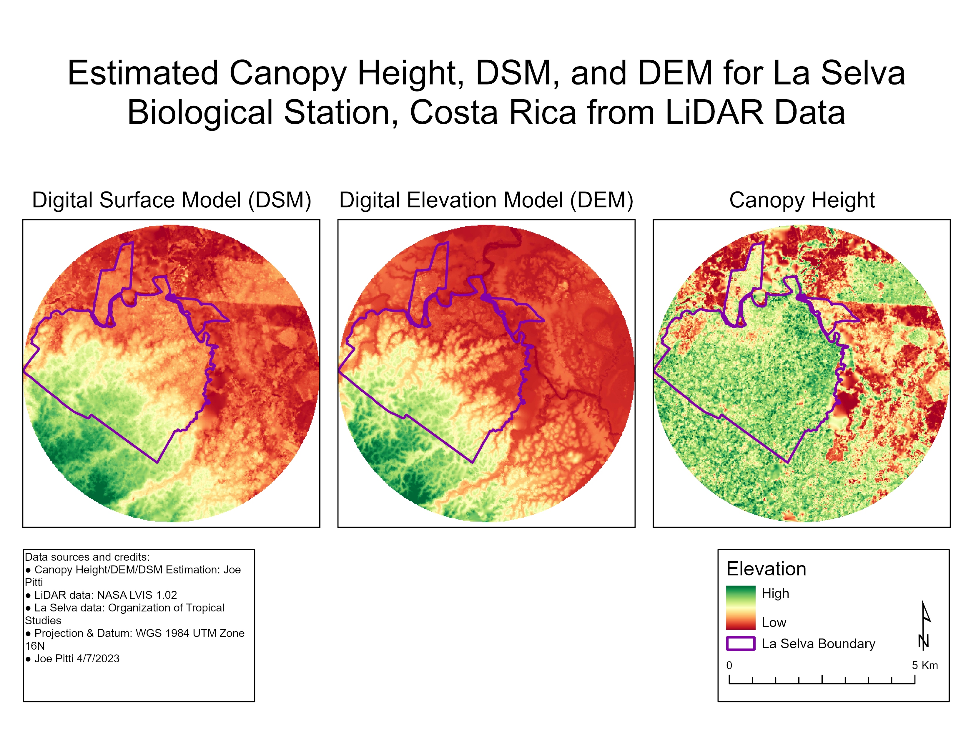
This project was part of a lab assignment I completed while at UM. We pulled data from the NASA LVIS 1.02, preprocessed to remove outliers (+-2 SD), generated DSMs/DEMs, and estimated canopy height (DSM - DEM). Overall, I really enjoyed learning more about LiDAR and its applications in ecological research!
Estimating Canopy Height from LiDAR
Tools used
ArcGIS ProLidar dataset
Plug-ins used
3D AnalystSpatial analyst
tags
canopycanopy-heightforestLiDAR
More by Joe Pitti
You might also like


Join the community!
We're a place where geospatial professionals showcase their works and discover opportunities.