
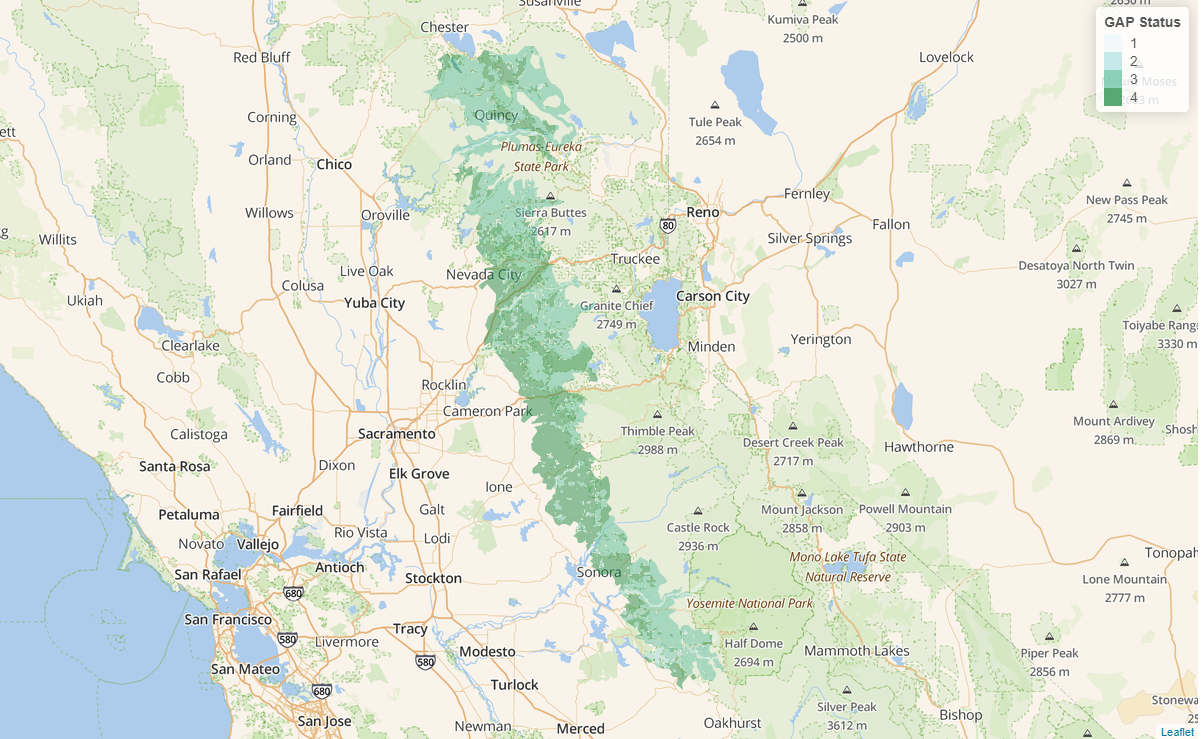
This shiny application allows users to explore the U.S. Protected Area Database (PAD-US) within the Sierras High Carbon Area (HCA). By drawing polygons over the Sierras HCA, users generate graphs summarizing the GAP status, management, and ownership of the land within their drawn polygons. It's a little rough around the edges, but I'm thrilled that I could achieve this level of interactivity in my first shiny app!
US-PADUS Explorer
Tools used
LeafletR ShinyRStudio
Plug-ins used
sftidyverse
tags
PAD-USR ShinySierra NevadaUsgs
More by Joe Pitti
You might also like


Join the community!
We're a place where geospatial professionals showcase their works and discover opportunities.