
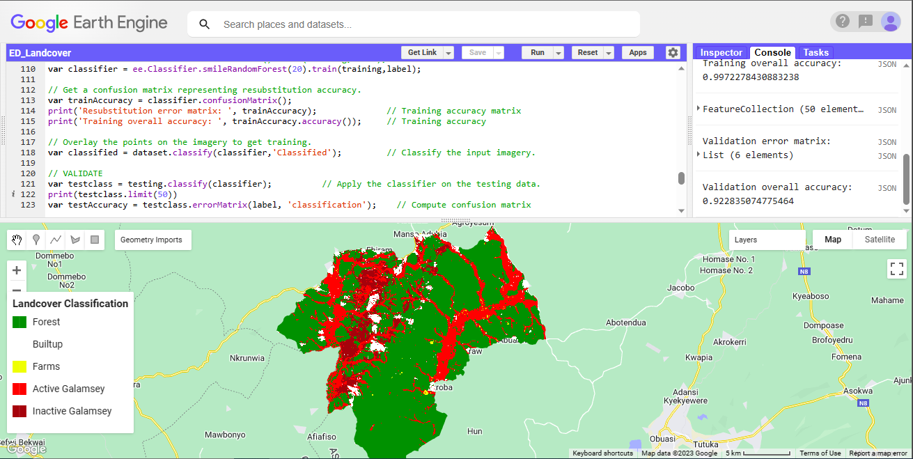
The classification was to show landcover types in the study area with focus on mining
Supervised Classification
Tools used
Google Earth Engine(GEE)Javascript
Plug-ins used
image classificationRandom forest classifier
tags
Machine LearningRemote Sensing
More by Marvin Ayeh


You might also like


Join the community!
We're a place where geospatial professionals showcase their works and discover opportunities.