
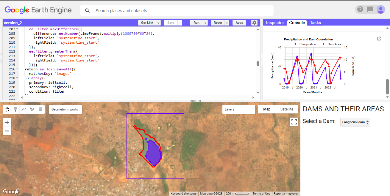
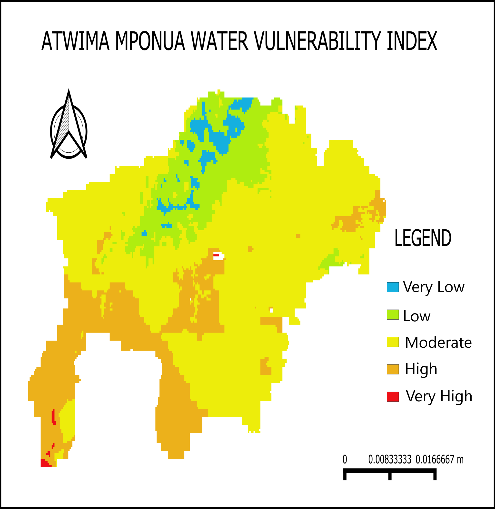
The aim of the project was to estimate the surface area of water contained in the dam during the dry season. To achieve this, Sentinel-2 imagery was used to calculate a water index, with a threshold applied to detect the presence of water. Additionally, CHIRPS global rainfall data was utilized to account for precipitation patterns. Explore the app here
Dam Quantity Assessment
Tools used
CHIRPS PENTADGoogle Earth Engine(GEE)Remote Sensingsentinel-2
Plug-ins used
Data VisualizationJavascriptmndwitime series analysis
tags
Google Earth Engine(GEE)water management
More by Marvin Ayeh


You might also like


Join the community!
We're a place where geospatial professionals showcase their works and discover opportunities.