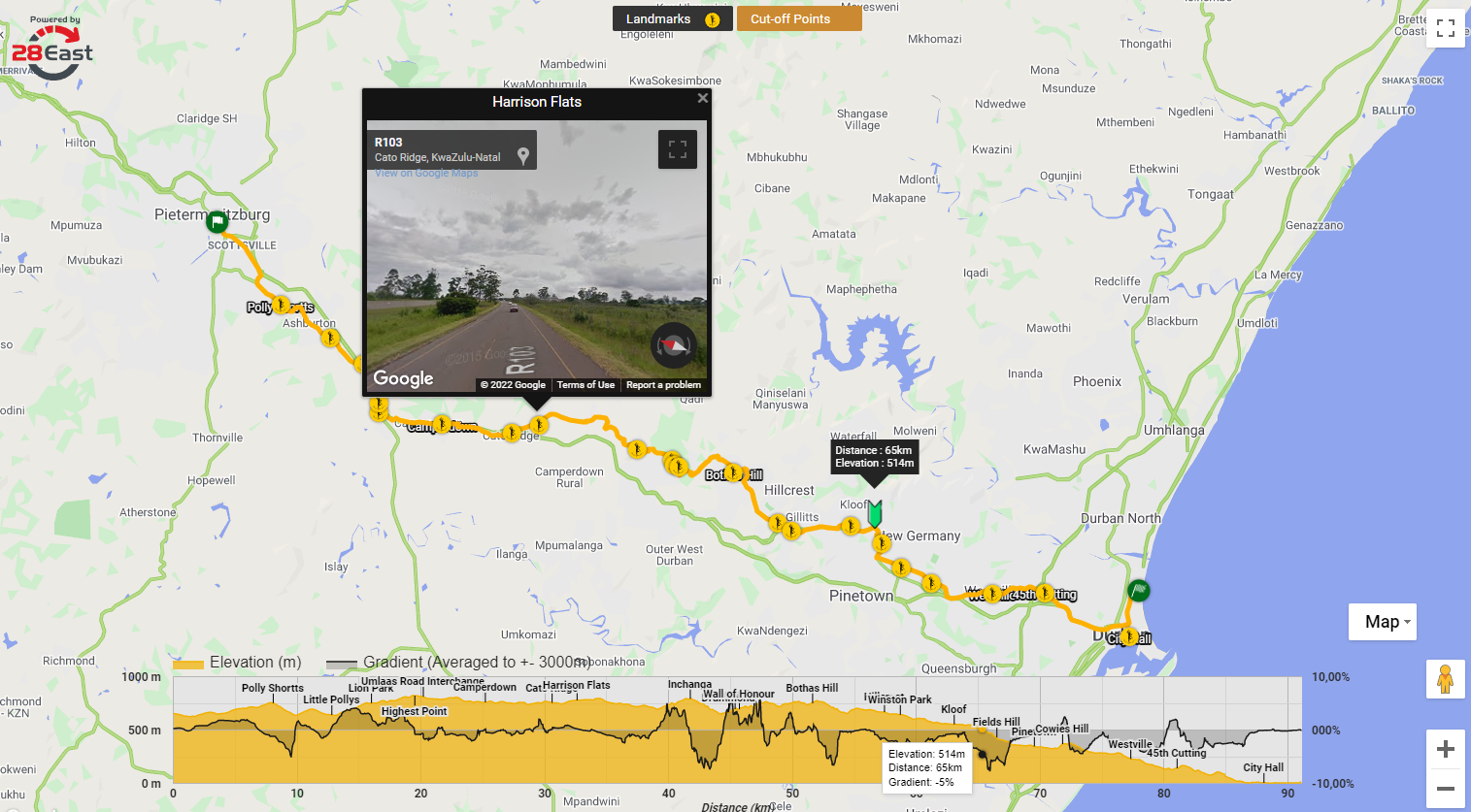
An interactive map made for the Comrades Marathon in South Africa (outdated since COVID). The map indicates gradient, elevation, distance-to-marker, and loads street view images from Google to help runners plan their event.
Data was provided by https://www.comrades.com and ingested into a simple GeoJSON dataset using QGIS. All points were mapped to elevations using Google Maps Elevation API. Gradients, distances and street view images are calculated and provided using browser JavaScript on user events.