Sign up or log in to your Spatialnode account.

Takes less than a few seconds.

Hexagonal Digital Elevation Model

Adam O Dolce
Adam O Dolce•

November 17, 2022

Hexagonal Digital Elevation Model

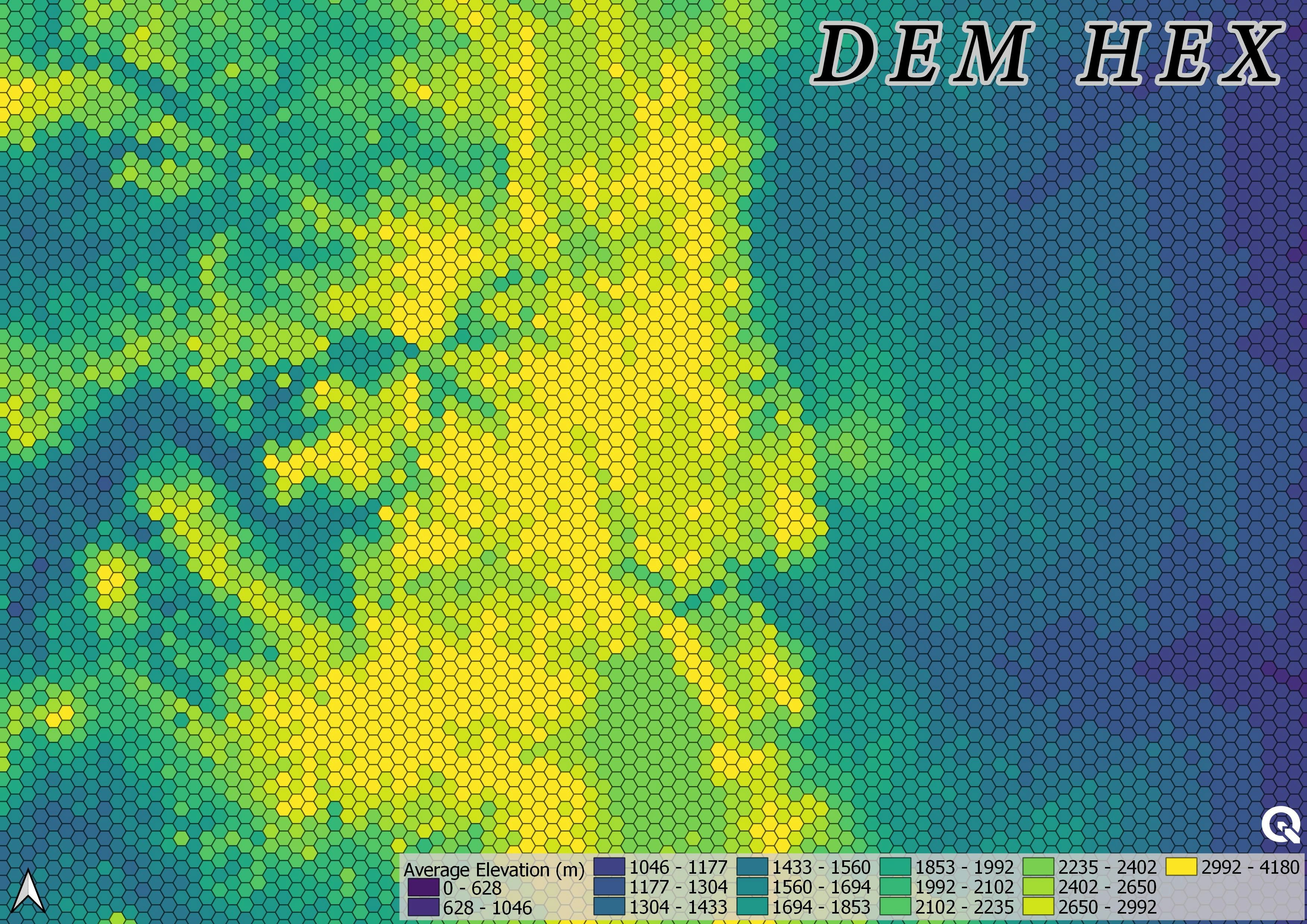
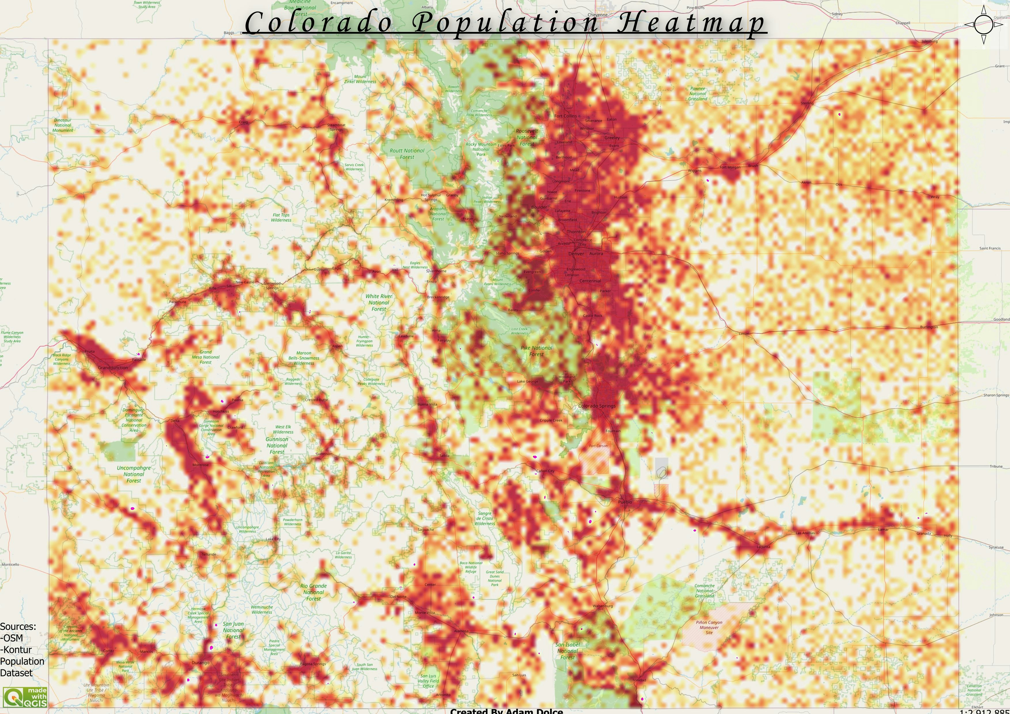
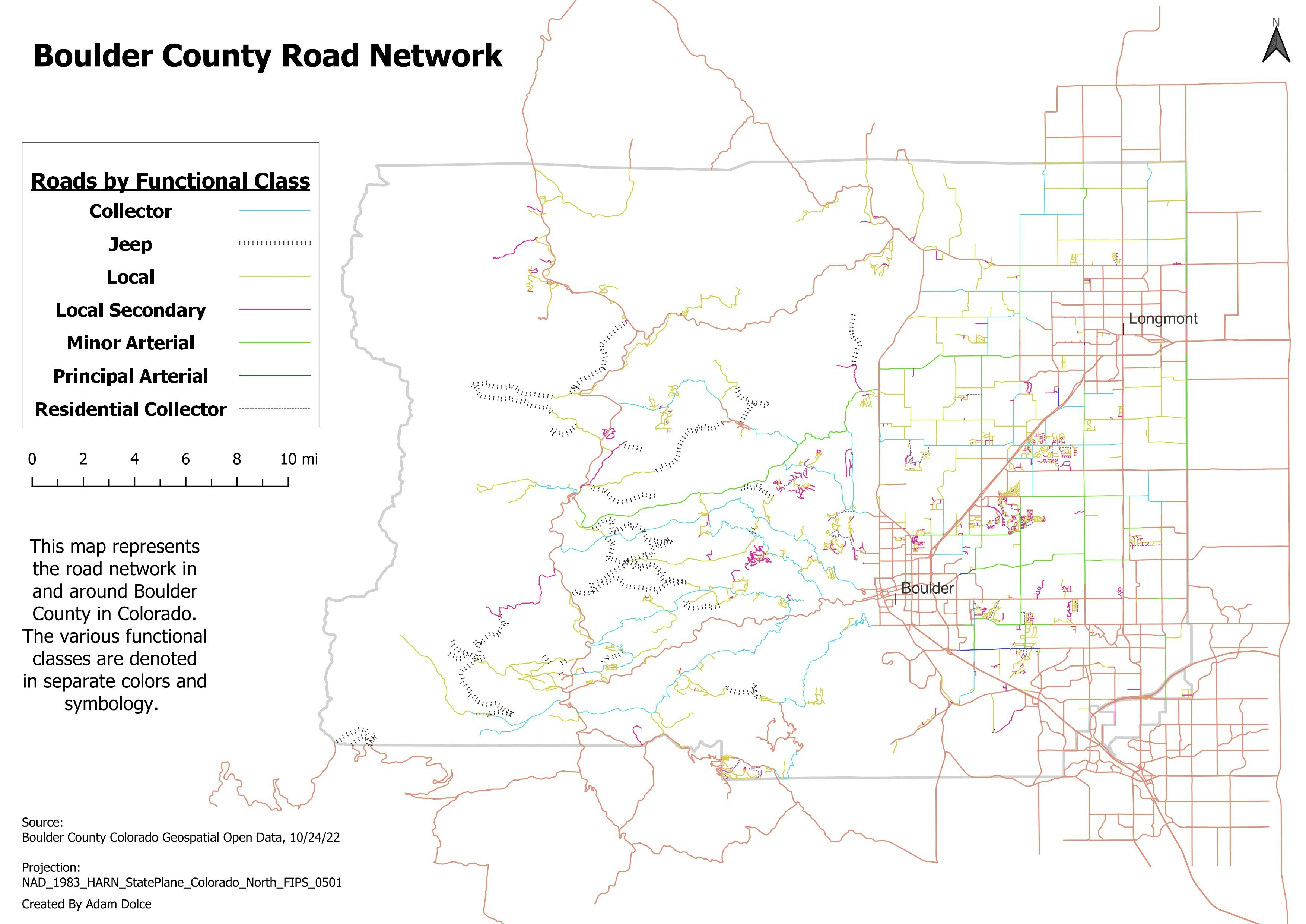
Day 14 30-day map challenge: Hexagons


Tools used

QGIS

Plug-ins used

QGIS

tags

#30DayMapChallenge

More by Adam O Dolce

Boulder County Road Network
26
Colorado County Population
77
Roughness
Roughness
44
Bike Paths
Bike Paths
24
Food and Drink with Restaurant Names
92
December 2022 Earthquakes
26
Registered EV Owners
92
EVSE Charging Stations
77
Bad Map
Bad Map
35
Fire Districts
Fire Districts
59
Open Spaces
Open Spaces
75
Electric Transmission Network
45

You might also like

KENYA SPACE AGENCY
Lawrence Kimutai
KENYA SPACE AGENCY
Lawrence Kimutai
33
Python script using GUI
David Muchiri Kimotho
Python script using GUI
David Muchiri Kimotho
103
Google Street View Layer plugin for QGIS
Nathan Saylor
Google Street View Layer plugin for QGIS
Nathan Saylor
97
Elevation and slope - Jundiaí/SP/Brazil
André Santos
Elevation and slope - Jundiaí/SP/Brazil
André Santos
21
Mauritania 2019 Election - Regions
Alec Soltes
Mauritania 2019 Election - Regions
Alec Soltes
22
geological ages of sediments in Brazil
fernand Lopes
geological ages of sediments in Brazil
fernand Lopes
17
Deforestation in Rondonia, Brazil
Amira Ramadan
Deforestation in Rondonia, Brazil
Amira Ramadan
323
Protected areas of Costa Rica
Millie Brand
Protected areas of Costa Rica
Millie Brand
23
MAPA USO E OCUPAÇÃO DO SOLO
Fabio Rodrigo Aliberti
MAPA USO E OCUPAÇÃO DO SOLO
Fabio Rodrigo Aliberti
182
Pontos de Resíduos sólidos
Priscila Andreza dos Santos Buarque
Pontos de Resíduos sólidos
Priscila Andreza...
51
Study Area Maps
Paul Ugbong
Study Area Maps
Paul Ugbong
46
 Área Industrial em Apucarana - PR
WILLIAN S. SANTOS 🇧🇷
Área Industrial em Apucarana - PR
WILLIAN S....
55

Join the community!

We're a place where geospatial professionals showcase their works and discover opportunities.

Sign Up for free