Sign up or log in to your Spatialnode account.

Takes less than a few seconds.

Propriedades Interferidas

DOUGLAS HENRIQUE MANOEL PEREIRA
DOUGLAS HENRIQUE MANOEL PEREIRA•

July 10, 2023

Propriedades Interferidas

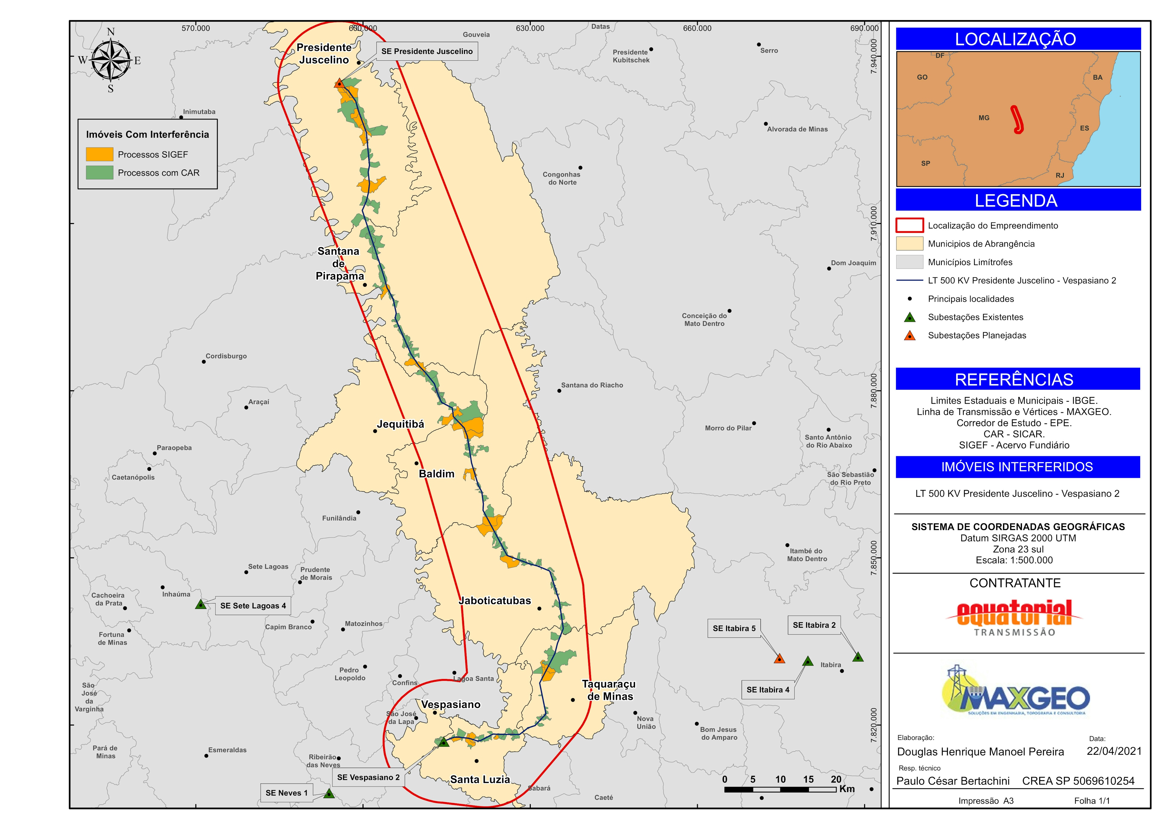
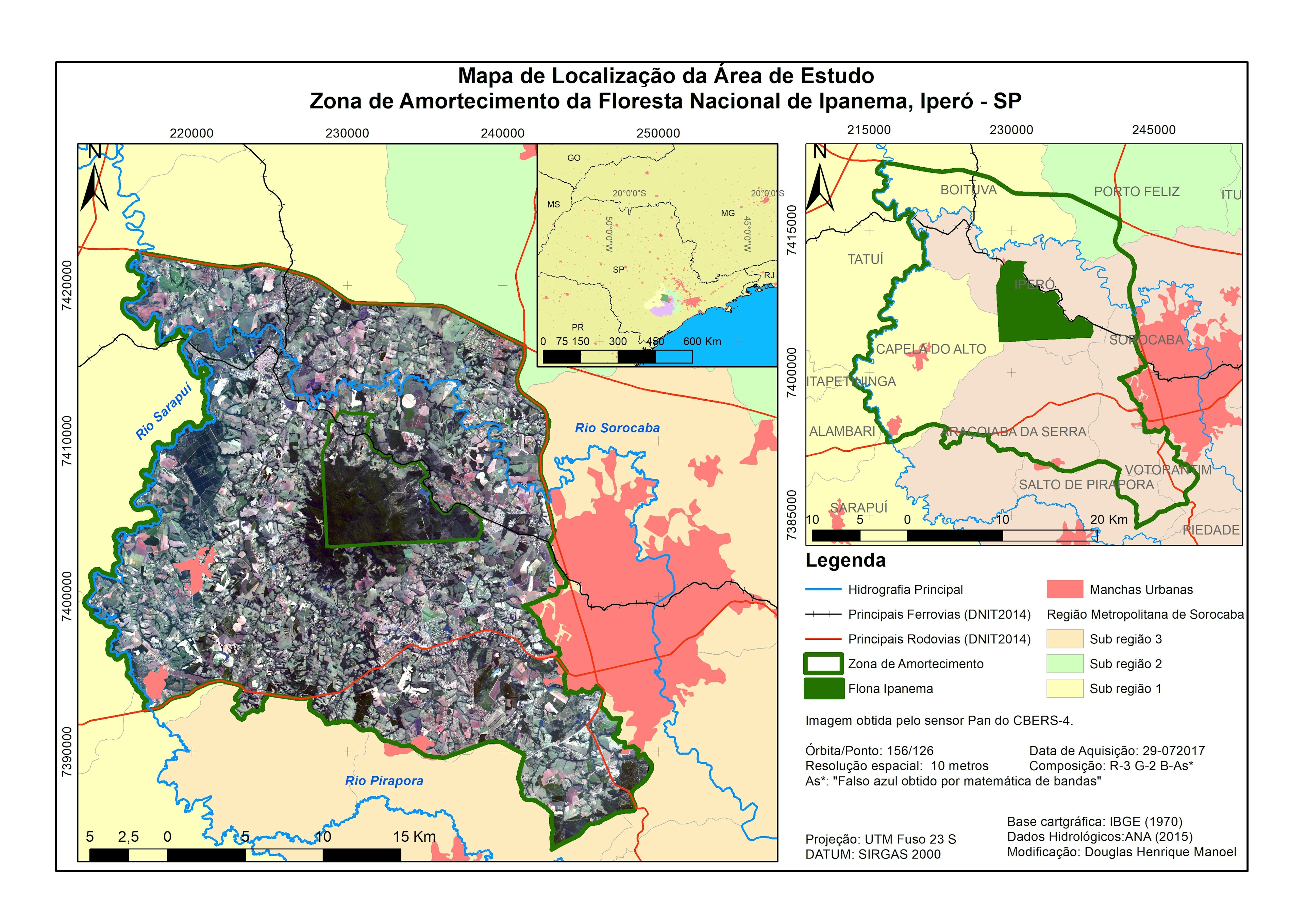
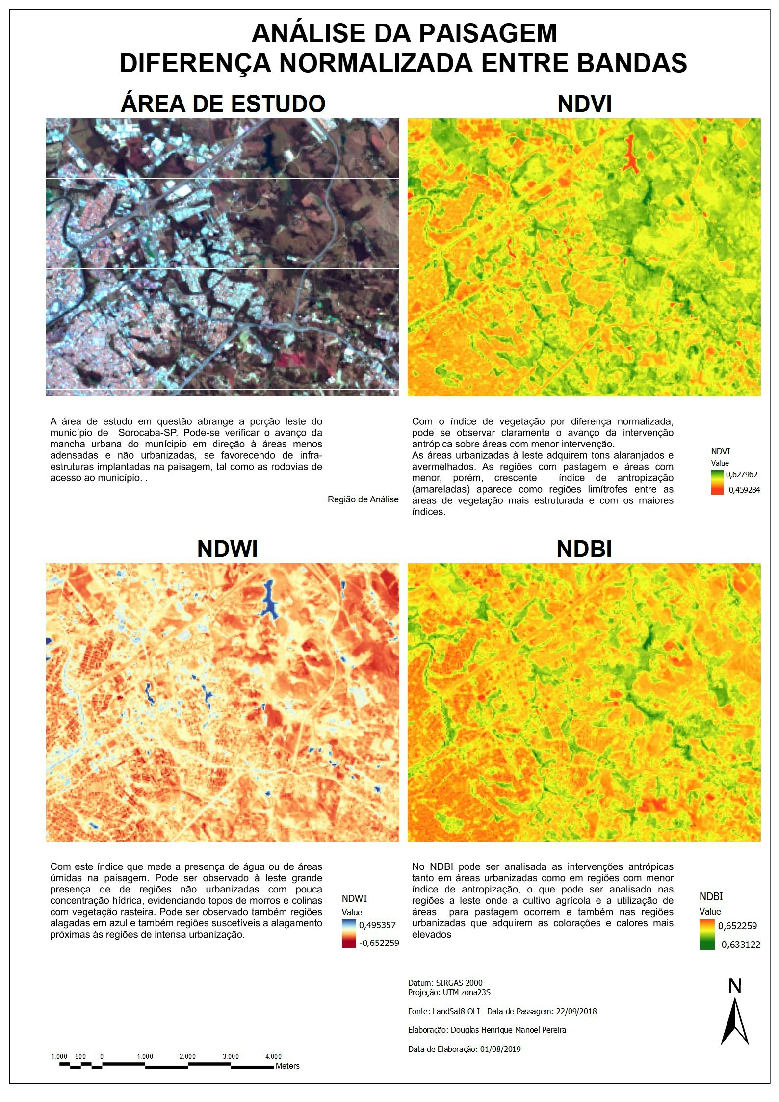
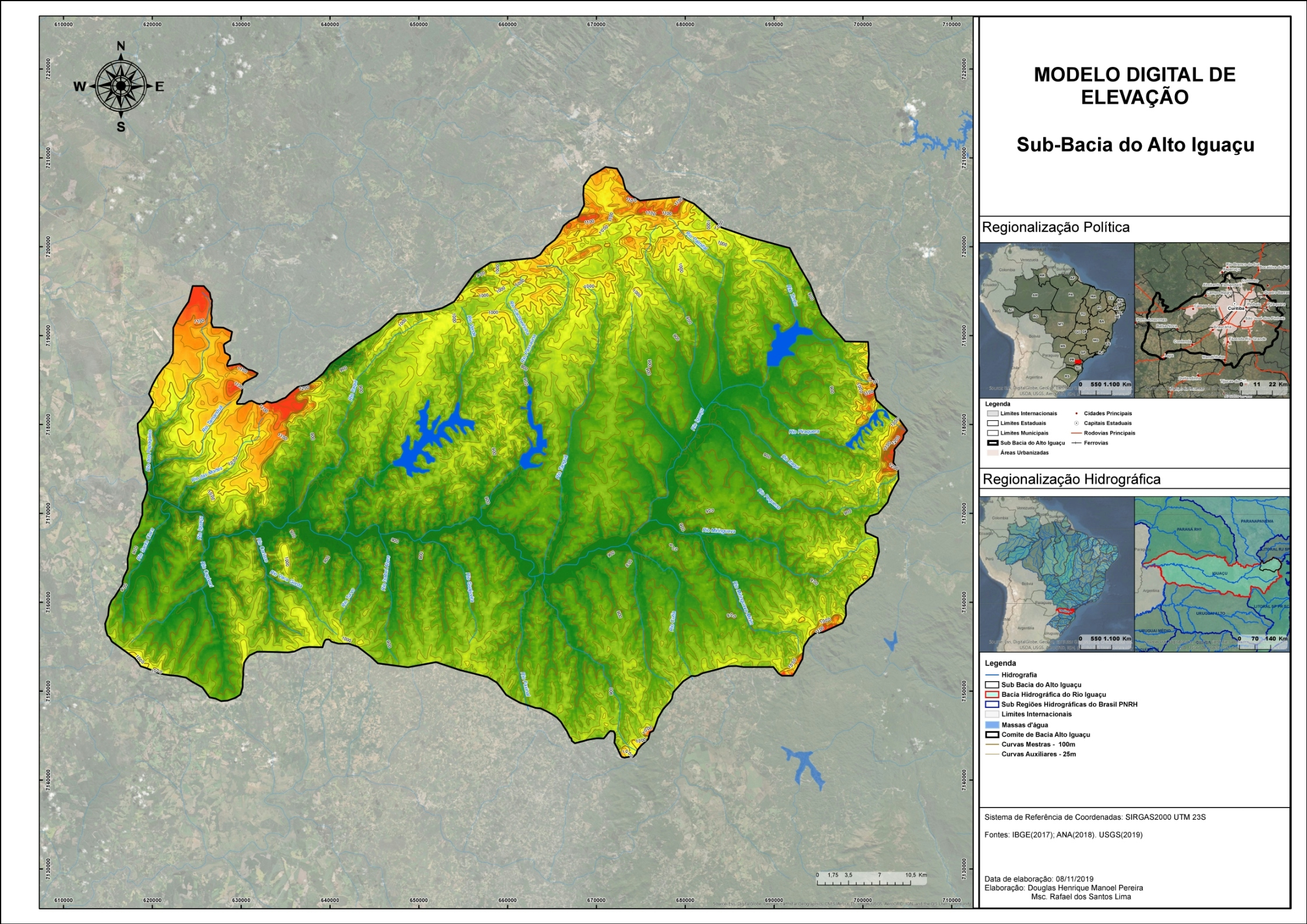
Mapeamento contendo a estimativa de propriedades interferidas  por projeto de Linha de Tranmissão à partir da Base do SICAR e do SIGEF. 


Tools used

ArcGIS

Plug-ins used

ArcGIS

tags

ArcGIS

More by DOUGLAS HENRIQUE MANOEL PEREIRA

Modelo Digital de Elevação - Alto Iguaçu
17
Unidades Litológicas
22
Floresta Nacional de Ipanema, Iperó - SP
19
Vulnerabilidade Ambiental
10
Análise da Paisagem por Índices
9
Planta Cadastral da Faixa de Servidão
29
Diagnóstico de Vegetação
7
Análise Temporal de Focos de Calor
9
Subestação Junqueirópolis
5

You might also like

Water Lines in Portland
Troy Mills
Water Lines in Portland
Troy Mills
4
Bathymetry Map of Philippine Sea
Christina Nedo
Bathymetry Map of Philippine Sea
Christina Nedo
17
Site Selection of Medium Density Housing
Kevin Le
Site Selection of Medium Density Housing
Kevin Le
78
Study area map
Oladeji Muhammed
Study area map
Oladeji Muhammed
166
Fragmentation - random forest algorithm
Emilian
Fragmentation - random forest algorithm
Emilian
11
Obesity Prevalence
Harrison Howe
Obesity Prevalence
Harrison Howe
6
Burn Severity Index: NBR
Noel Png
Burn Severity Index: NBR
Noel Png
231
U of A Conservation Planning Upper Peace
Martijn Dieleman
U of A Conservation Planning Upper Peace
Martijn Dieleman
25
octagon map
yousef
octagon map
yousef
33
NDVI map of Akoko Northeast
Ologun Emmanuel Ayowole
NDVI map of Akoko Northeast
Ologun Emmanuel Ayowole
25
Hydrographic basins of Puerto Rico
Jonathan Correa Varela
Hydrographic basins of Puerto Rico
Jonathan Correa Varela
51
Elizabeth Albernaz
Land Use and Cover over 20 years.
Elizabeth Albernaz
6

Join the community!

We're a place where geospatial professionals showcase their works and discover opportunities.

Sign Up for free