

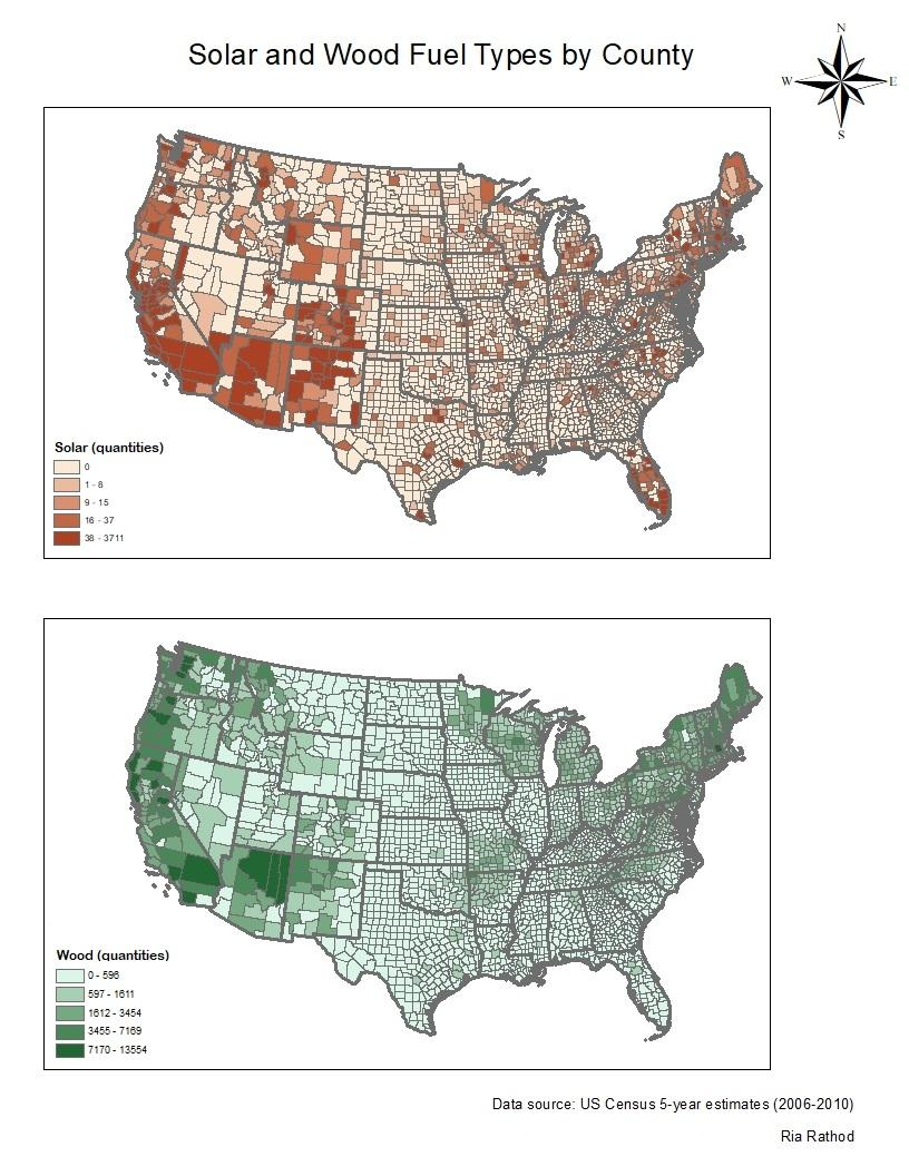
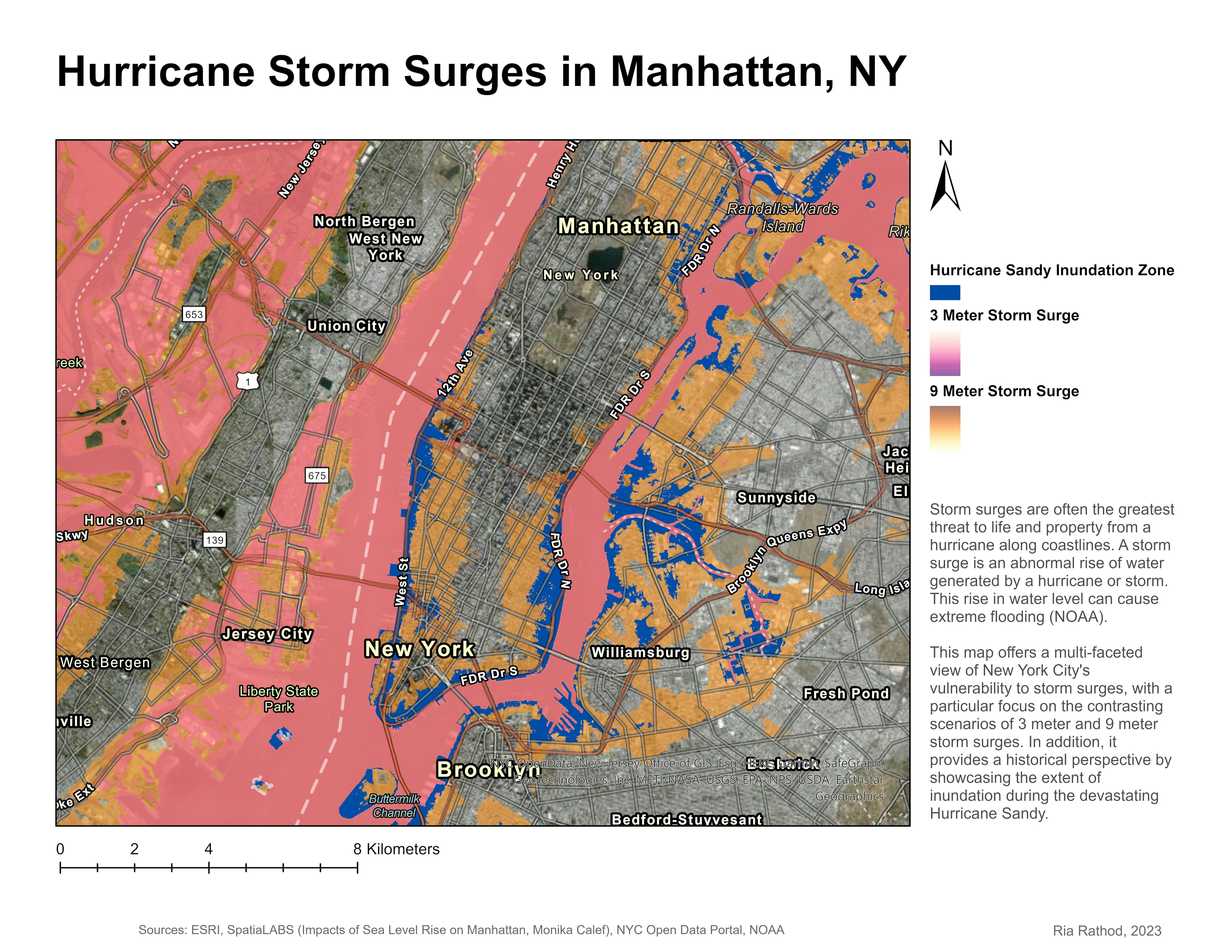
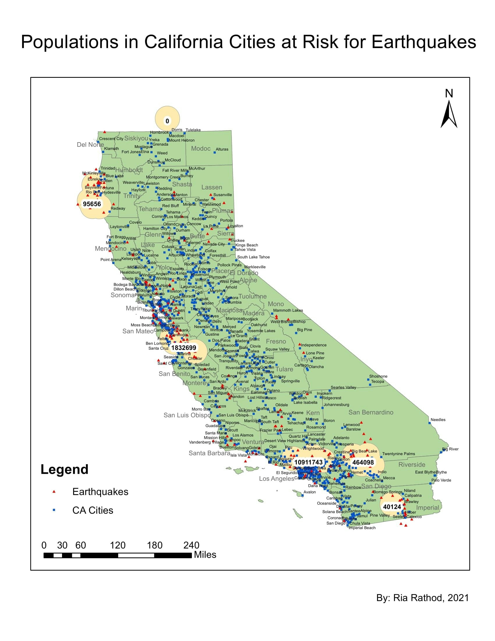
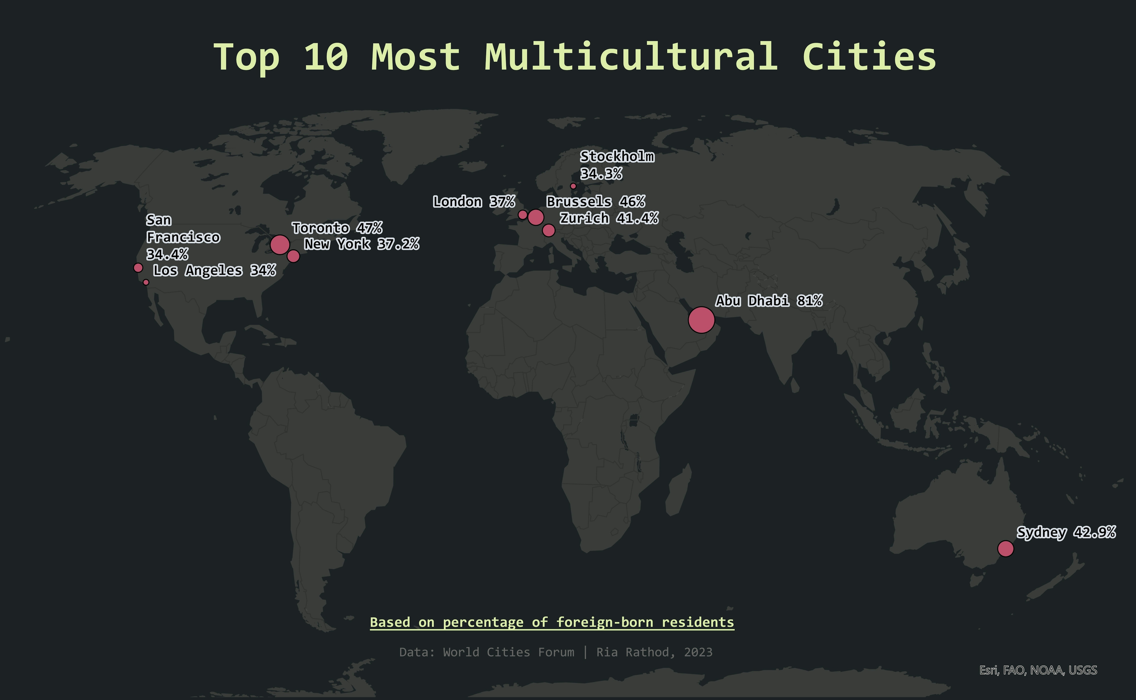
This map was created for my URSP 360 course. Data from US Census. Made using ArcMap.
Percent Elderly & Youth Pop., CA 2010
Plug-ins used
not used
tags
population
More by Ria Rathod
You might also like


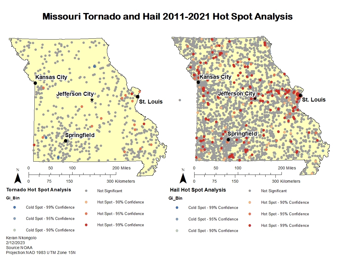
.svg "Keran Nkongolo")


Join the community!
We're a place where geospatial professionals showcase their works and discover opportunities.