Sign up or log in to your Spatialnode account.

Takes less than a few seconds.

Contour Map and Topographic Profile

Amira Ramadan
Amira Ramadan•

March 02, 2022

Contour Map and Topographic Profile

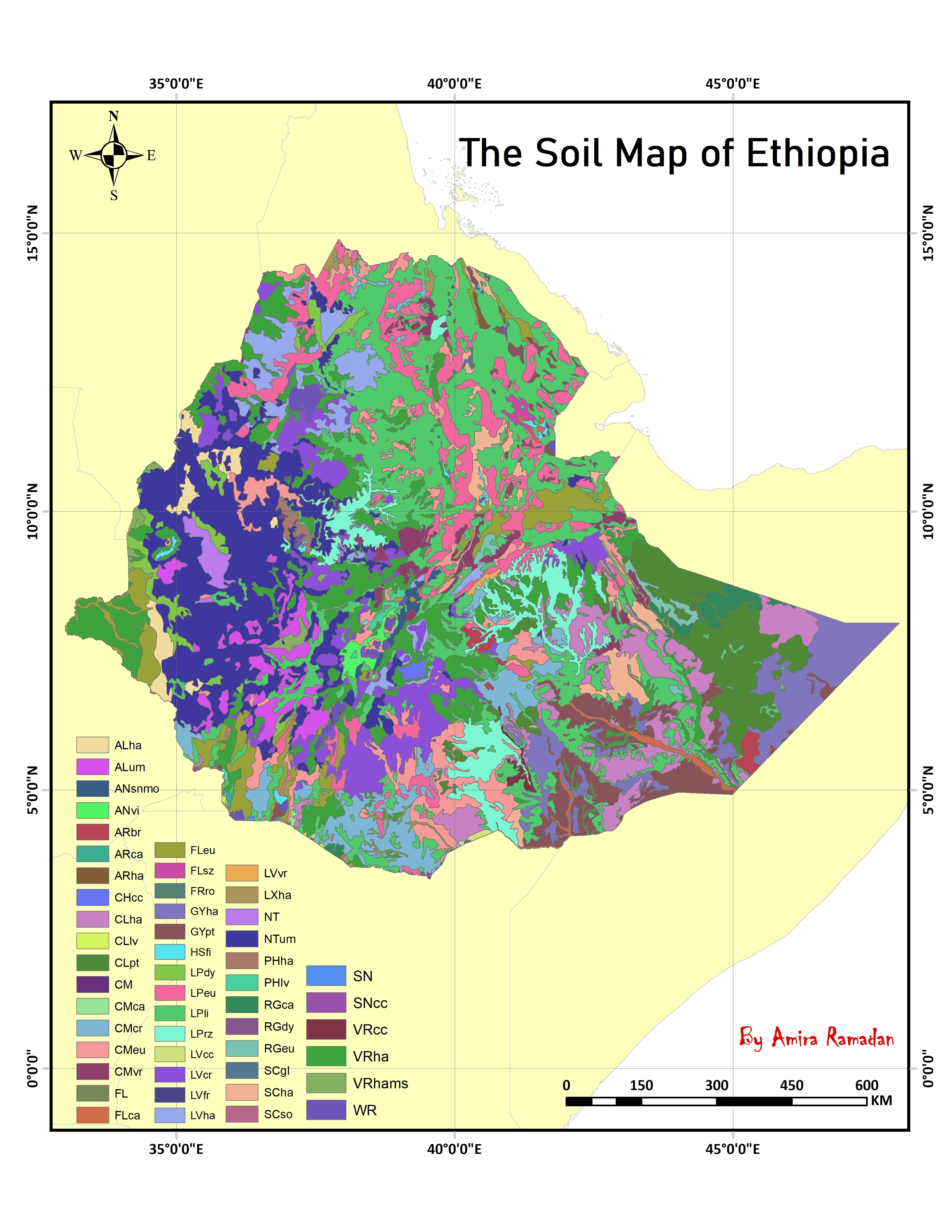
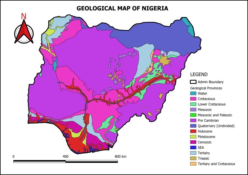
Contour Map and Topographic Profile of Sina


Tools used

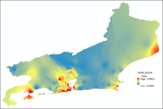
ArcMapContour Data Visualization

Plug-ins used

ArcMapData Visualization

tags

SinaTopographic

More by Amira Ramadan

The Soil Map Of Ethiopia
848
Deforestation in Rondonia, Brazil
323

You might also like

Mapa de localização de área de estudos
Jailane de Sousa Gomes
Mapa de localização de área de estudos
Jailane de...
47
St. Joe County Contours
Seth Frame
St. Joe County Contours
Seth Frame
100
Top amazing waterfalls in Africa
Balogun Temitope
Top amazing waterfalls in Africa
Balogun Temitope
551
Solar Energy Assessment in Washington DC
Ishampreet
Solar Energy Assessment in Washington DC
Ishampreet
37
Industrial Sites in Urban Growth Rings
Cole Feyen
Industrial Sites in Urban Growth Rings
Cole Feyen
16
Surveillance Camera Suitability Map
Oswald Onimhawo
Surveillance Camera Suitability Map
Oswald Onimhawo
22
LOCALIZAÇÃO DO MUNICÍPIO DE BELÉM
Mapa_Geo
LOCALIZAÇÃO DO MUNICÍPIO DE BELÉM
Mapa_Geo
129
Size of deforestation patches
Rayane Pacheco
Size of deforestation patches
Rayane Pacheco
85
Remote Sensing of Orchard
Reese Dresch
Remote Sensing of Orchard
Reese Dresch
28
Species Distribution Model (Part 1)
Ali Mulla
Species Distribution Model (Part 1)
Ali Mulla
22
Invasive Species Sightings in Whistler
Talvinder Gill
Invasive Species Sightings in Whistler
Talvinder Gill
21
Tagragra of Akka, Morocco
Hamza Bouarakia
Tagragra of Akka, Morocco
Hamza Bouarakia
171

Join the community!

We're a place where geospatial professionals showcase their works and discover opportunities.

Sign Up for free