Sign up or log in to your Spatialnode account.

Takes less than a few seconds.

Change Detection

Vincent Abere
Vincent Abere•

August 10, 2022

Change Detection

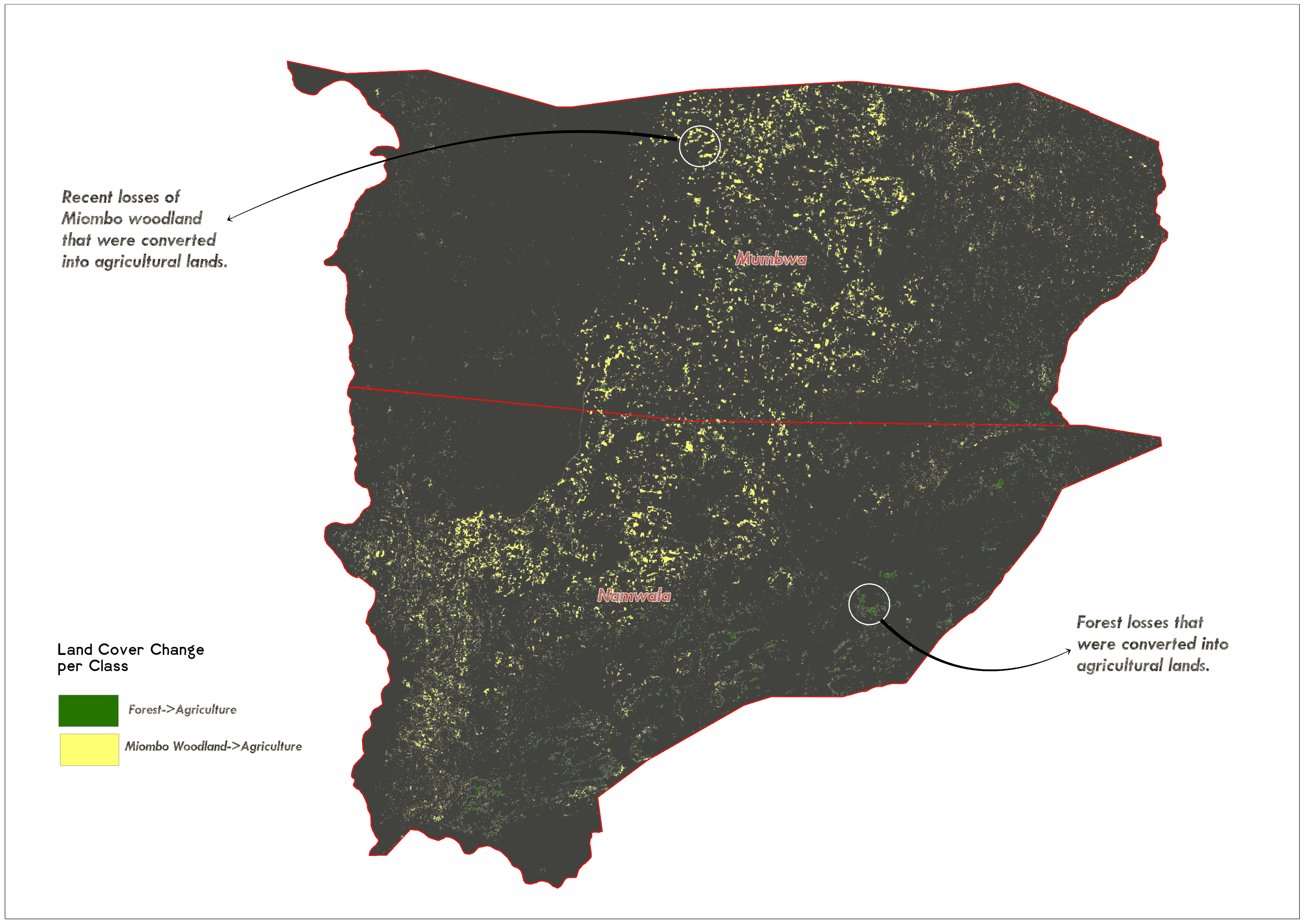
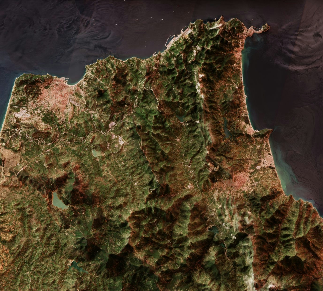
Used change detection tools to quantify losses in vegetation in protected areas to agricultural lands


Tools used

ArcGIS ProArcGIS Story Maps

tags

GISlandcoverRemote Sensing

You might also like

Colorado Food Deserts and Obesity
Sasha Kaplan
Colorado Food Deserts and Obesity
Sasha Kaplan
262
Land Cover in Boston Subwatersheds
Dylan Kelly
Land Cover in Boston Subwatersheds
Dylan Kelly
24
Mapa Litológica
RODRIGO DE ARAUJO BELOTE
Mapa Litológica
RODRIGO DE...
2
AUTO DE INTIMAÇÃO -  ATLAS QGIS
Gustavo da Silva Francisco
AUTO DE INTIMAÇÃO - ATLAS QGIS
Gustavo da...
12
Least Cost Path Hiking Trail Improvement
Colin Young
Least Cost Path Hiking Trail Improvement
Colin YoungPro
28
المواقيت المكانية للحج والعمرة
Eid
المواقيت المكانية للحج والعمرة
Eid
2.8K
Vegetation Indices on Landsat 1-3 data
Corrine Coakley
Vegetation Indices on Landsat 1-3 data
Corrine Coakley
30
Food & Pharmacy Flood Risk Mapper
Simone Chapman
Food & Pharmacy Flood Risk Mapper
Simone Chapman
317
Cartographic Explorations
Sunder Gurung
Cartographic Explorations
Sunder Gurung
23
Elevation Map Bay of Bengal (Bangladesh)
Loviena Garcia
Elevation Map Bay of Bengal (Bangladesh)
Loviena Garcia
13
Mapa de Declividade P. N. do Caparaó
Alexandre Basílio Oliveira
Mapa de Declividade P. N. do Caparaó
Alexandre Basílio Oliveira
55
LOCALIZAÇÃO DO MUNICÍPIO DE PARANAVAÍ-PR
Itamar Sateles de Sá
LOCALIZAÇÃO DO MUNICÍPIO DE PARANAVAÍ-PR
Itamar Sateles...
756

Join the community!

We're a place where geospatial professionals showcase their works and discover opportunities.

Sign Up for free