Sign up or log in to your Spatialnode account.

Takes less than a few seconds.

Priority Planting in Louisville, KY

Sean Willis
Sean Willis•

July 21, 2022

Priority Planting in Louisville, KY

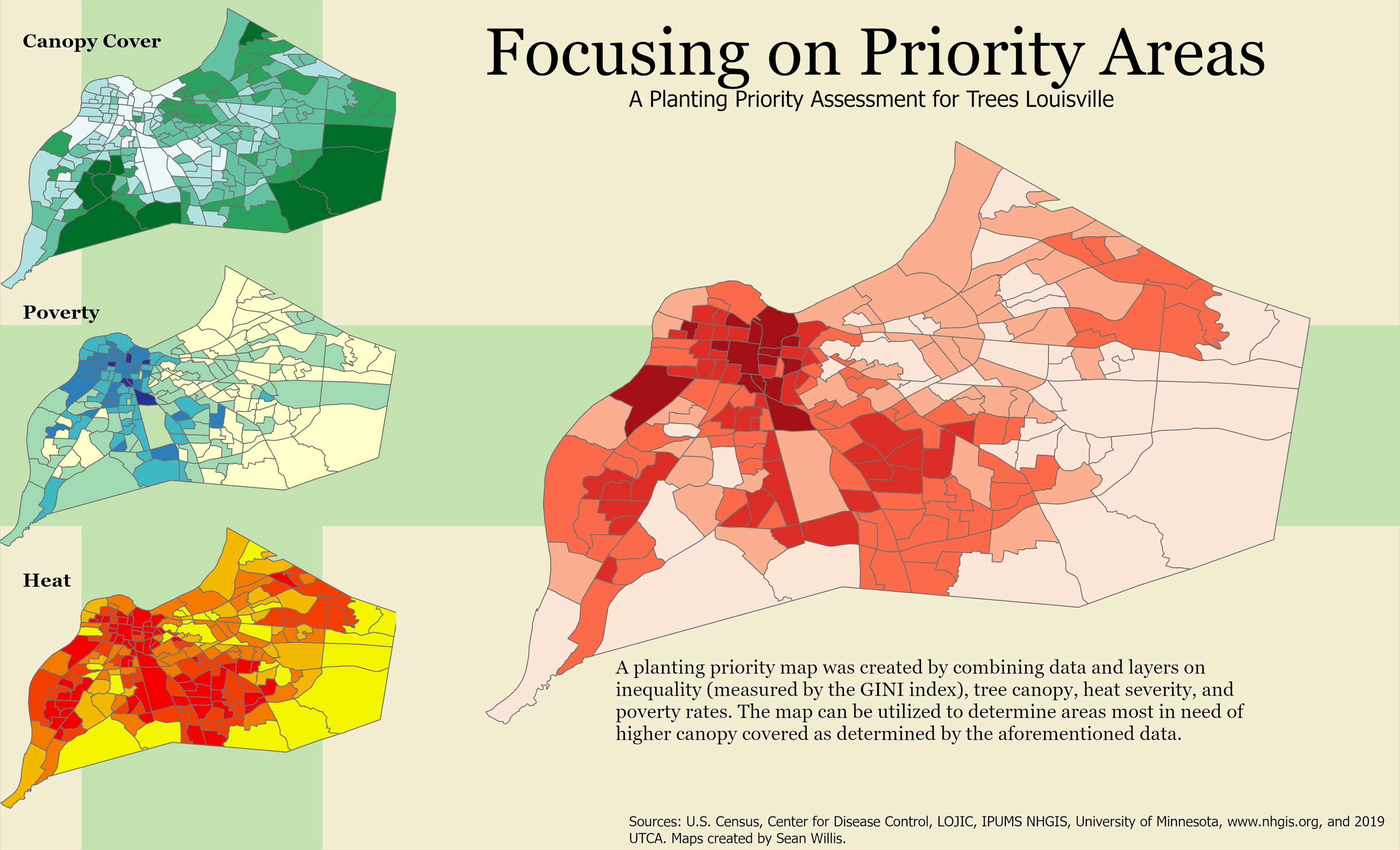
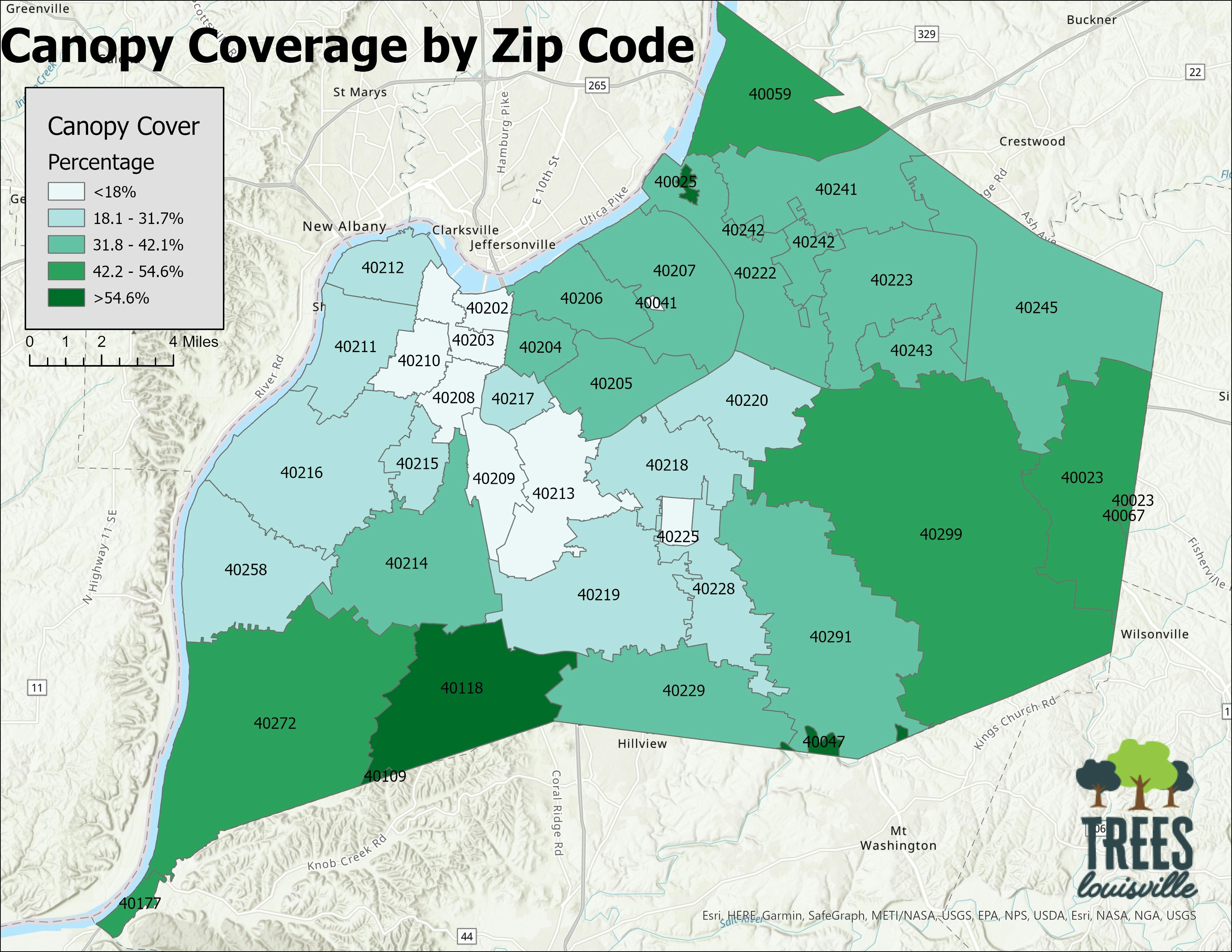
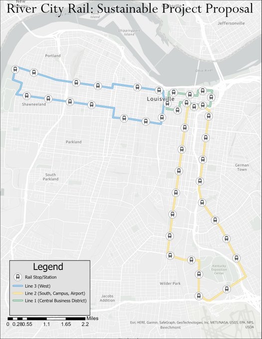
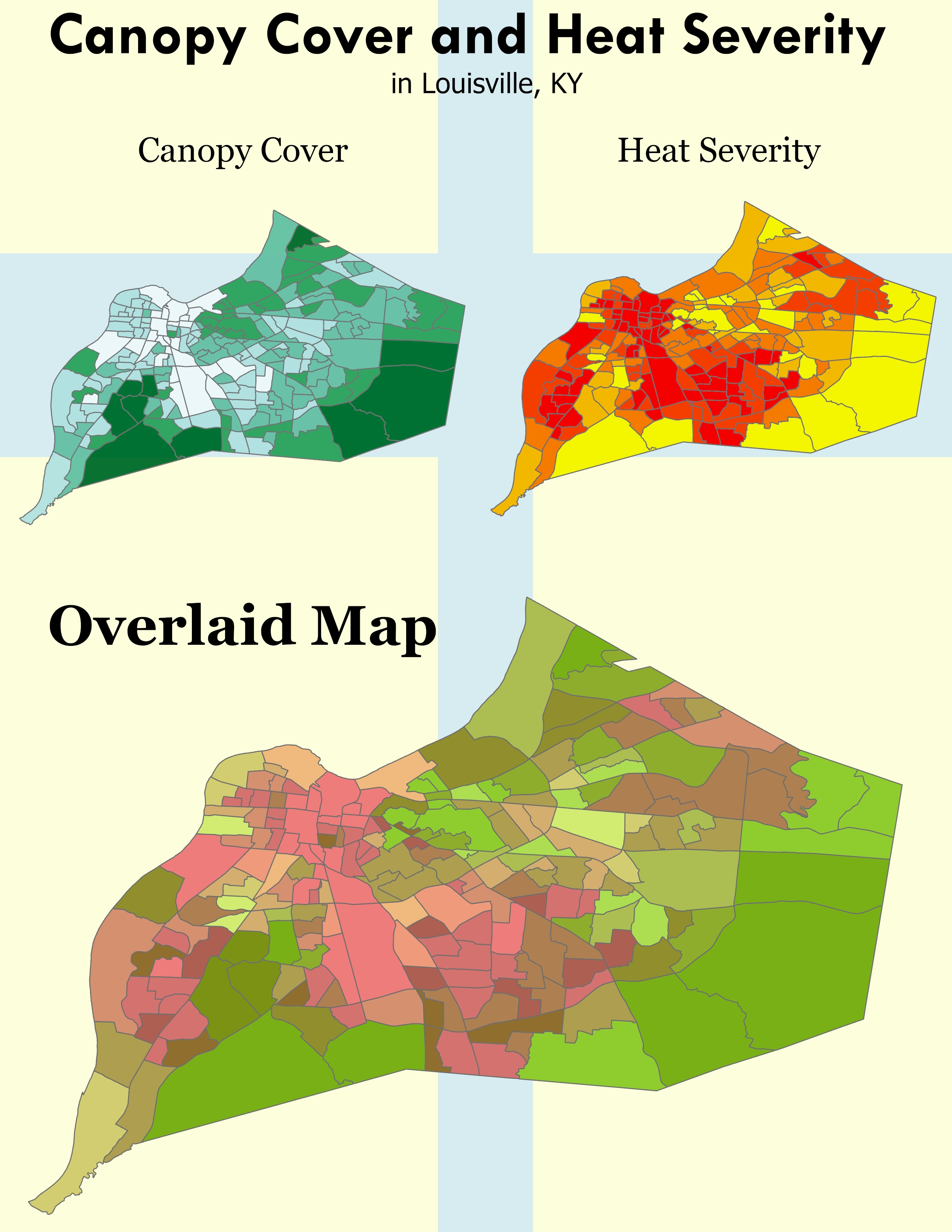
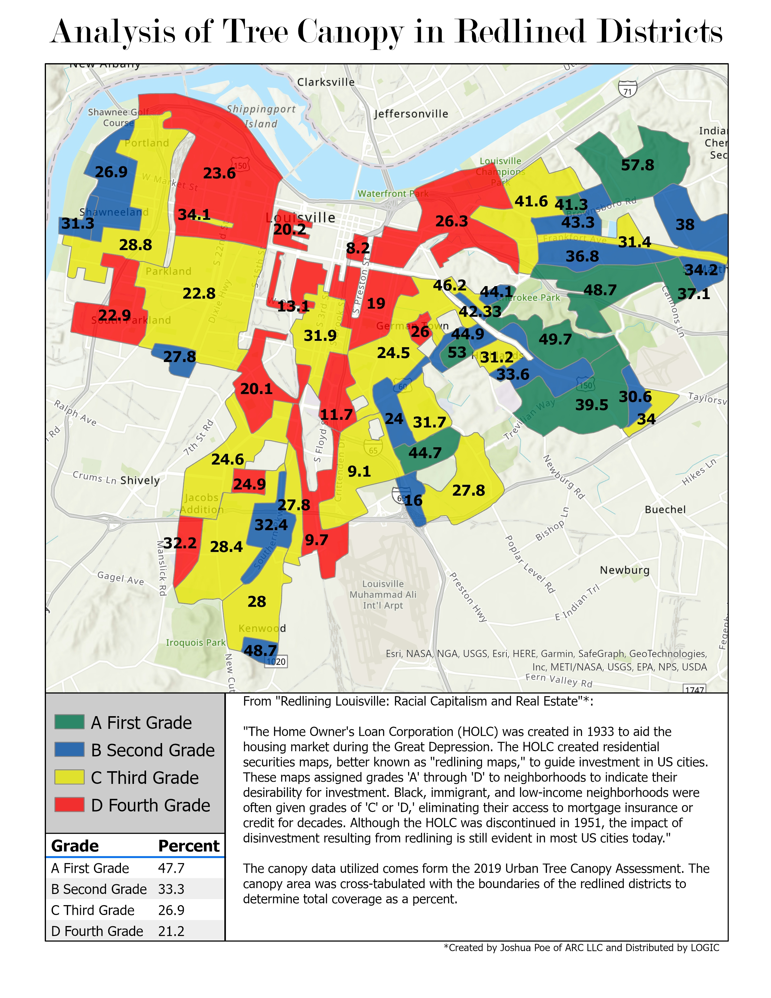
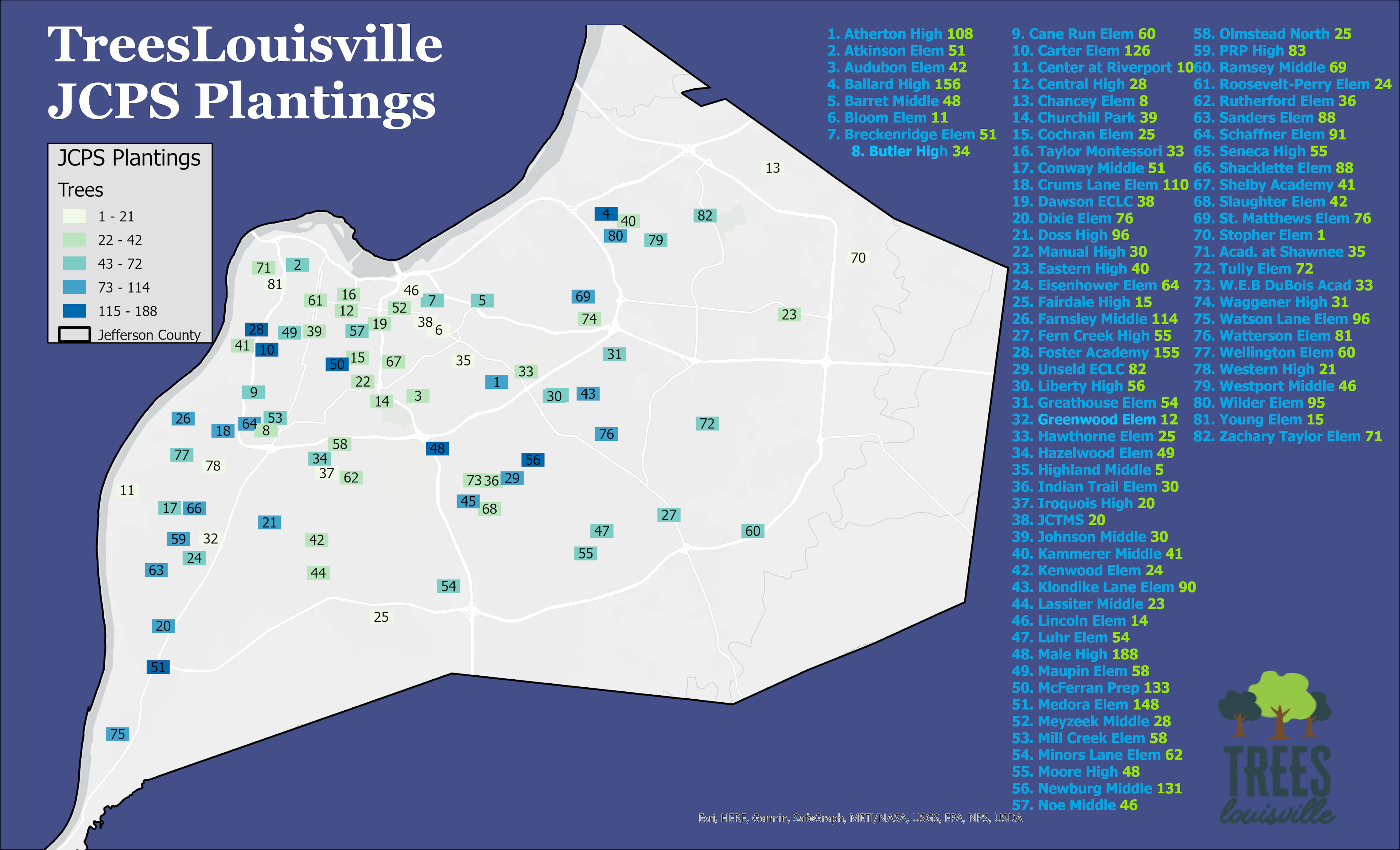
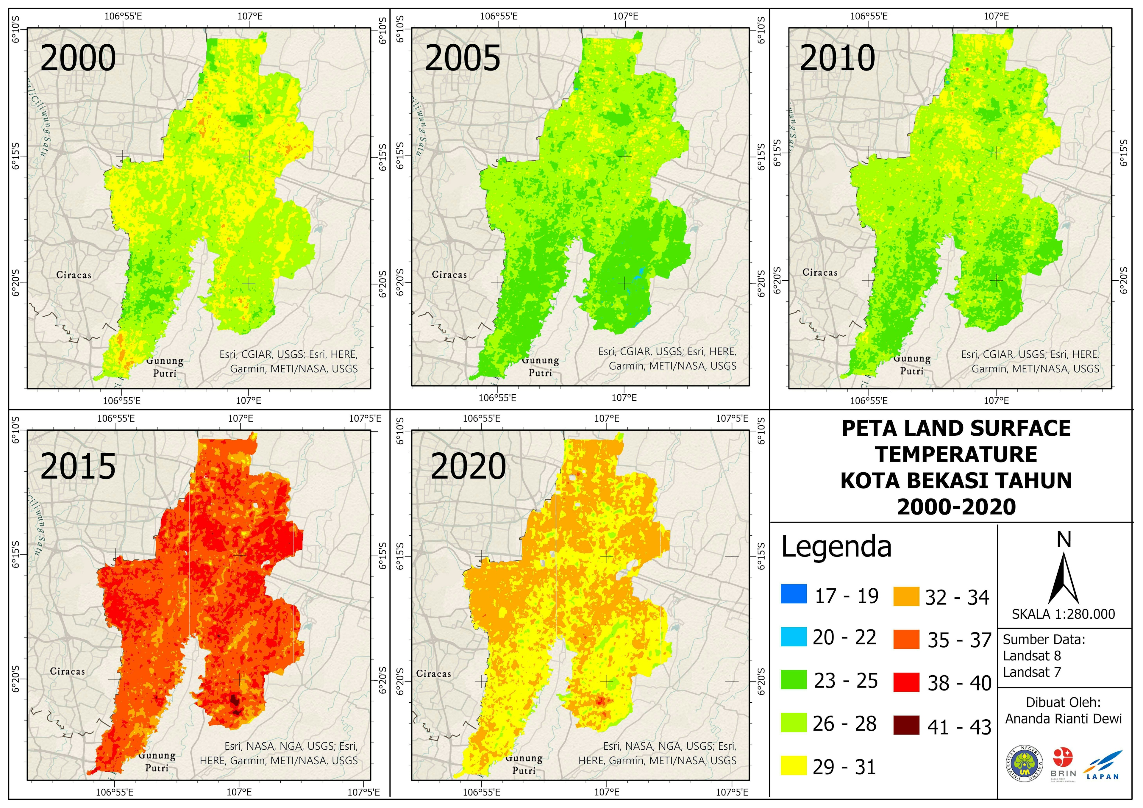
Sourced census data on issues such as heat severity, poverty, and tree canopy coverage to create layers that were combined together to determine areas of priority for tree plantings in Louisville, Kentucky.


Tools used

ArcGIS Pro

tags

mapstreesUrban Heat Island

More by Sean Willis

Louisville, KY Housing Density
25
Waste Container Inventory
22
Intersection Collisions in Louisville
21
Canopy Cover and Heat Severity
79
Tree Canopy in Redlined Districts
128
JCPS District 4 Tree Plantings
43
Jefferson County Tax Income
61
Old Louisville Property Tax Income
17
Canopy Cover by Zip Code
128
TARC Stops by Headway
16
Louisville Light Rail Proposal
89
TreesLouisville JCPS Plantings
45

You might also like

Route Analysis (ArcGIS Network Analyst)
Martin Nuñez Igarzabal
Route Analysis (ArcGIS Network Analyst)
Martin Nuñez Igarzabal
23
1a: At Risk School Walking Areas
carson allen
1a: At Risk School Walking Areas
carson allen
2
Satellite data
Kareen Bröker
Satellite data
Kareen Bröker
39
Map production
Ogungbemi Ezekiel Tobiloba
Map production
Ogungbemi Ezekiel Tobiloba
14
 Área Industrial em Apucarana - PR
WILLIAN S. SANTOS 🇧🇷
Área Industrial em Apucarana - PR
WILLIAN S....
42
Mapa de Solos
Luiz Gustavo De Góes Sterle
Mapa de Solos
Luiz Gustavo...
28
Artigo Scientifica (Fig. S1)
João Gabriel Feriato do Nascimento
Artigo Scientifica (Fig. S1)
João Gabriel...
4
Mapa de Imóveis
MICHAEL LUCAS DA SILVA SA
Mapa de Imóveis
MICHAEL LUCAS...
4
Vuyani Mondli Buthelezi
Land Cover
Vuyani Mondli Buthelezi
4
Mapa analítico exposição rochosa SE
Aristoteles Fernandes da Silva Filho
Mapa analítico exposição rochosa SE
Aristoteles Fernandes...
4
Malaria Mortality Rate in Nigeria Map
Olugbenga Ebenezer Bamidele
Malaria Mortality Rate in Nigeria Map
Olugbenga Ebenezer Bamidele
28
Colombia Water Transitions
Paola Prieto Botero
Colombia Water Transitions
Paola Prieto Botero
32

Join the community!

We're a place where geospatial professionals showcase their works and discover opportunities.

Sign Up for free